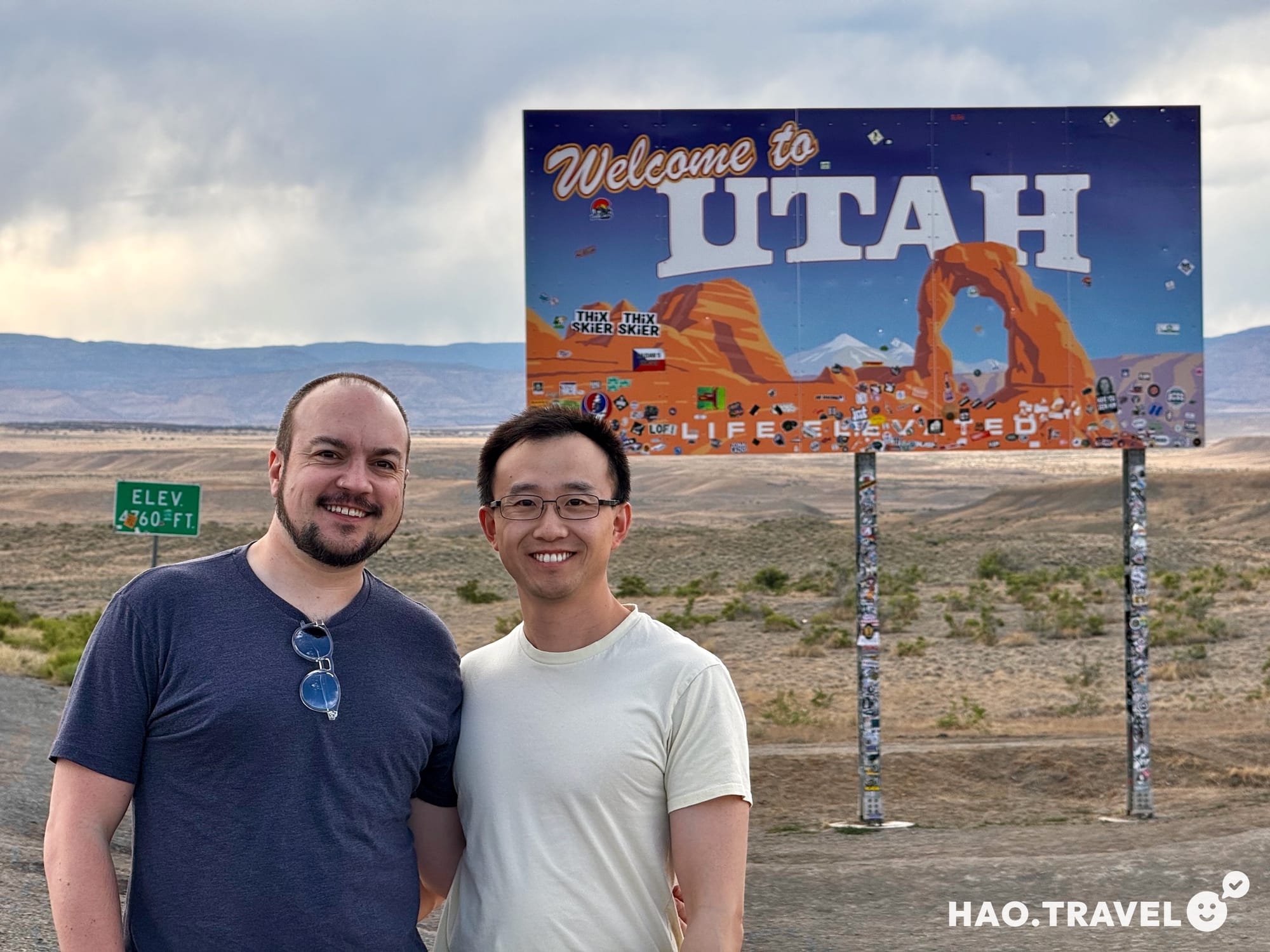
Southwest Adventure
Hi, we’re Mitchell and Nongchao. We met in January 2024 over our shared love for travel and hiking. We’ve done some weekend trips, but our first major trip was a week-long road trip from Denver through Utah to Arizona. There’s nothing like a long road trip spanning four states and hundreds of miles to test a fresh relationship. As it turns out, the real test was getting back up the steep walls of the Grand Canyon after hiking down to the bottom. More on that later.
We visited the Grand Canyon, did an epic hike, and then moved on to Page, Arizona. There, we experienced prime time at Antelope Canyon (midday when the sun was coming through at just the perfect angle), saw the sunset at Horseshoe Bend, and stayed right on Lake Powell that night. From there, we drove to Arizona to explore the town where Mitchell has fond memories of visiting a great aunt while growing up. We ventured into a lava cave and explored the spiritual aspects of Sedona before moving on to a quick stop at Petrified Forest National Park, then onto Chaco Canyon Culture Park, an enchanting national park in New Mexico.
It was a packed week of hiking, sightseeing, and road-tripping through the southwest United States, and we got to experience some of Mother Nature’s most grand beauty along the way. We’re excited to share our travels with you and hopefully inspire you to go out and explore for yourself. This was the first of many trips, and we can’t wait to continue sharing them with you.
Trip Overview
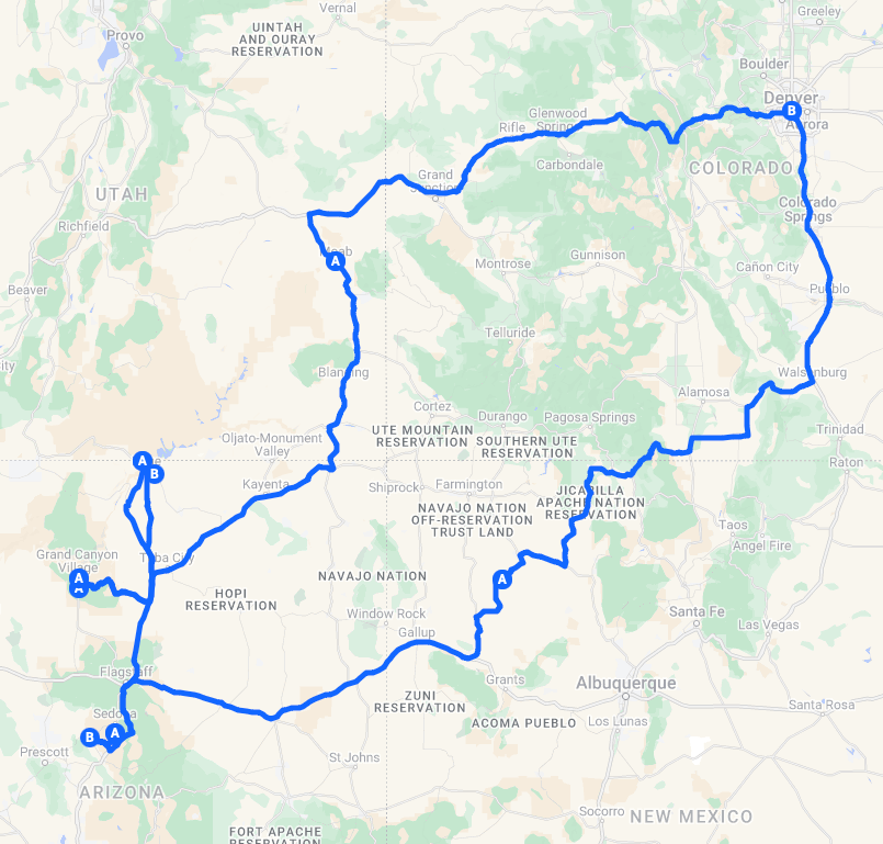
Total Distance: 2,011 miles
Total Days: 8
States Visited: Colorado, Utah, Arizona, New Mexico
National Parks: Arches, Grand Canyon, Petrified Forest, Chaco Culture Historical Park
Day One: Denver to Moab
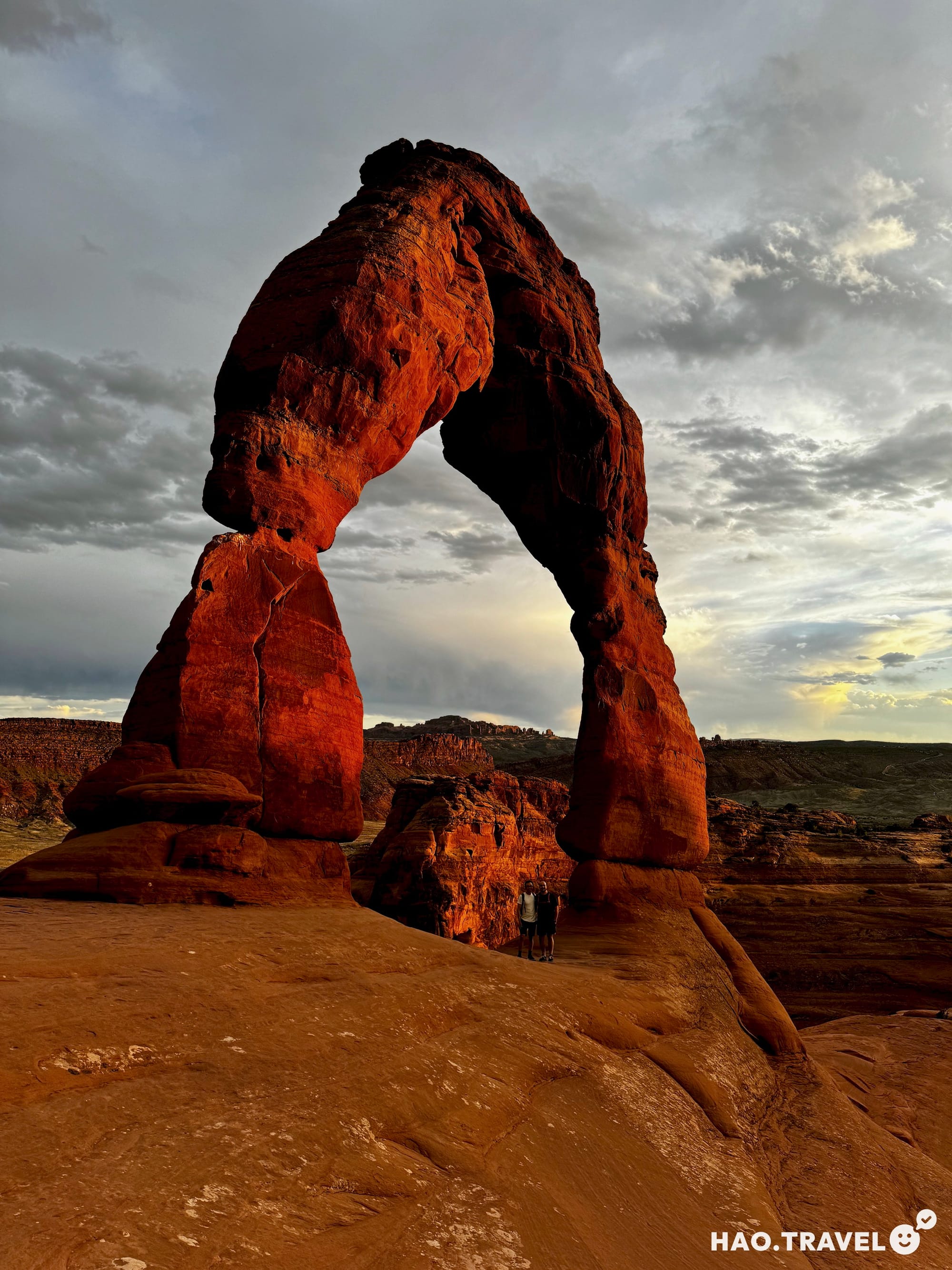
We started our trip from Denver, aiming for Moab, Utah—a six-hour drive with plenty of scenic stops along the way. Even though this trip was mainly about the Grand Canyon, we couldn’t pass up the chance to hike to the famous Delicate Arch in Arches National Park before sunset.
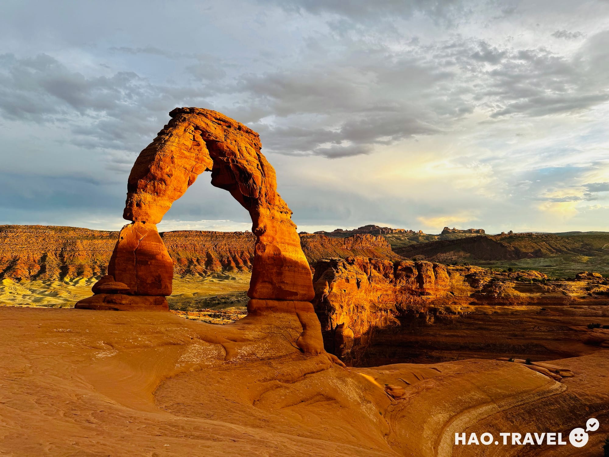
The Delicate Arch hike is 3.2 miles (5.1 km) round-trip, with an elevation gain of 192 meters. It's a moderate uphill trek over smooth rock, shaped by wind and water over thousands of years. The view at the top is worth every step. The natural sandstone arch perfectly frames the distant La Sal Mountains—one of those views that looks like a postcard but feels surreal in person. We arrived about 30 minutes before sunset, and while the trail was crowded with people waiting to catch the golden hour glow, everyone was polite, taking turns for photos under the arch.
When it comes to asking strangers to take your photo, here’s a trick we swear by: look for someone who shows subtle signs of "influencer" habits. This could be:
✦ Taking multiple pictures from different angles
✦ Talking into their phone camera
✦ Wearing trendy or coordinated outfits
These small cues suggest that they’re likely comfortable with basic photography principles like framing and lighting, which increases your chances of getting the perfect shot. It’s always worth the extra effort to observe before you ask—there's no shame in wanting great photos!
We brought snacks and hung around as the sun dipped lower, bathing the red sandstone in golden hour light. After a six-hour drive, the short hike was exactly what we needed to stretch our legs before heading into Moab to relax and grab some Mexican food.
Day Two: Moab to Grand Canyon Village
Before hitting the road, we stopped by Doughbird, a trendy shop in town that sells donuts and fried chicken—what better way to kick off a road trip than with the ultimate brunch of champions? When we arrived, a line was forming, and the shop's vibe was fun and inviting. A bright yellow neon sign that read "TREAT YO SELF" hung inside, and outside, a cool rooster mural marked the small eating area. We grabbed a couple of cronuts (donuts made with croissant dough) and some fried chicken. While the chicken took a bit longer to prepare, the guy working offered us an extra free donut for the wait, which we definitely didn’t mind! We took our food to a nearby food truck park to enjoy brunch. With the early June sun heating up fast, the misters at the park were a godsend.
After fueling up on donuts and fried chicken, we hit the road. Rather than take the default route suggested by Google Maps (US-191 to US-160 West), we opted for a detour along US-163—our go-to move for finding quirky and lesser-known stops. For us, travel is as much about the journey as it is about the destination.
Mexican Hat: A Quick but Worthwhile Stop
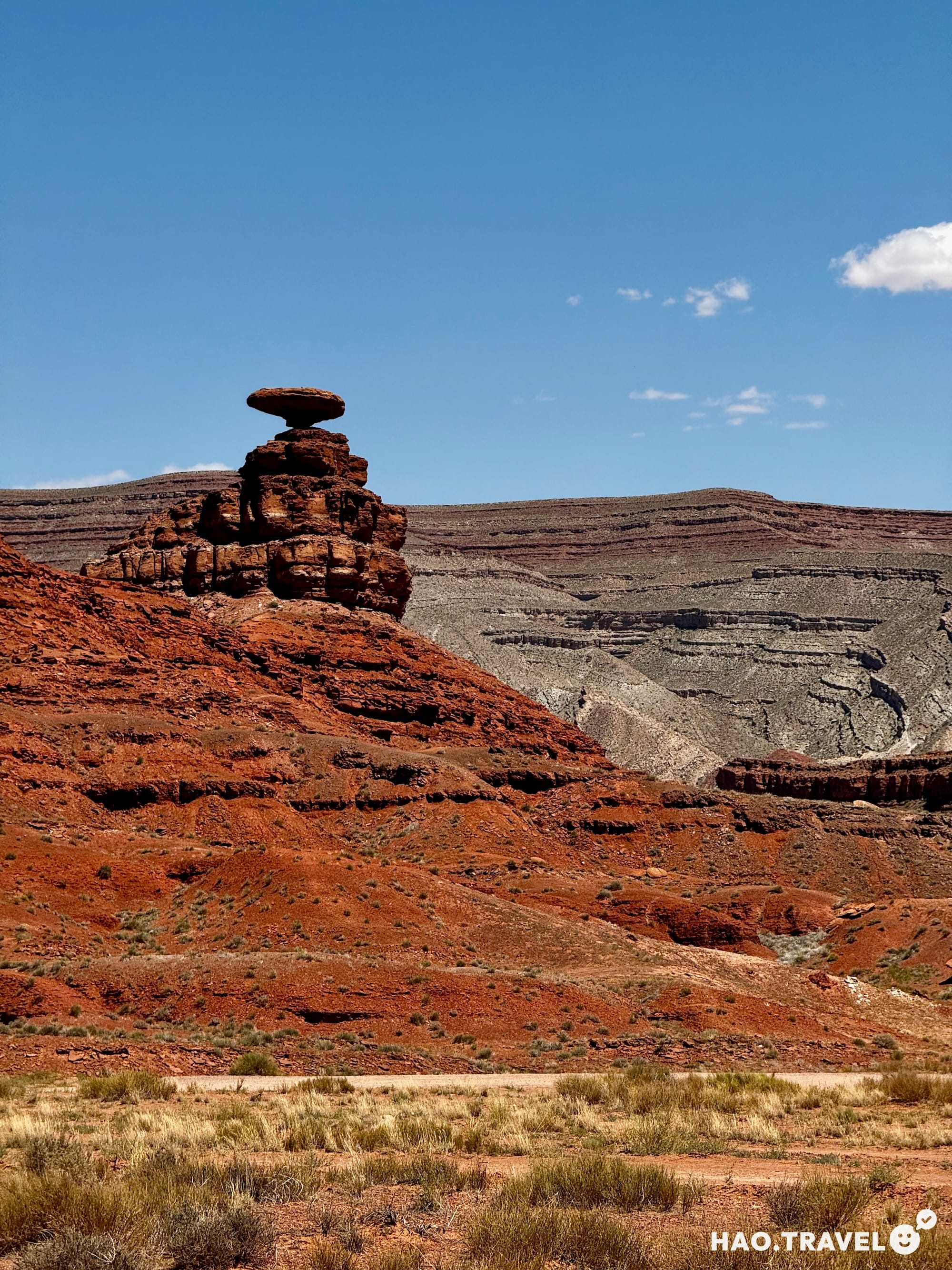
About two hours south of Moab and 20 minutes north of the Arizona border, we pulled off to see Mexican Hat, a unique rock formation that’s easy to spot from the road. Its shape resembles an upside-down sombrero—hence the name. The "hat" is a 3.7-meter thick rock slab perched on an 18-meter tall base resulting from millions of years of erosion. It’s one of those blink-and-you-miss-it spots, but we’re glad we stopped. We stayed for about 10 minutes, snapped some photos, and enjoyed the solitude—just one other couple left as we arrived. It was a quick but perfect way to break up the drive.
Forrest Gump Point: A Must-See for Movie Fans and Road-Trippers
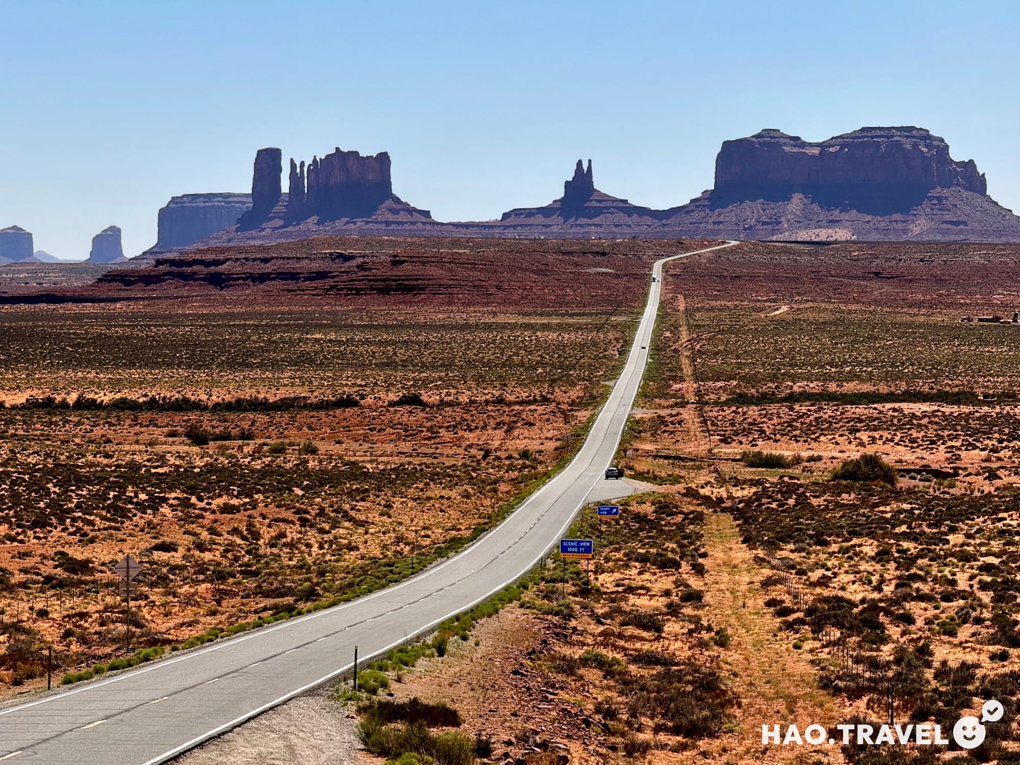
Just 10 miles further down US-163, we reached Forrest Gump Point, a popular viewpoint immortalized in the 1994 movie Forrest Gump. This is the spot where Forrest Gump, after running across the U.S. for over three years, stops and says, "I'm pretty tired... I think I'll go home now." Even if you’re not a fan of the movie, this stretch of road offers an epic view of Monument Valley, with its straight highway leading toward the towering red sandstone buttes.
As we approached mile marker 13, we saw people standing in the middle of the highway, trying to recreate the iconic shot. Be careful—this is still an active road, and cars will come by every few minutes. We parked in a pull-out on the side of the road to get our shots and took a moment to soak in the grand view. A few locals were nearby selling jewelry and trinkets, which added a nice, authentic touch to the stop.
Onward to the Grand Canyon
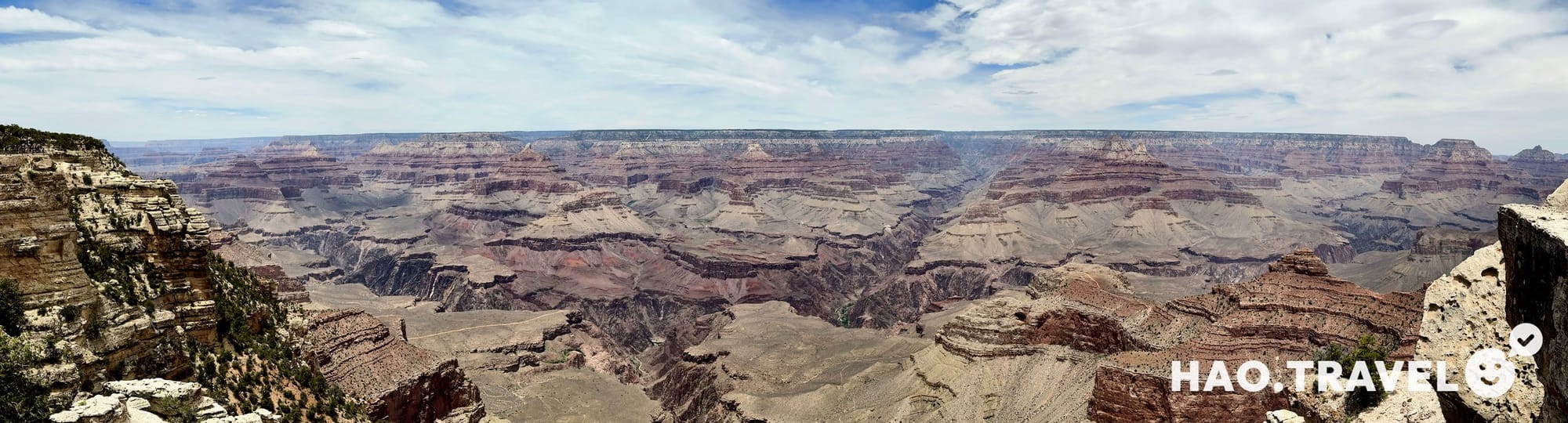
With our photos and memories in hand, we continued our journey toward the Grand Canyon. Along the way, we made a quick stop at an unofficial viewpoint just outside the national park. It was our first glimpse of the canyon, and even from this lesser-known spot, the vastness and beauty were awe-inspiring. Though the vendor stands were closed for the day, we managed to sneak in just before the area shut down, snapped a few photos, and used the restroom before returning to the road. This brief stop gave us a taste of what was to come, and it only heightened our excitement to see more.
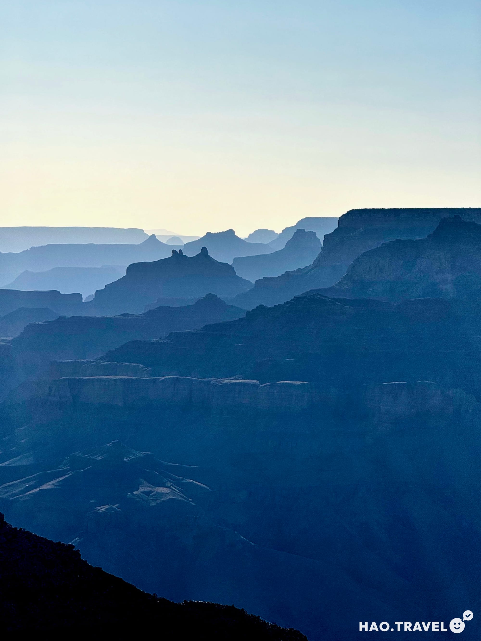
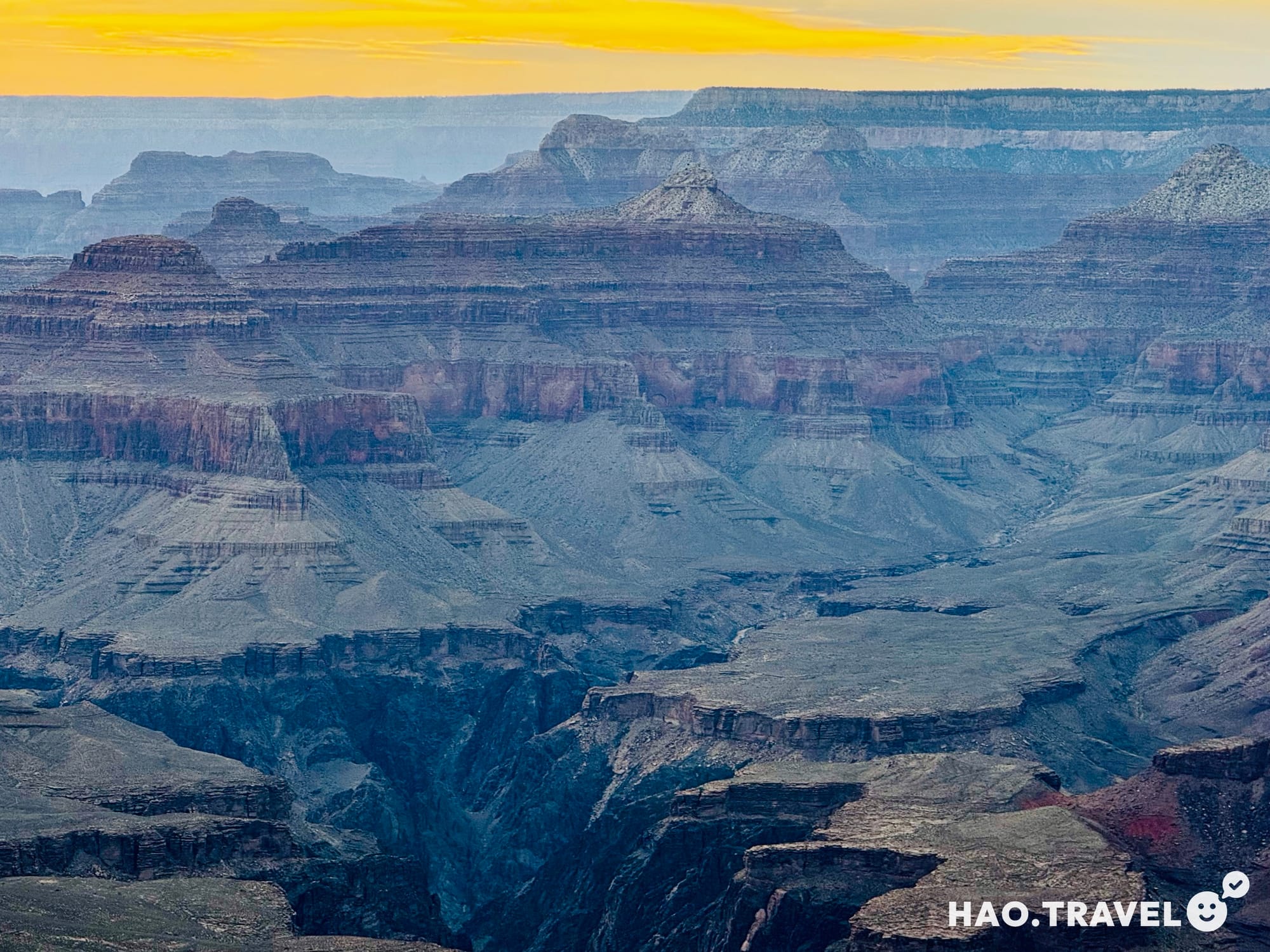
Not long after entering the park, we stopped at the Desert View Watchtower—just in time for sunset. The sky lit up in shades of pink and orange while the layers of the Grand Canyon took on a cool blue hue, giving us our first grand view of its vast expanse. It was a magical way to kick off our time at the Grand Canyon.
Our drive ended at Grand Canyon Village, where we checked into our hotel. After settling in, we headed back out for dinner at the historic El Tovar Dining Room.
Dinner at El Tovar
The El Tovar Dining Room, inside the historic El Tovar Hotel, has been part of the Grand Canyon experience since the hotel’s opening in 1905. Built by the Atchison, Topeka, and Santa Fe Railway to serve the growing number of tourists arriving by train, the hotel’s log-beamed ceilings and cozy, lodge-like atmosphere made for a perfect setting to start our adventures in the park.
We enjoyed a three-course meal, starting with French onion soup and continuing with dishes made from locally sourced ingredients. For dessert, we indulged in a sweet treat that topped off the evening. It was the perfect meal to fuel us up for the big hike ahead. After dinner, we returned to our hotel, eager to rest and recharge for the early wake-up call the following day.
Day Three: Bright Angel Trail - Rim to River and Back Up
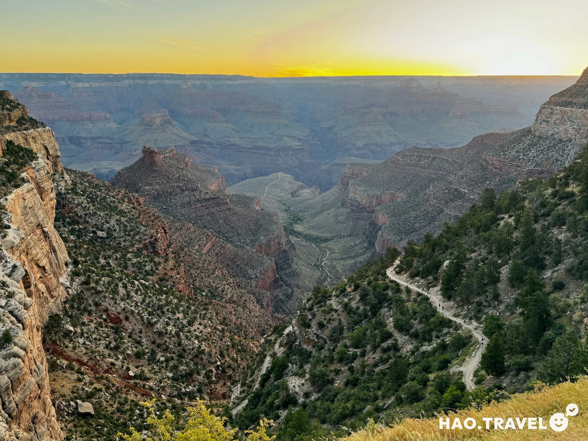
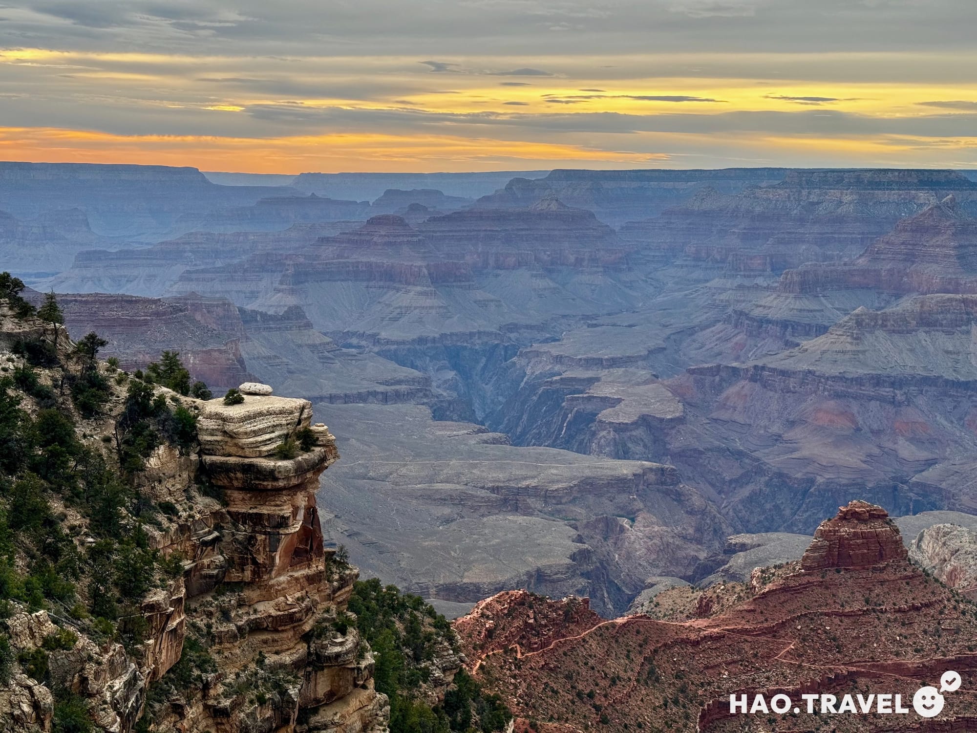
We kicked off the day around 3:30 AM, packing up our gear and driving through the dark to Bright Angel Lodge, where we miraculously snagged a parking spot. Looking out over the Grand Canyon before dawn, the vastness was almost overwhelming. Sure, we had studied the maps and elevation on AllTrails, but standing there in person, knowing we were about to hike all the way down, was a whole different thing. From the rim, you can see the trail snaking its way down until it disappears after Havasupai Gardens, which we knew was around the halfway point down to the river.
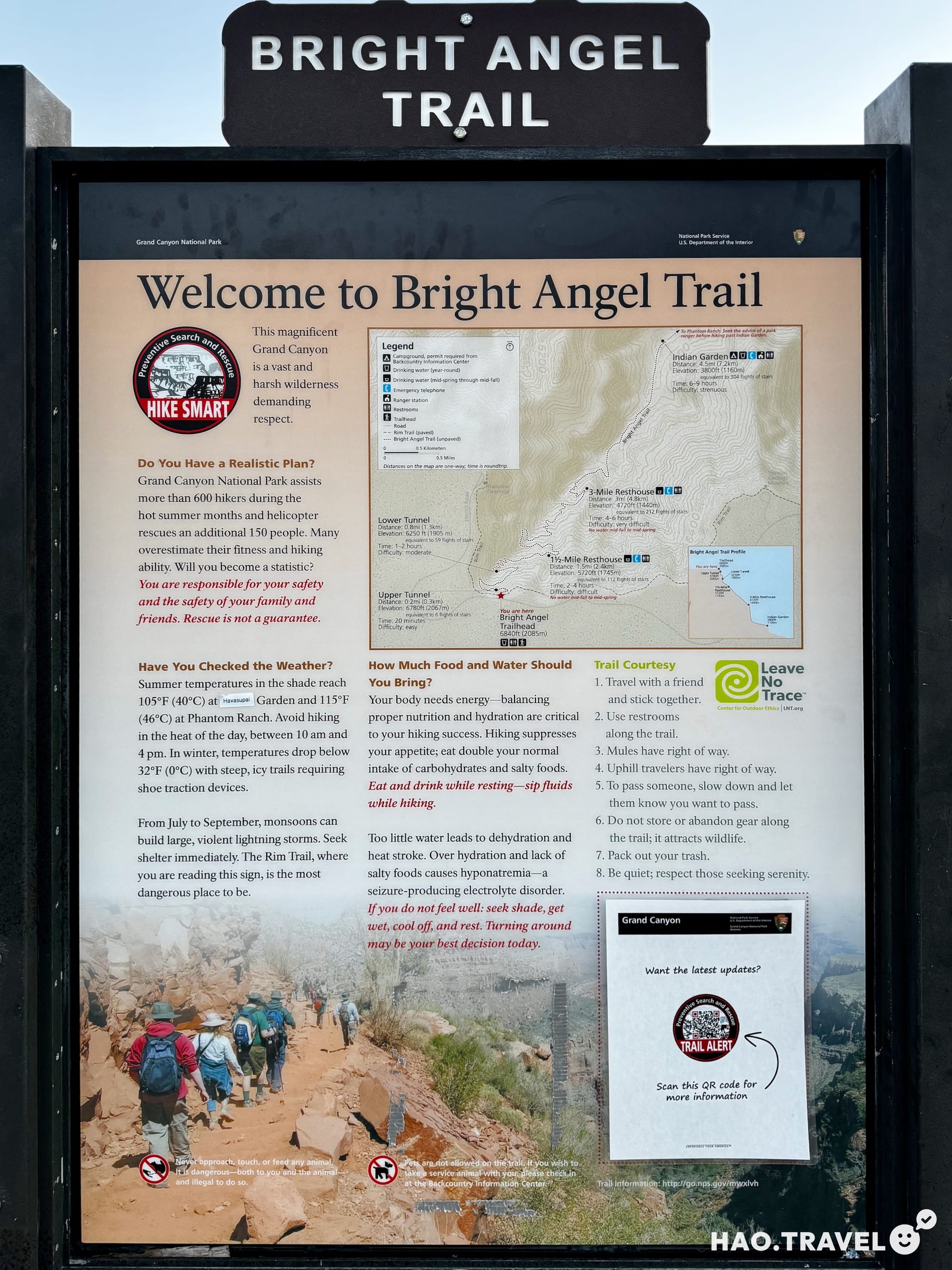
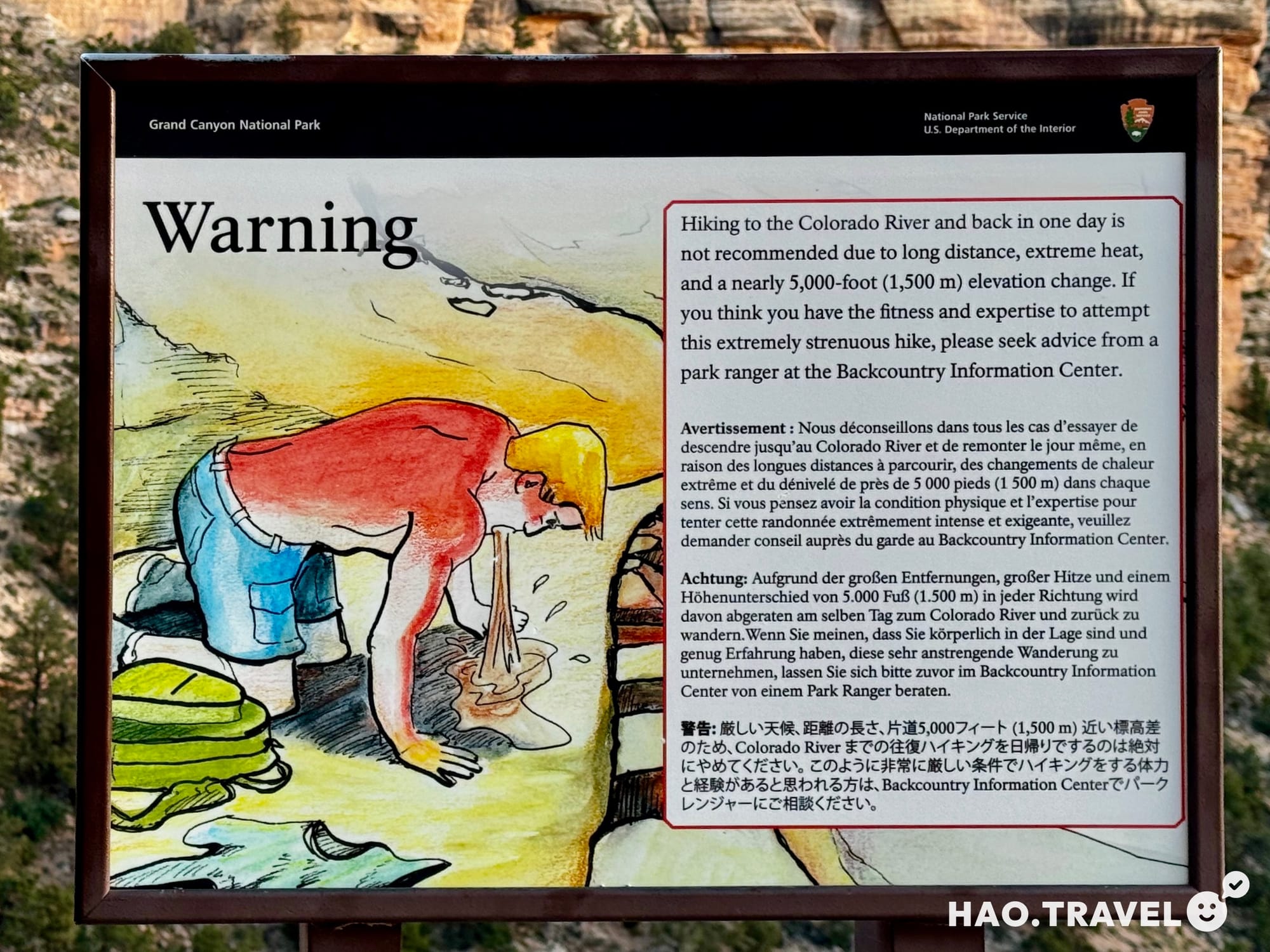
Informational signs at the Bright Angel trailhead
The Descent
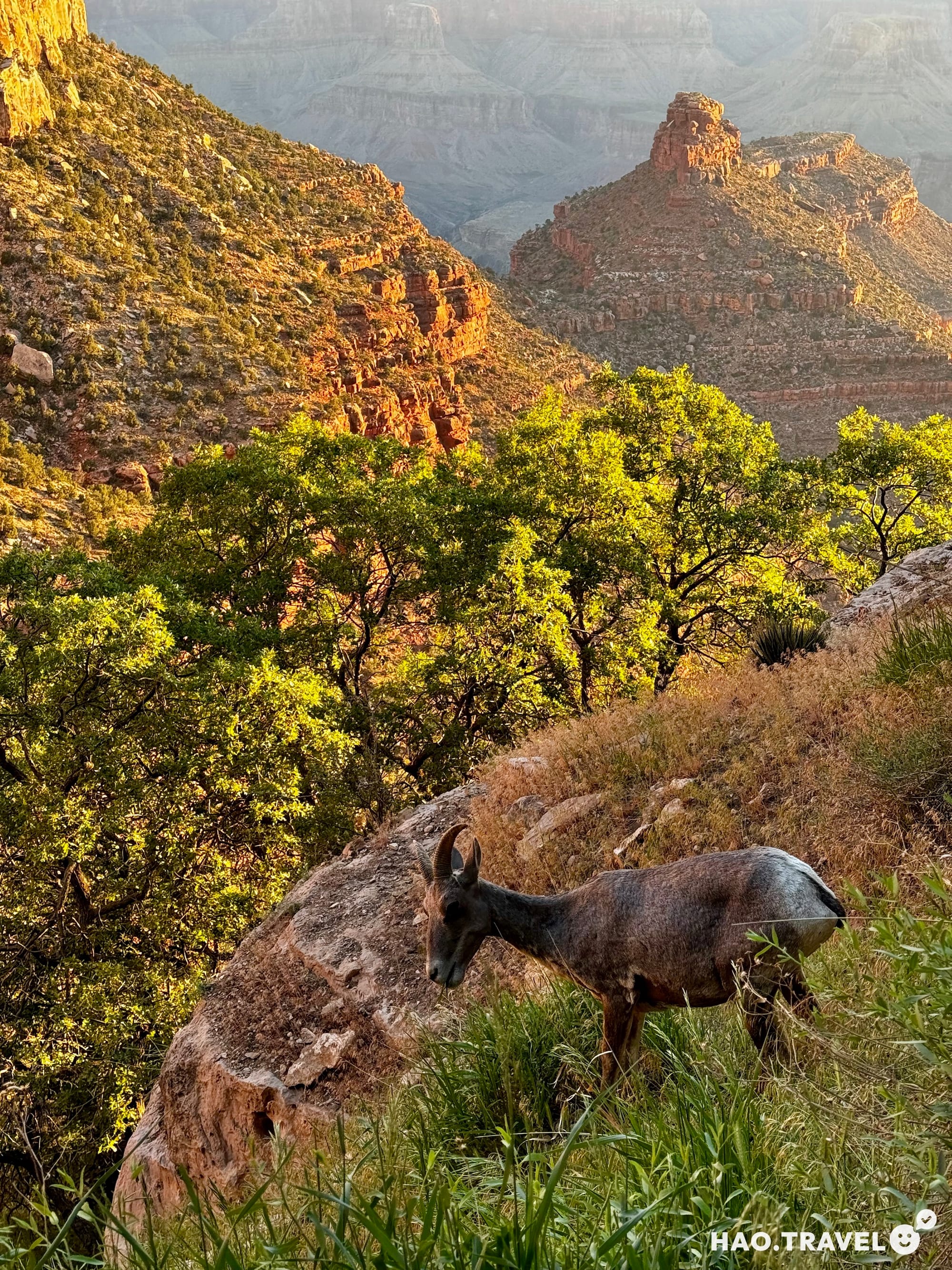
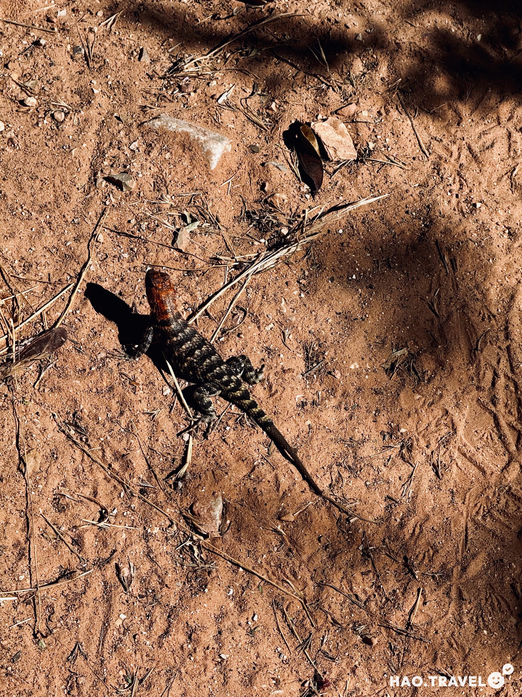
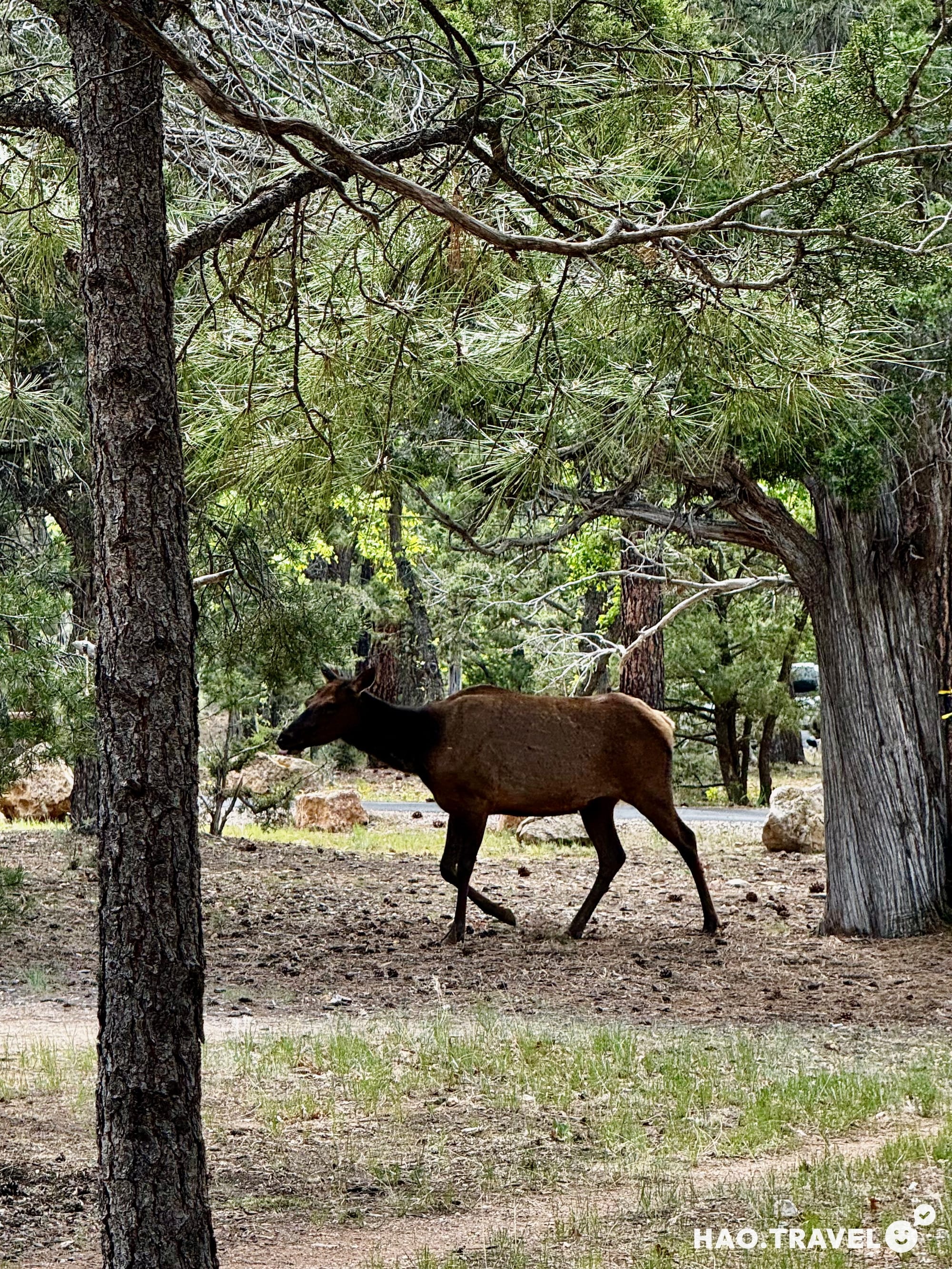
We hit the trail around 5 AM, and it was a perfect time to start. The cool morning air made the descent feel manageable. Plus, we had the trail almost entirely to ourselves, which made it feel like we were the only ones out there. The peace and solitude at that hour were something special. Just after sunrise, we spotted a few mountain goats enjoying their breakfast—definitely a highlight of the early hike. Watching the canyon light up as the sun slowly crept down the walls was mesmerizing.
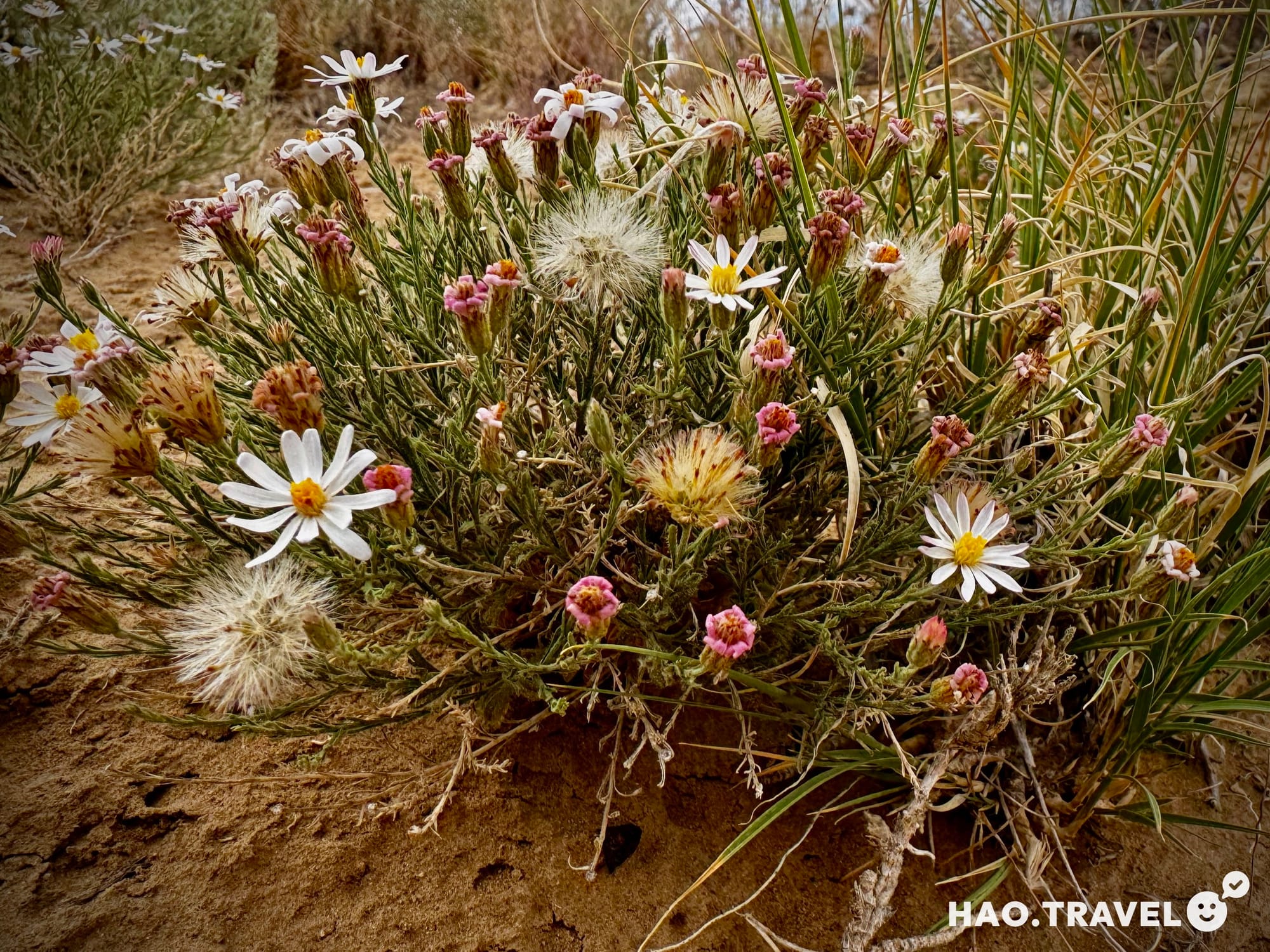
One of the coolest parts of this hike was how the landscape changed as we descended. We started noticing how different the vegetation and wildlife were the further we got into the canyon. At the top, cacti flowers were still closed in the early morning, but they were wide open by the time we were heading back up. It was like nature’s way of reminding us just how long we’d been out there.
The steep switchbacks on the way down felt okay at this point, but we both knew they’d be much tougher on the way back up. We made sure to take breaks at the 1.5- and 3-mile rest houses, topping off our water and drinking electrolytes. Luckily, the water was turned on, which wasn’t the case earlier in the season, according to other hikers we talked to. Not having water available to refill our camelbacks along the way would be an even tougher challenge.
Havasupai Gardens
A butterfly on the trail—a quiet reminder of how this hike would transform us
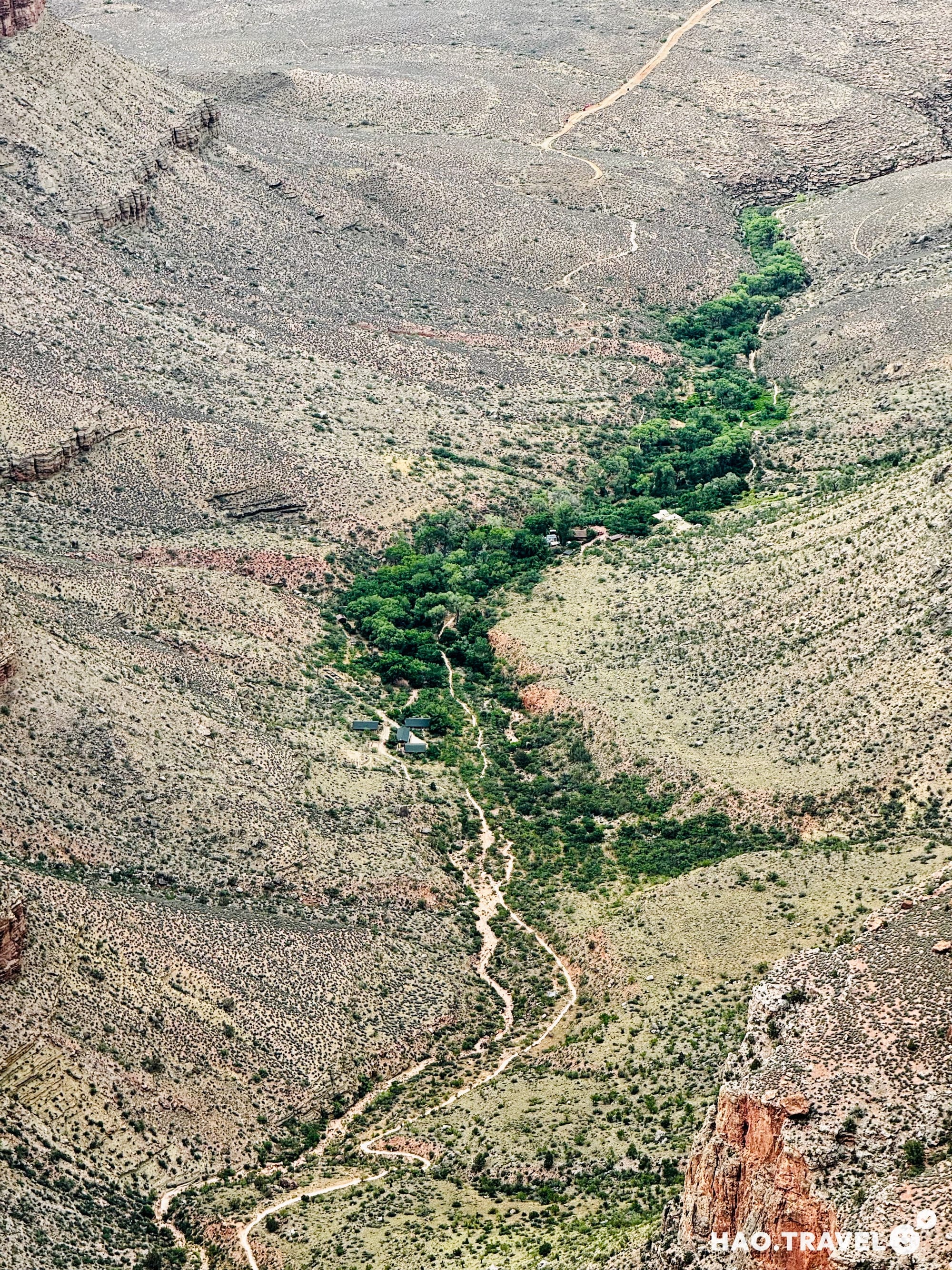
As we descended further, the landscape started to shift—more greenery, softer ground underfoot, and a sense of relief knowing we were getting close to Havasupai Gardens. This area is a true oasis in the middle of the desert-like canyon, and you can instantly feel the change in temperature and atmosphere. It used to be called Indian Garden, but the National Park Service recently renamed it Havasupai Gardens in 2022 to honor the Havasupai Tribe, who lived in this area for generations before being displaced in the early 1900s. The Havasupai people used this fertile land to farm, growing crops like corn, beans, and squash, which thrived with the help of the nearby spring.
Today, it serves as a popular rest spot for hikers on the Bright Angel Trail, offering shade, water, and a chance to recharge. The garden’s lushness is a stark contrast to the dry, rocky terrain around it—it’s almost like stepping into another world. The nearby creek provides cool water, which explains the dense vegetation here, including cottonwood trees and other desert plants. It’s also a spot where you might encounter mule trains carrying supplies to Phantom Ranch or giving day hikers a ride back to the rim.
After taking a much-needed break here, we knew we had to press on. But Havasupai Gardens was a mental checkpoint for us—it felt like a halfway point where we could gather our strength before tackling the more challenging stretches ahead. The peacefulness of the area was hard to leave behind, especially knowing the difficult terrain that still lay in front of us.
The Ledges
After the Gardens, we hit a part of the trail we nicknamed "The Ledges." It’s this section where the trail feels like it’s been carved right into the side of the canyon, with stone on one side and this surprisingly lush greenery on the other. The flat terrain felt like a gift at that point, but we knew it wouldn’t last.
The Devil’s Corkscrew
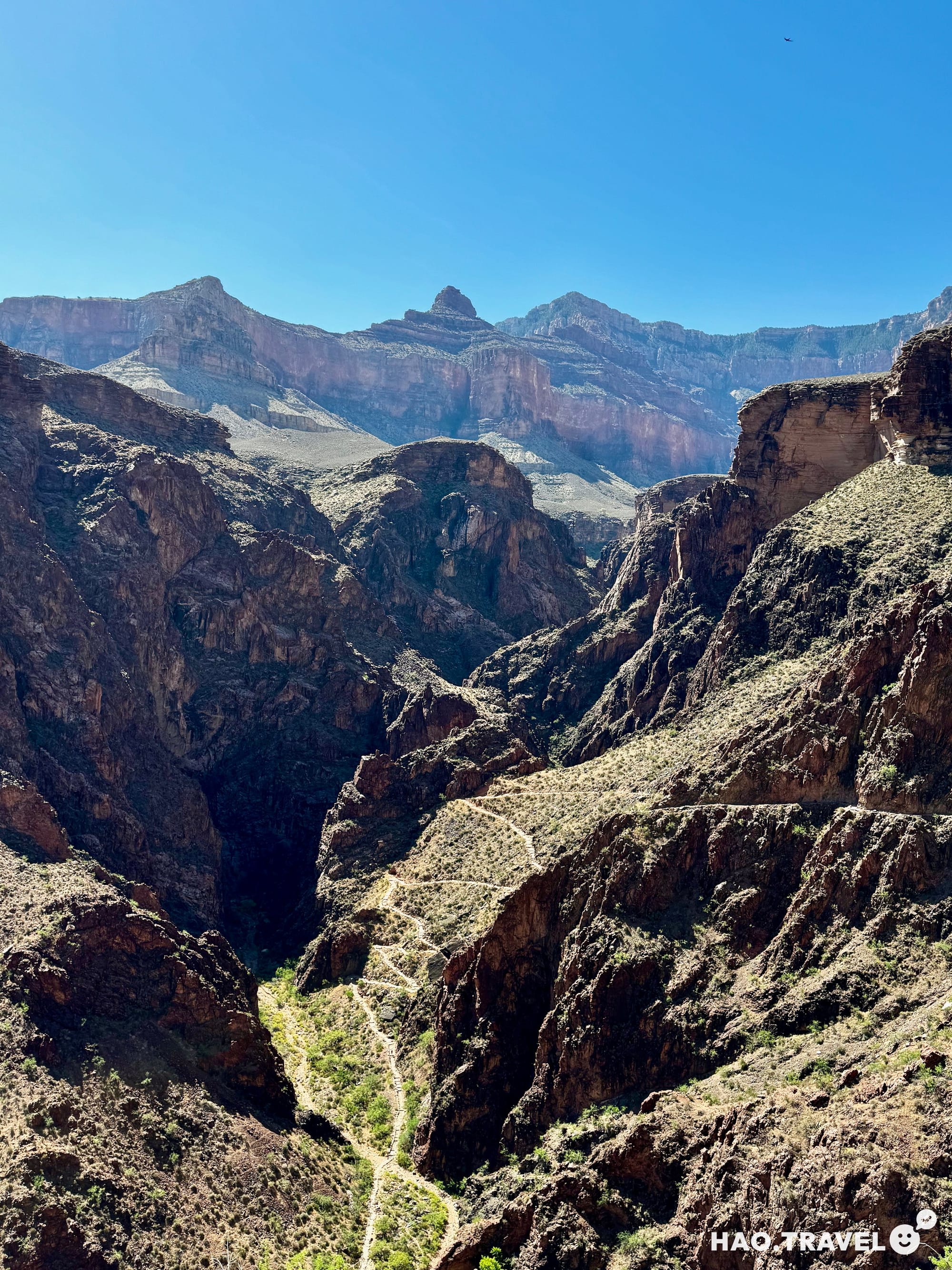
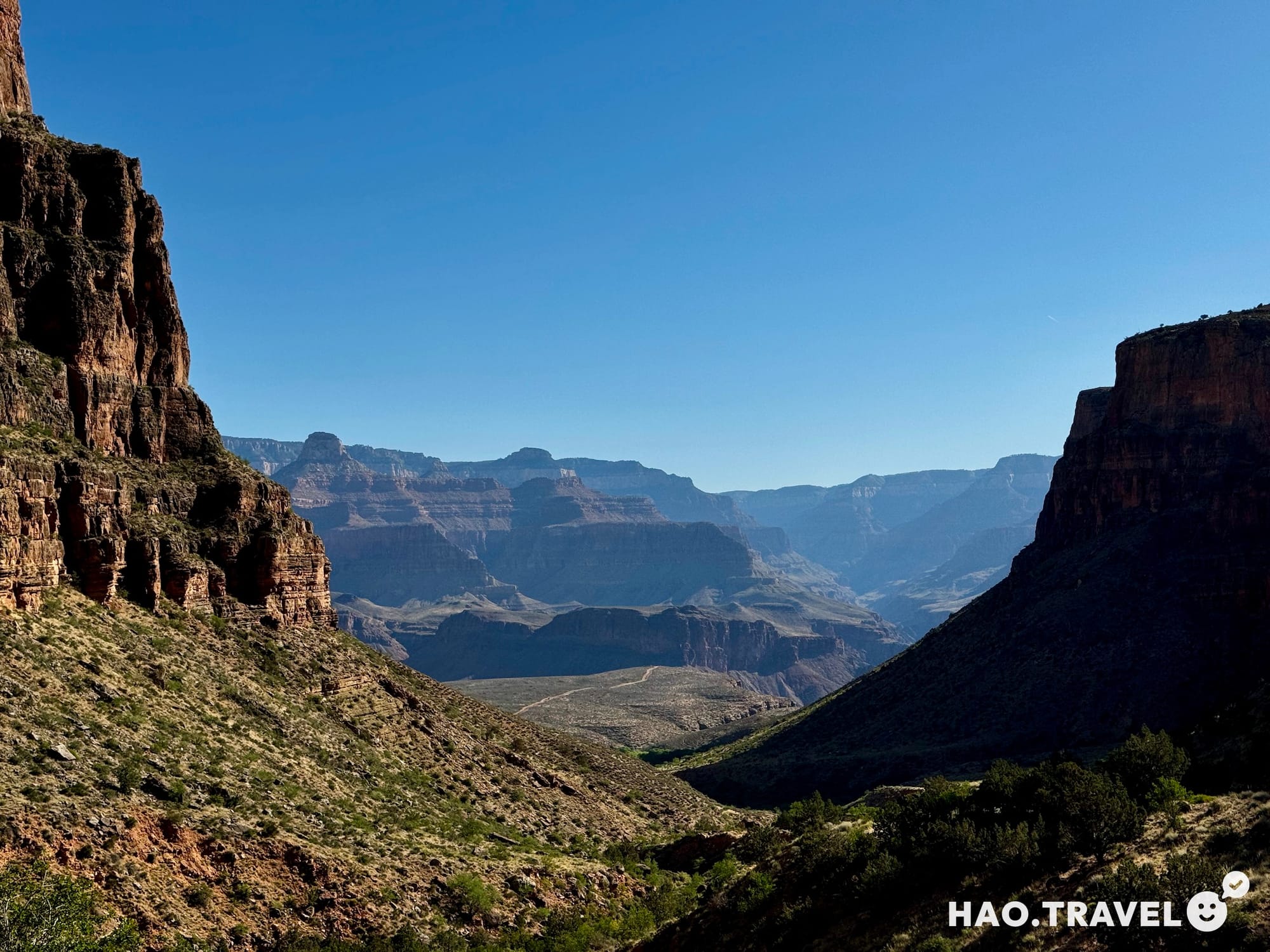
Then came the Devil’s Corkscrew—a notorious section of the trail where the path spirals sharply down through tight switchbacks, surrounded by towering canyon walls. It’s where you really start to feel the heat, with the sun bouncing off the rocks. Near the top of the Devil’s Corkscrew, we ran into a guy heading back up who gave us a heads-up about a rattlesnake that had been spotted just past the Corkscrew. Luckily, we didn’t have that encounter! The trail here felt grueling, but the views were worth it, with every turn giving us a new perspective on the cliffs above and the vastness below.
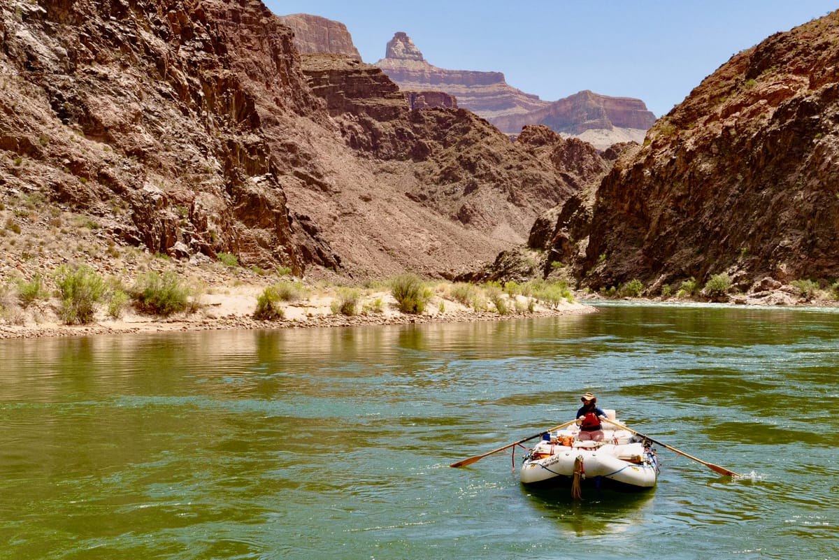
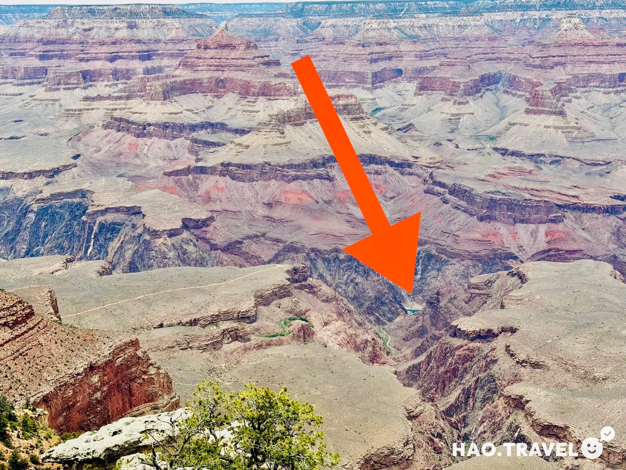
The River at the Bottom of the Canyon
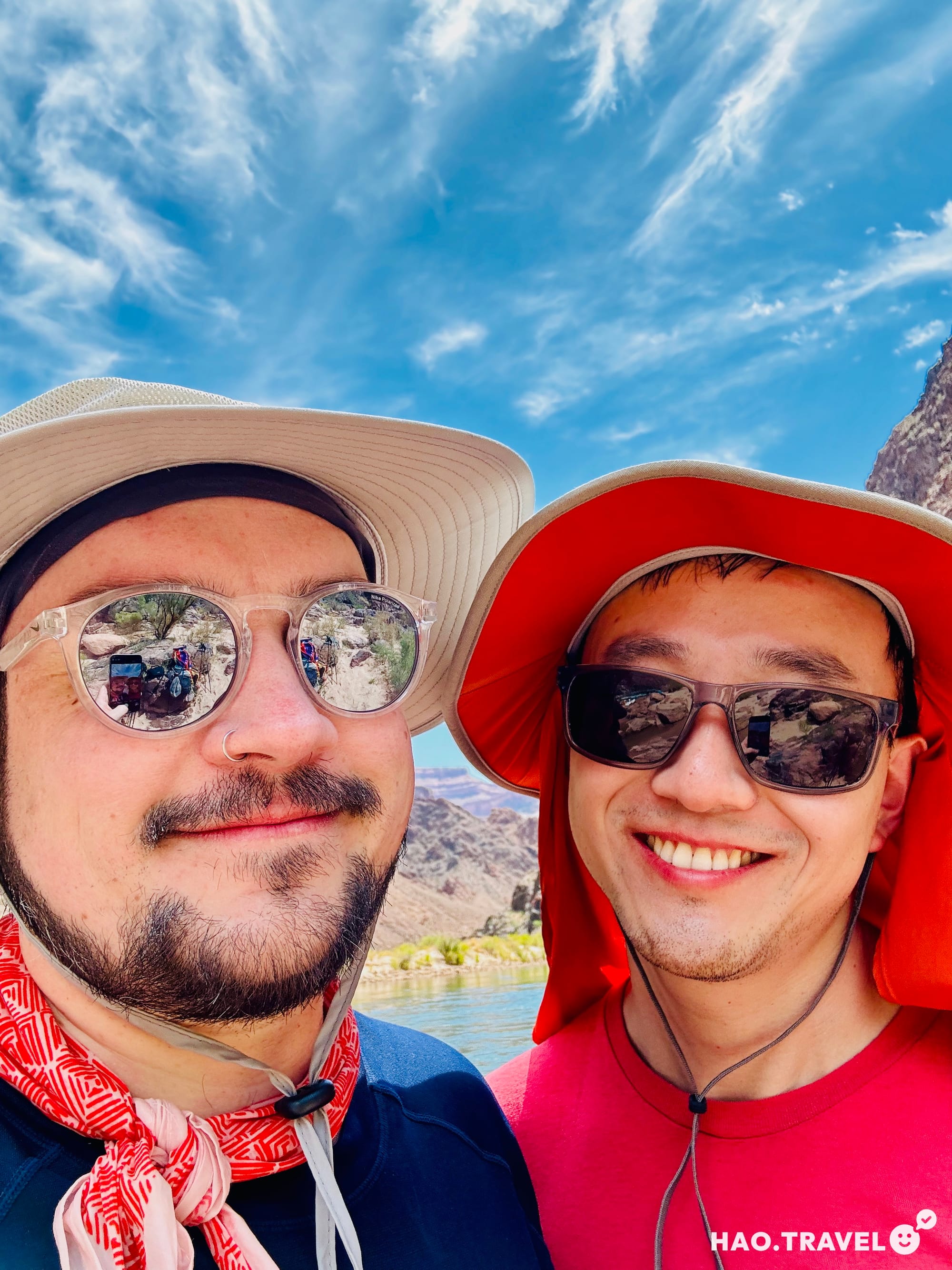
As we continued down, the temperature started climbing—by the time we reached the bottom, it felt like a 20°F (about 7°C) difference from the top. The heat was intense, and we could feel it radiating off the canyon walls. Just when we thought we could hear the Colorado River, we realized it was actually a small stream. Eventually, we made it to the River Resthouse and finally laid eyes on the Colorado. Several rafts were waiting there, and at that moment, I seriously considered hopping on one and rafting the heck on outta there! If I were to do this hike again, I’d pack a swimsuit and a quick-dry camp towel for a quick dip in the river—it would’ve been the perfect way to cool off.
The Colorado River cutting through the base of the canyon
The Real Challenge Begins
Reaching the bottom felt like a huge accomplishment, but we knew the hardest part was still ahead. Those signs you see on the way down that say, “Going down is optional, coming back up is mandatory”? They seemed funny at first, but by this point, they were starting to make sense. At the river, it was easily pushing 100°F (38°C), so we soaked our bandanas in the stream and stretched out in the shade before starting the ascent.
The Ascent
The climb back up was brutal, no sugar-coating it. We had sun protection and plenty of water, but the heat and elevation gain made every step feel like a challenge. We stopped whenever we found a sliver of shade, trying to keep cool with soaked bandanas and wide-brimmed hats. At this point, the hike became more of a mental game than a physical one. The last 3 mi (5 km) were the hardest—just pure elevation gain. This is where I, Mitchell, hit my wall. I started channeling my inner Christine D’Ercole (shoutout to Peloton!), repeating her mantra: I am. I can. I will. I do. That helped push out the pain, the muscle fatigue, and the thoughts of how out of breath I was. One step at a time, we kept moving.
Final Push to the Top
By the time we reached Havasupai Gardens again, we were exhausted but knew we still had the toughest climb ahead—just over 3,000 feet (900 meters) of elevation to gain in just 4.5 miles (7 km). It’s a challenging hike on its own, but it was absolutely grueling after going down and halfway back up. We took it slow, stopping whenever we needed to. One thing that really stood out was the camaraderie among hikers—whether at the rest stops or along the trail, everyone was in it together, offering encouragement as we all pushed through.
We finally reached the top around 7:45 PM, just under 15 hours after we’d started. Standing there, looking back down into the canyon, the feeling was indescribable—We. Did. That. According to our plan, we were supposed to set up camp at Mather Campground, but after such a long and arduous day, I insisted on sleeping in a real bed. So, we booked another night at the hotel, grabbed some pizza, and collapsed into much-needed rest.
✦ Calories & Electrolytes: Bring more food and electrolytes than you think you’ll need.
✦ Gear for Recovery: Mitchell’s OOFOS recovery slides were lifesavers for the next day.
✦ Essentials: Headlamp, Camelback, wide-brim hat, and trekking poles.
Day Four: Along the Rim & Stargazing Under a Dark Sky
Exploring the Rim
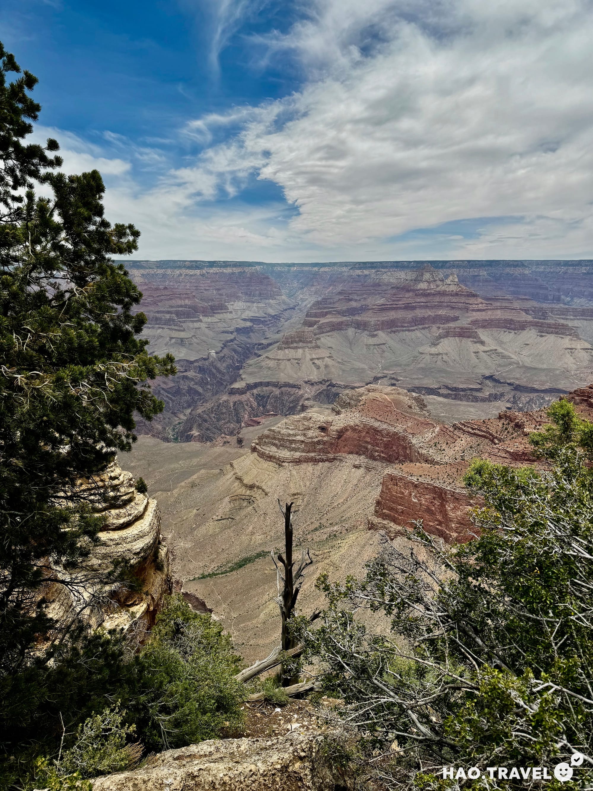
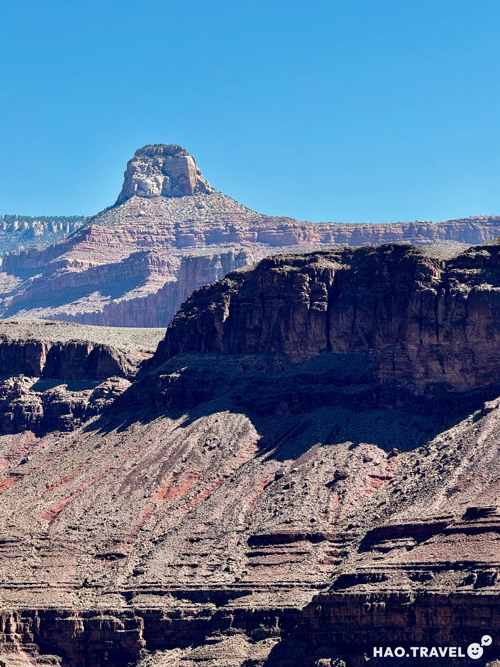
After our hike, we spent a slower day exploring the Grand Canyon’s rim. Starting at the Visitor Center, we gathered maps and a national park-themed bandana, which we thought would be a fun souvenir. Using the shuttle system, we explored Mather Point and Yavapai Point, each offering a different view of the canyon’s geological layers, some dating back over a billion years. The Yavapai Geology Museum did a great job illustrating the age and scale of this place, making us stop and think about the eons it has taken to form.
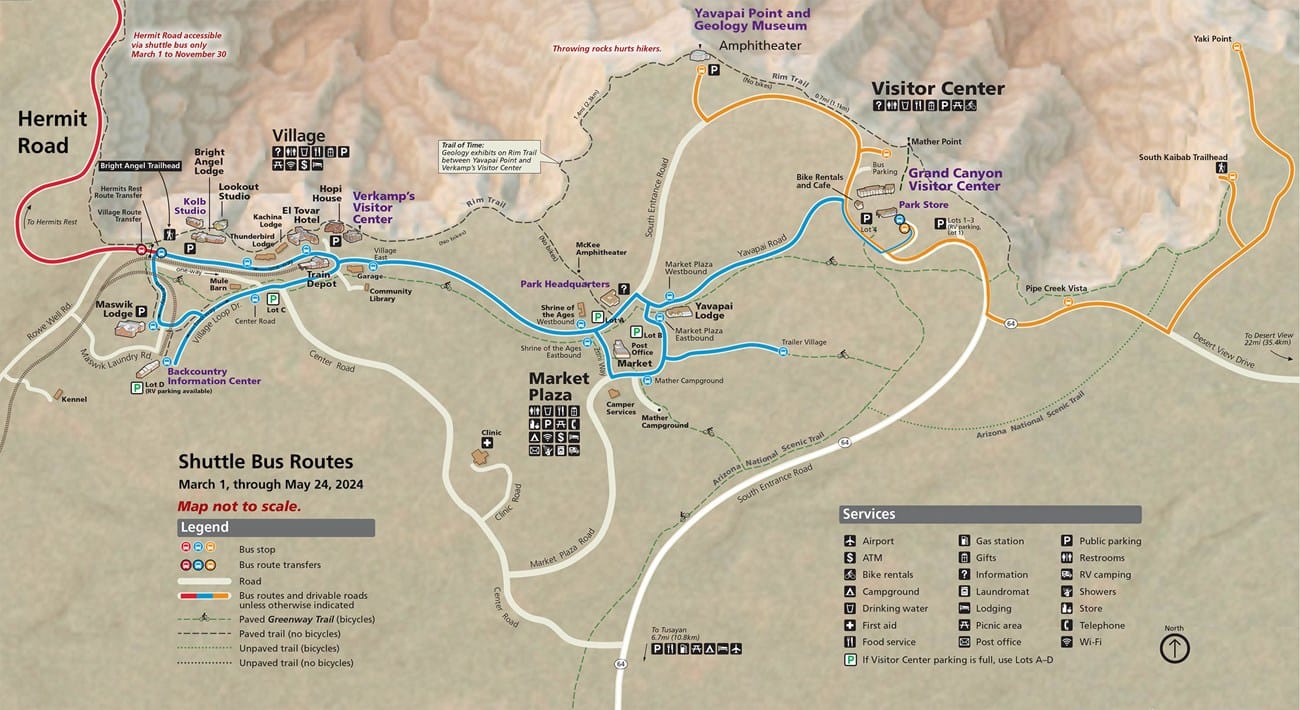
Starting westward from the Visitor Center, we hopped off at classic viewpoints like Mather Point and Yavapai Point. Each stop had its own unique perspective, with Mather Point offering a glimpse of the Colorado River at the bottom of the canyon—where we adventured to just the day before—and Yavapai Point revealing a fascinating peek into the canyon’s geological history. The Yavapai Geology Museum here does a great job explaining the canyon’s layers, some dating back over a billion years. The time scale on display made us stop and think: this place has been evolving over eons.
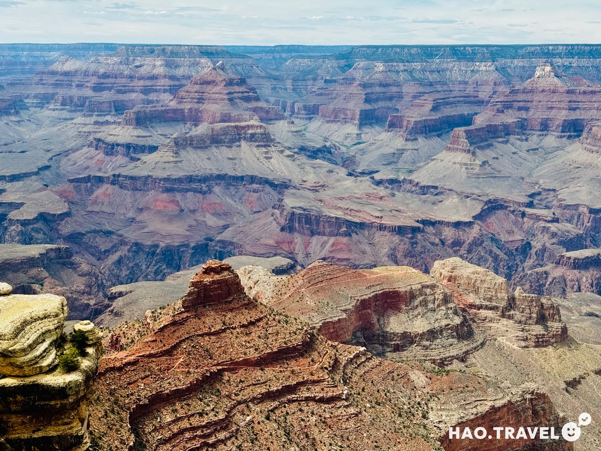
On the east side, we explored Pipe Creek Vista and Yaki Point. Yaki Point was a standout, so much so that we decided it’d be perfect for a sunset return. We hit Yavapai Lodge for lunch, where we could refuel before claiming a campsite at Mather Campground.
If you plan to take the red shuttle route out toward Hermit Road, know that it’s a longer route and takes a bigger chunk of your day. We didn’t have time for it this trip, but it’s on our list for next time.
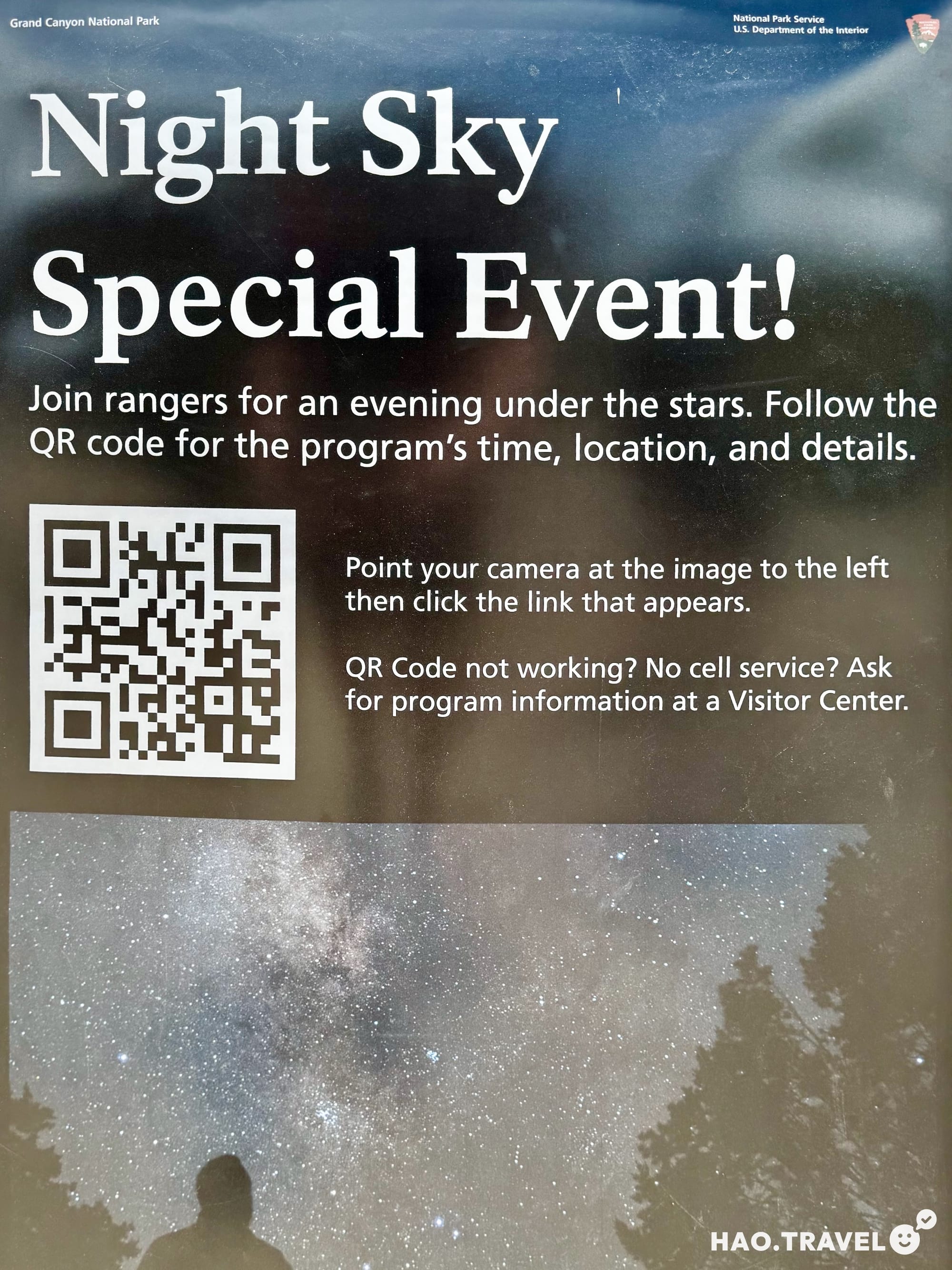
A Night Under the New Moon: The Grand Canyon Star Party
We timed this visit with a new moon, which turned out to be a perfect accident. At the Visitor Center, we learned about the evening’s “star party,” an event where astronomers and stargazing enthusiasts gather to explore the cosmos with telescopes and give talks on astronomy. The park’s astronomer, Dean Regas, was hosting a talk that evening, offering what he called a “tour of the universe.” Listening to him made us feel the vastness of it all, a reminder of how small we are and the perspectives that kind of immensity can bring.
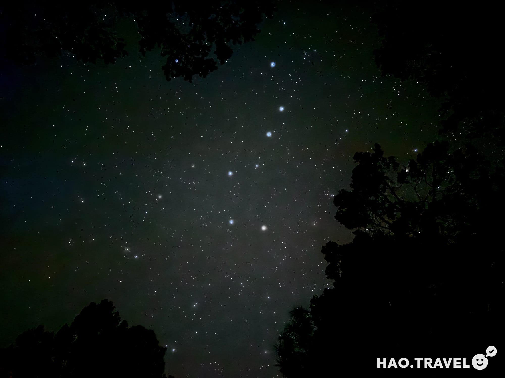
For us, stargazing is a chance to reflect on the sublime, on the profound sense of humility that comes with contemplating the vastness of space. The feeling of interconnectedness and of the tiny part we play always puts life in a different light. Unfortunately, cloud cover cut our stargazing short, but we’ve learned to be patient with the weather and will be back for another Star Party under those dark skies.
Tips for Stargazing at Grand Canyon: Planning for Dark Skies
Grand Canyon National Park is a designated Dark Sky Park, meaning it’s taken significant steps to limit light pollution and keep its skies as clear as possible for stargazers. From carefully designed lighting around buildings to working with nearby towns on lighting ordinances, the park goes above and beyond to minimize light interference, which makes for some of the best stargazing conditions you can find.
DarkSky International, the organization behind the certification, partners with parks like the Grand Canyon to maintain these standards. They work worldwide to protect night skies for both ecological and cultural reasons, preserving the night environment not only for stargazers but also for nocturnal wildlife and local ecosystems.
Our Go-To Stargazing Apps: Checking for Ideal Conditions
For stargazing forecasts, Clear Outside is essential for weather forecasting. It provides details on cloud cover, visibility, and even hourly forecasts. Sky Guide is a fantastic app for identifying stars and constellations, and PhotoPills is a solid option for visualizing sun, moon, and Milky Way placements.
Day 5: Antelope Canyon, Horseshoe Bend, and Lake Powell
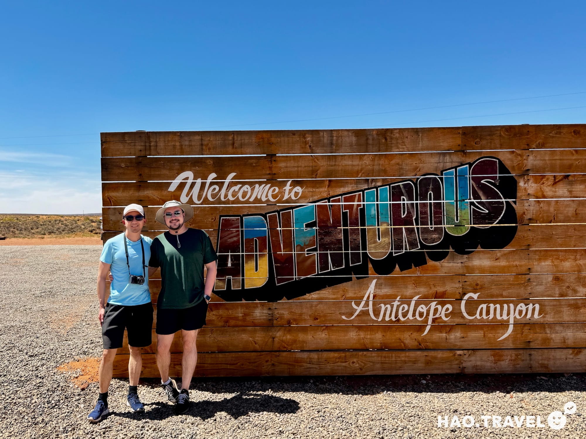
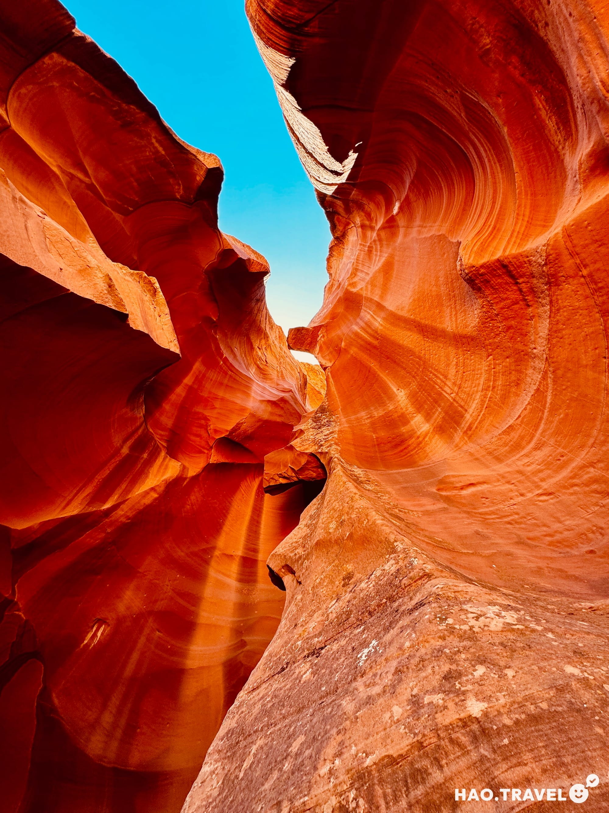
Exploring Upper Antelope Canyon
Antelope Canyon is only accessible by tour, and after a bit of last-minute booking, we secured a prime slot with a tour company with great reviews. Pro tip: Your experience (and photos) can depend significantly on the tour guide’s ability to know where to stop for the best angles and navigate in harmony with other groups. Our guide was fantastic, pointing out the best spots to see the shifting light and sharing stories of Navajo lore that added to the mystique of the canyon.
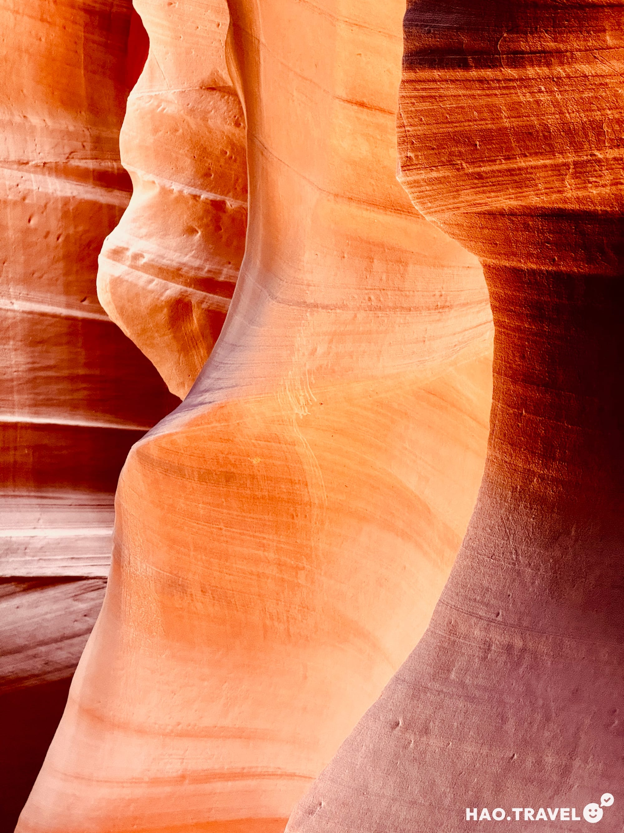
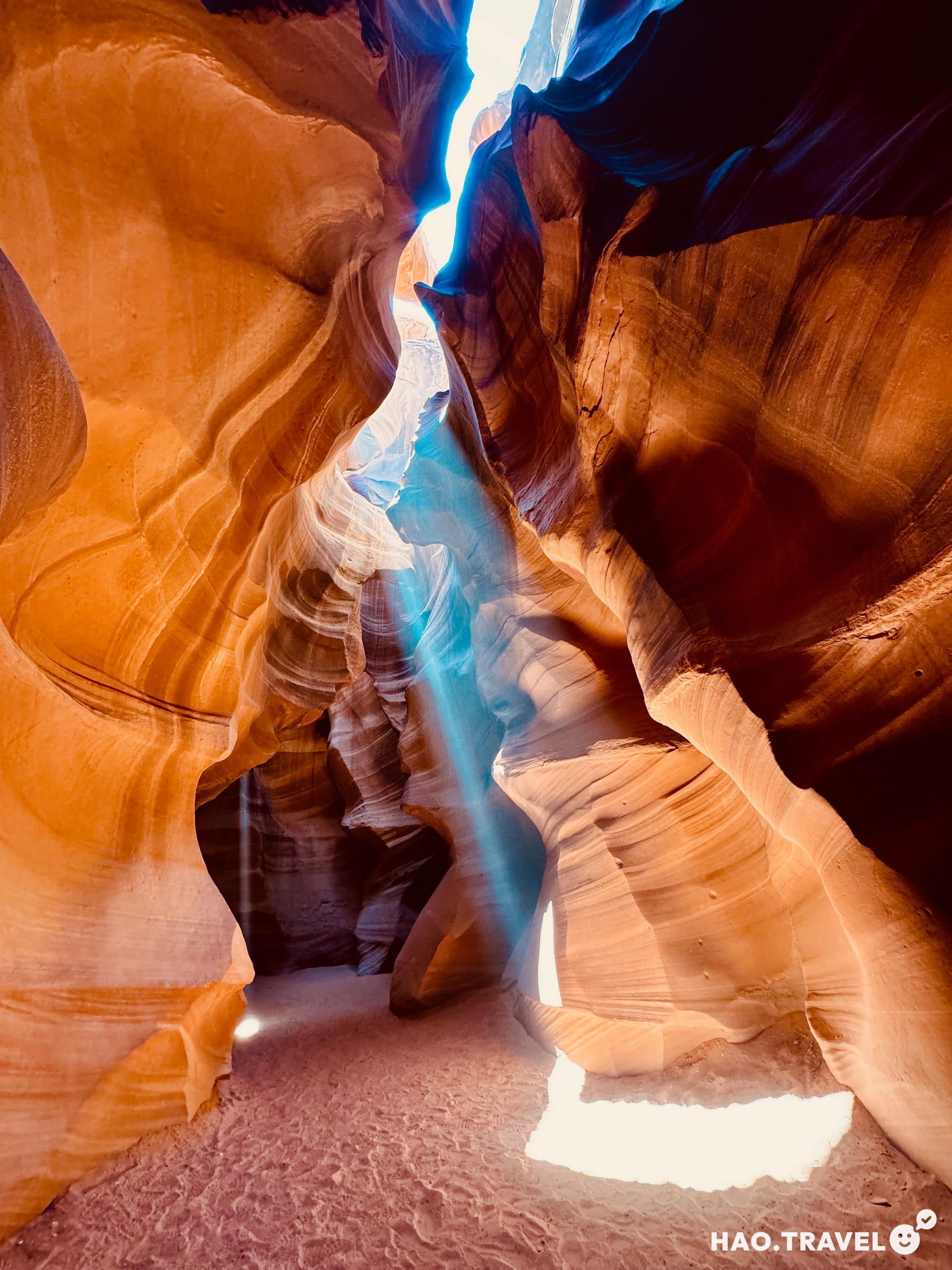
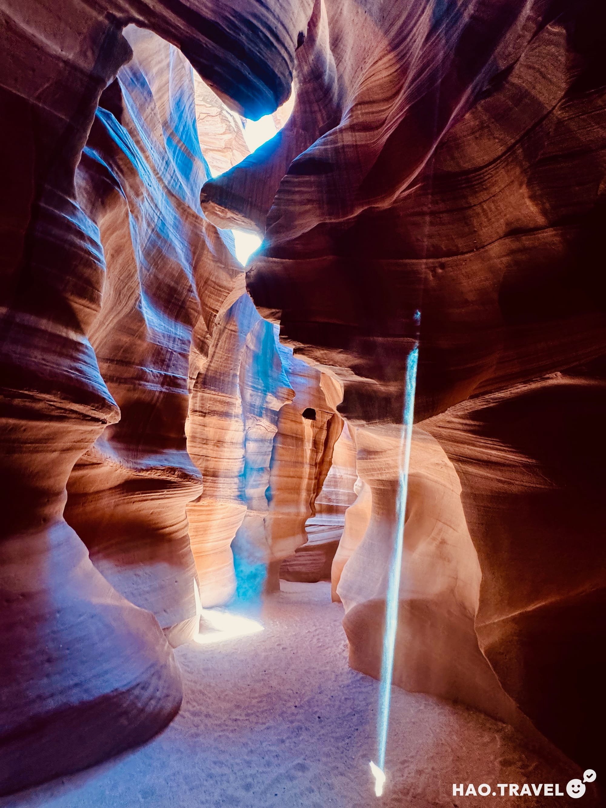
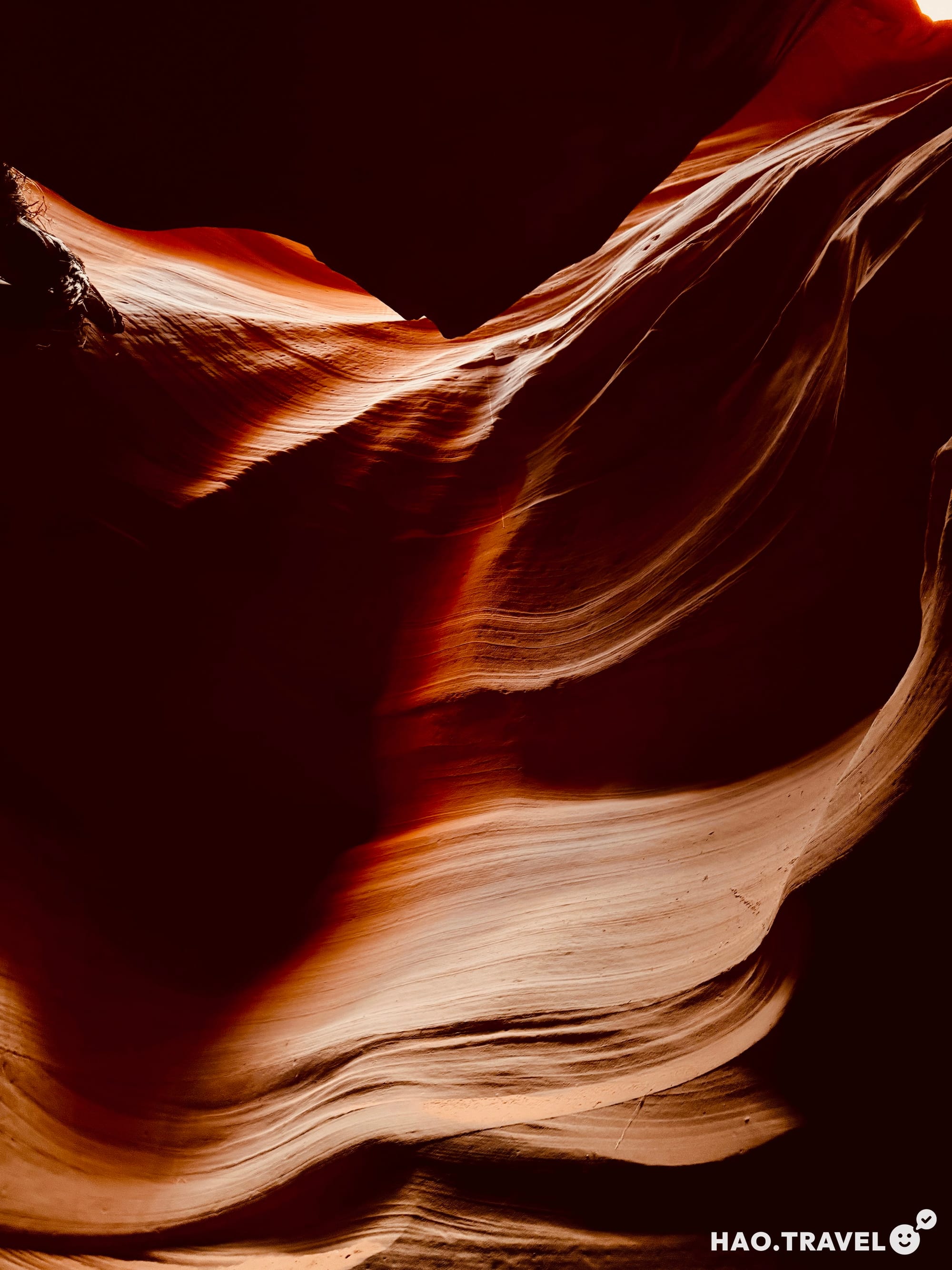
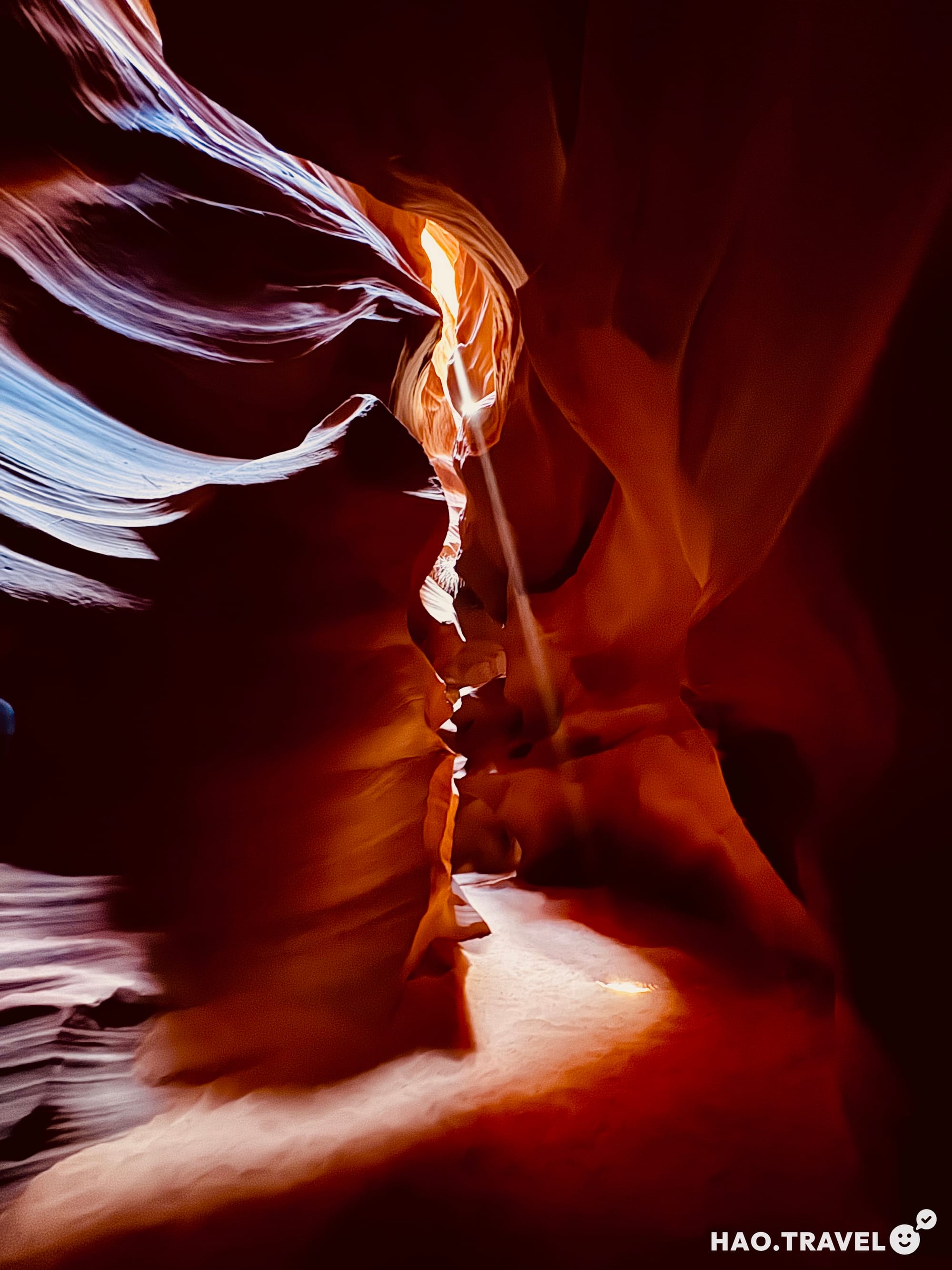
After a short, bumpy van ride to the canyon entrance, we set off on foot with our group. Entering the canyon feels like stepping into a different world, with walls of deep red sandstone soaring over 100 feet above. Formed by centuries of flash floods carved through Navajo sandstone, Antelope Canyon is narrow, winding, and filled with surreal textures. These slots have seen powerful forces over time—water rushing through here carves out layers and shapes that shift with every flood season.
Our 11:05 tour time got us there just as the sun reached the perfect angle, sending beams of light into the depths of the canyon. It was a magical sight that lived up to all the photos we’d seen. Besides those dramatic beams, the colors and textures in the canyon were amazing: the walls shift from red to purple and orange depending on the light. Our guide shared that the Navajo have long regarded these canyons as sacred, places where nature’s power and beauty converge. According to legend, these slot canyons are watched over by guardian spirits, who are believed to protect those who visit with respect.
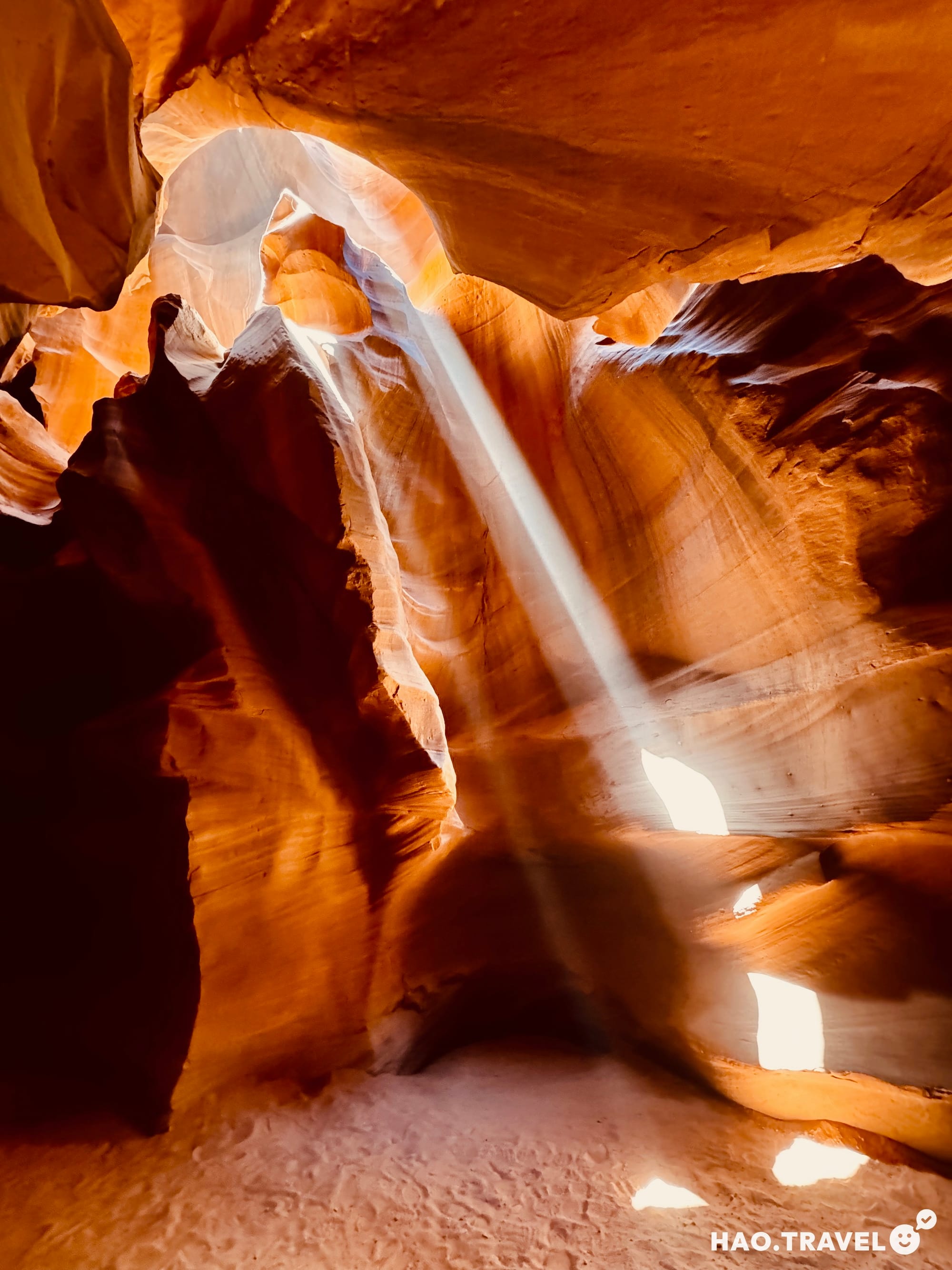
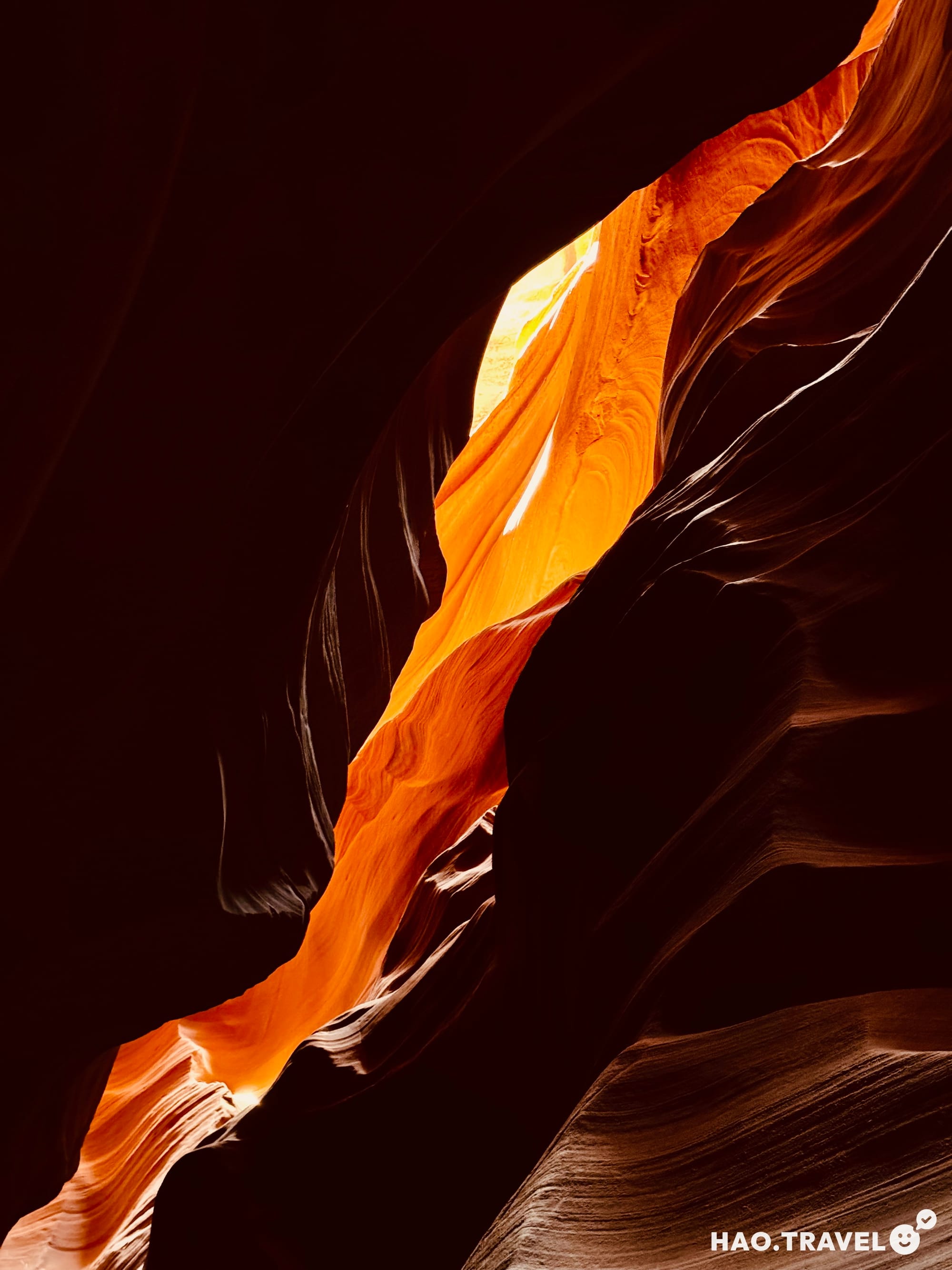
✦ Timing: Midday tours (typically between 11 a.m. and 1 p.m.) are best for catching the famous light beams.
✦ Angles: Low-angle shots capture the height of the canyon walls while framing upward helps get the full effect of the light beams.
✦ Settings: Turn off the flash and adjust your exposure for better contrast. If you’ve got it, a wide-angle lens will help you capture the canyon’s full scale.
Afternoon in Page: Lake Powell and Horseshoe Bend
After Antelope Canyon, we drove into Page to run a few errands (including a stop at a teriyaki restaurant in a building that looked like a steamboat!). We also checked out Glen Canyon Dam and the visitor center, a cool spot if you’re interested in learning about how Lake Powell was formed and how the dam affects water levels in the region.
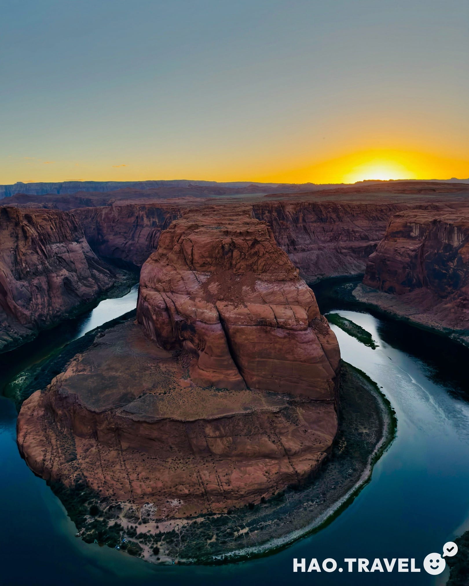
We ended our day with a sunset trip to Horseshoe Bend. Located about 9 miles (14.5 km) upstream from the Grand Canyon, this meander of the Colorado River is a short 3/4-mile (1.2 km) hike from the parking lot. It’s popular at sunset, and we arrived about 30 minutes beforehand. For the best views, try to arrive earlier—especially in summer when the crowds are heavy. We found a spot near the edge with a good view of the river winding through the canyon, and it was surreal to watch the colors change as the sun dipped behind the cliffs.
✦ Positioning: Get there early to secure a spot close to the ledge for an unobstructed view.
✦ Best Angle: A wide-angle lens (or phone panorama) helps capture the full curve of the river.
✦ Lighting: The sunlight will be bright and direct in the late afternoon; a polarizer filter can reduce glare for DSLR users.
A Starry Night Near Lake Powell
After sunset, we drove back toward Lake Powell and pulled off at a scenic overlook to take in the night sky. June’s skies were especially clear, and we had an incredible view with minimal light pollution around Page. Constellations like Ursa Major (the Big Dipper) and Scorpius were visible, with the red star Antares marking Scorpius’ heart. We even spotted Vega and Altair, both part of the Summer Triangle.
Ending our day under the vast, open sky felt like the perfect contrast to the day’s canyon adventure. Watching the stars over Lake Powell added a final, humbling reminder of the beauty and scale of the desert night.
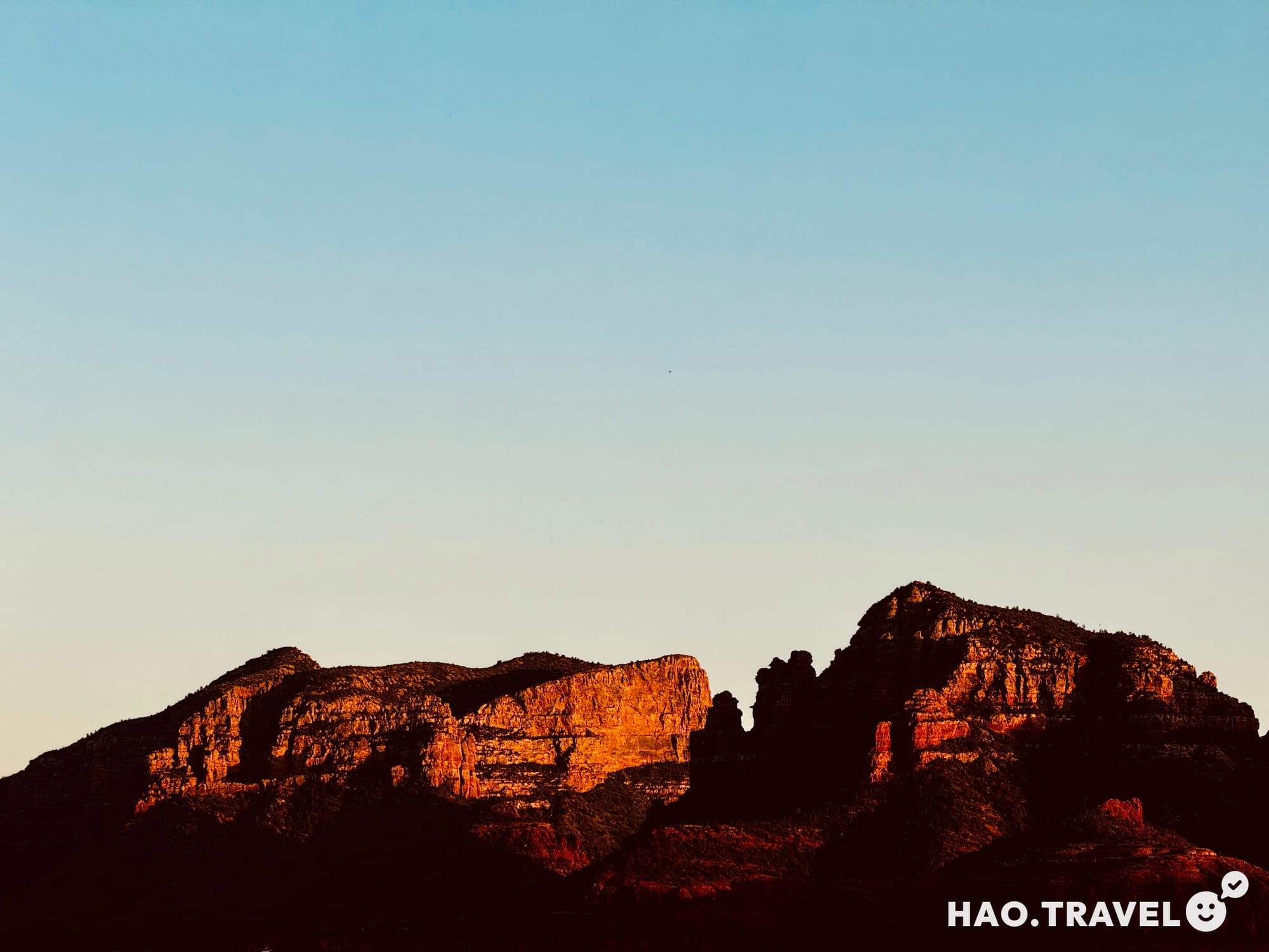
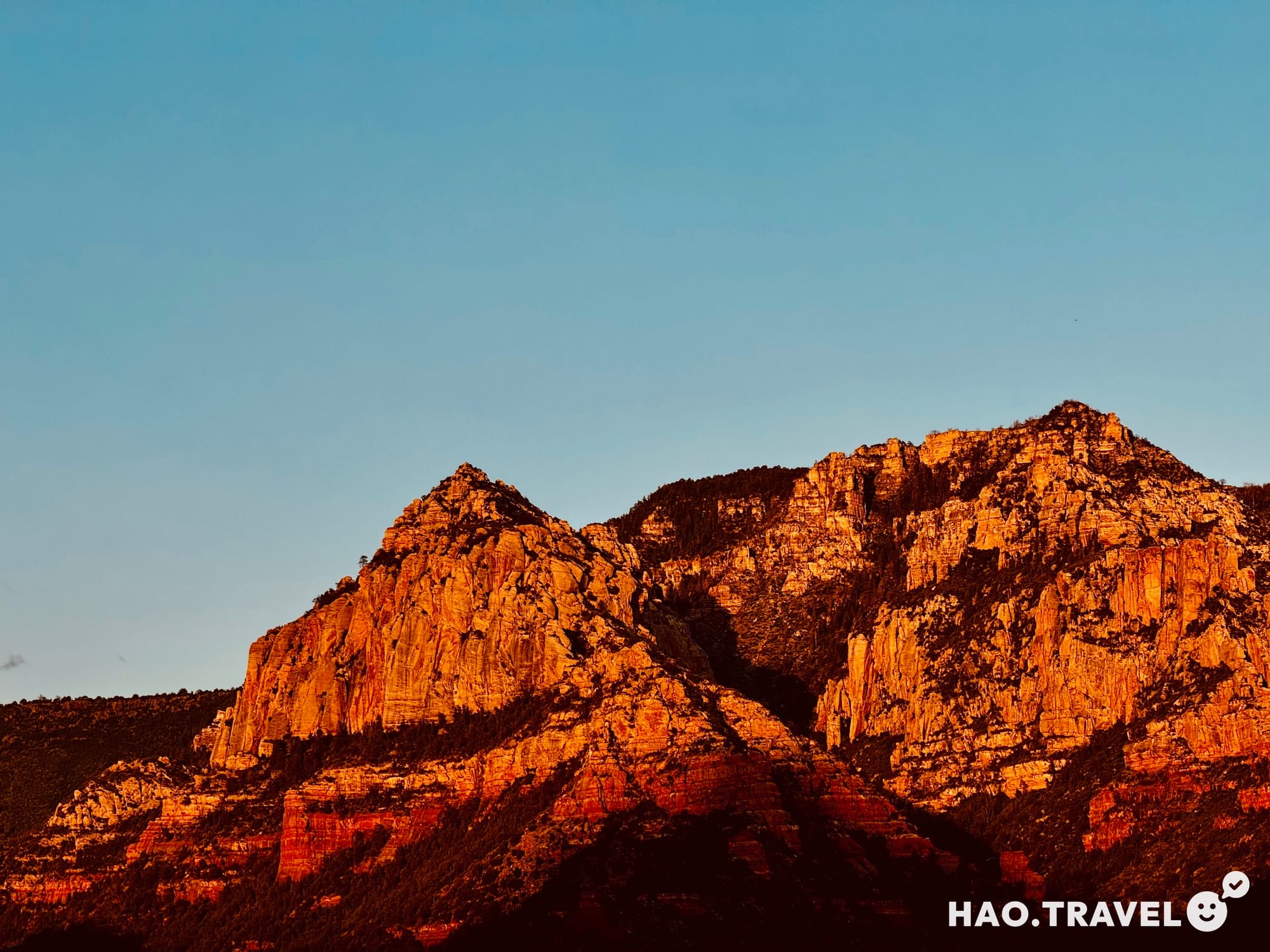
Day 6: Let’s Get Metaphysical
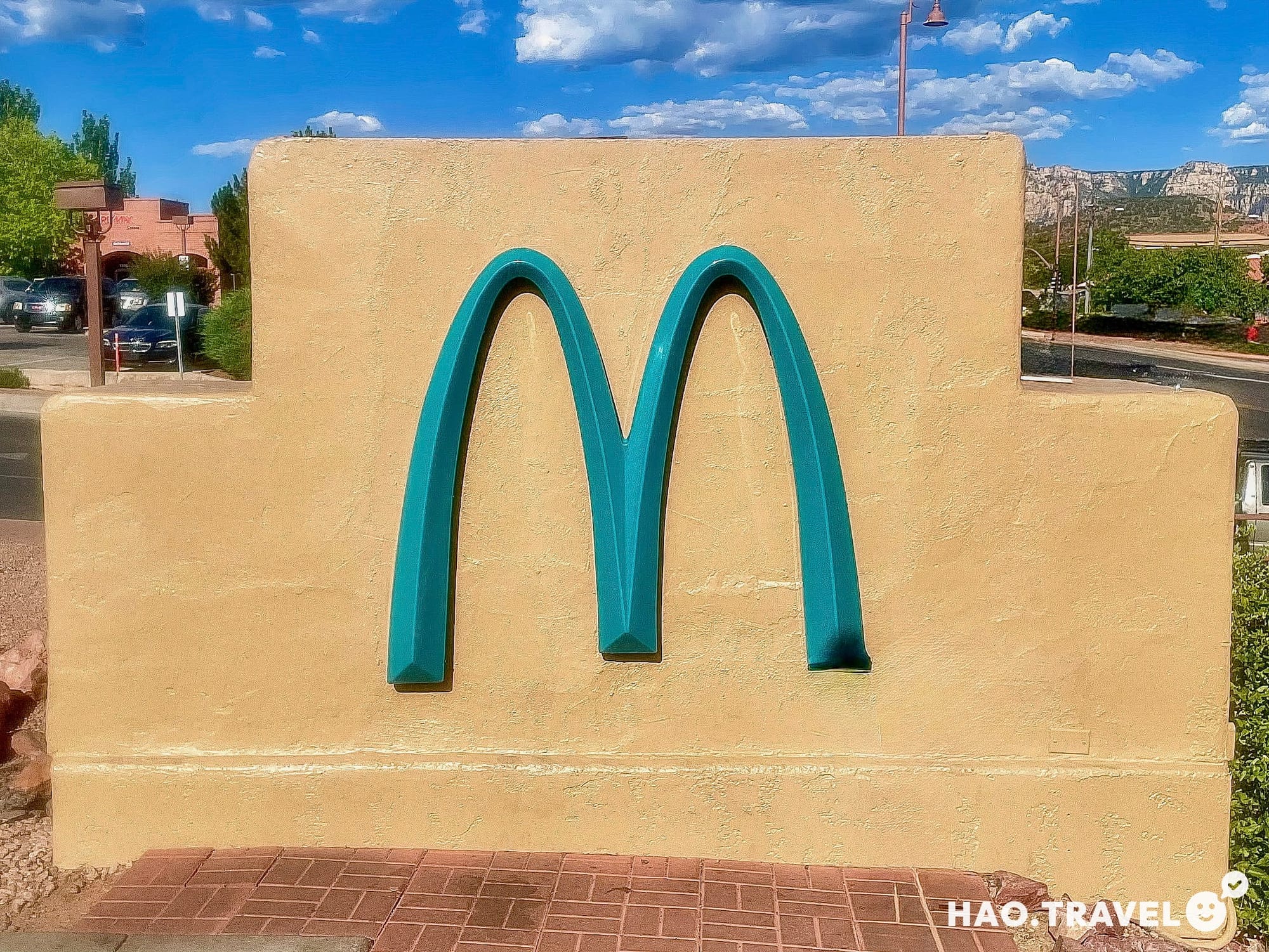
After leaving Lake Powell, we made the 2-hour-40-minute drive to Sedona, with one of our first stops being the “famous” McDonald’s with turquoise arches instead of the usual gold. Fun fact: this color swap was required by Sedona’s city ordinances to blend better with the desert landscape, giving it a quirky charm. Despite the unique look, the ice cream tasted like any other McDonald's—no surprises there.
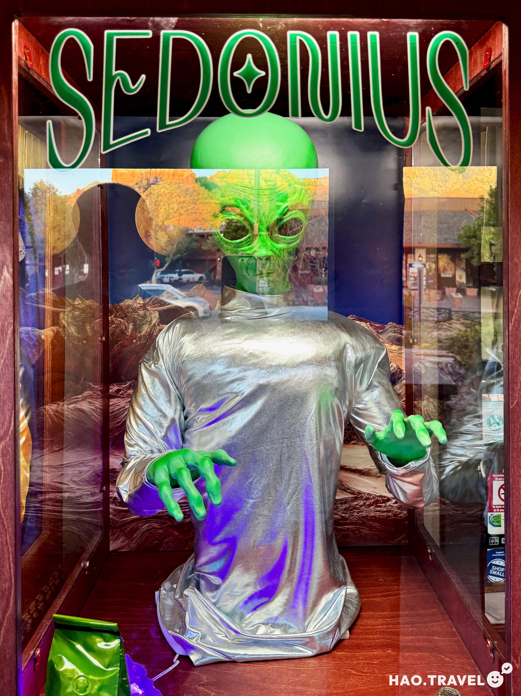
We also stopped at one of Sedona’s many metaphysical shops for an aura photo and tarot reading. This was my second time getting an aura photo (Nongchao’s first), so seeing how mine had changed over the years was interesting. It was a great way to reflect, and whether you believe in it or not, it’s an excellent reminder to listen to your instincts and focus on the positive.
Afterward, we wandered through Sedona’s Main Street, casually exploring the local art galleries and checking out little shops. Many places were closed since it was a Wednesday night, but we still enjoyed the relaxed vibe. Once hunger set in, we hunted down a highly-rated food truck stationed in a gas station parking lot and tried their pollo and carne asada tacos, plus a side of elote. These street tacos were simple, fresh, and delicious—perfect for a low-key dinner under the stars.
We wrapped up the day with a drive out to Dead Horse Ranch State Park, where we’d rented a cabin for the night. While the cabin was basic (you have to provide your own sheets—we used our sleeping bags), it had everything we needed: a double bed, a twin bunk, a table with chairs, and an air-conditioning unit that we were especially thankful for. There was also an outdoor picnic table and a grill, but since we arrived after dark, we settled in and rested up for an early start the next morning. It was a quiet, cool, and comfortable place to call home for the night—perfect for our low-key “camping” stop in the desert.
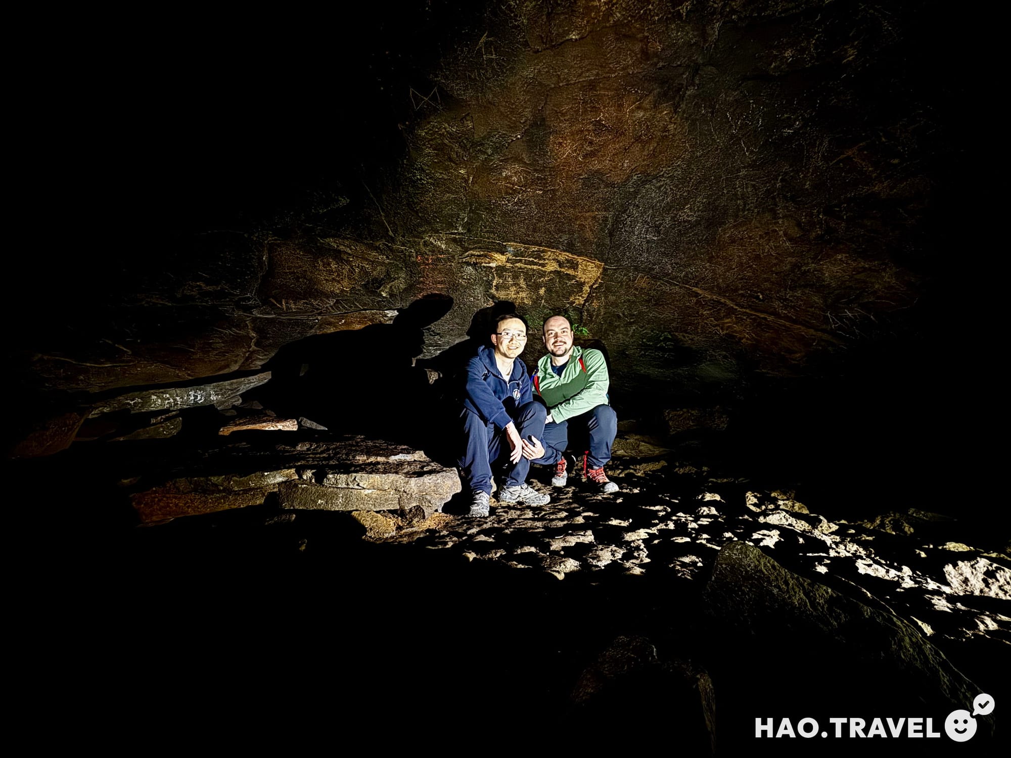
Day 7: Cooling Off in a Lava River Cave
As fate would have it, we arrived in Sedona in the middle of a heatwave, with temperatures soaring past 100°F. Initially, we’d planned to do some hiking and visit one of Sedona’s famous vortex sites—energy-rich locations that draw people for meditation, self-reflection, and creative inspiration. Sedona has a natural energy that feels palpable. While many of these vortex spots, like Boynton Canyon and Cathedral Rock, have become popular destinations, we were looking forward to soaking in the region’s atmosphere. But with the intense heat, we decided to switch things up.
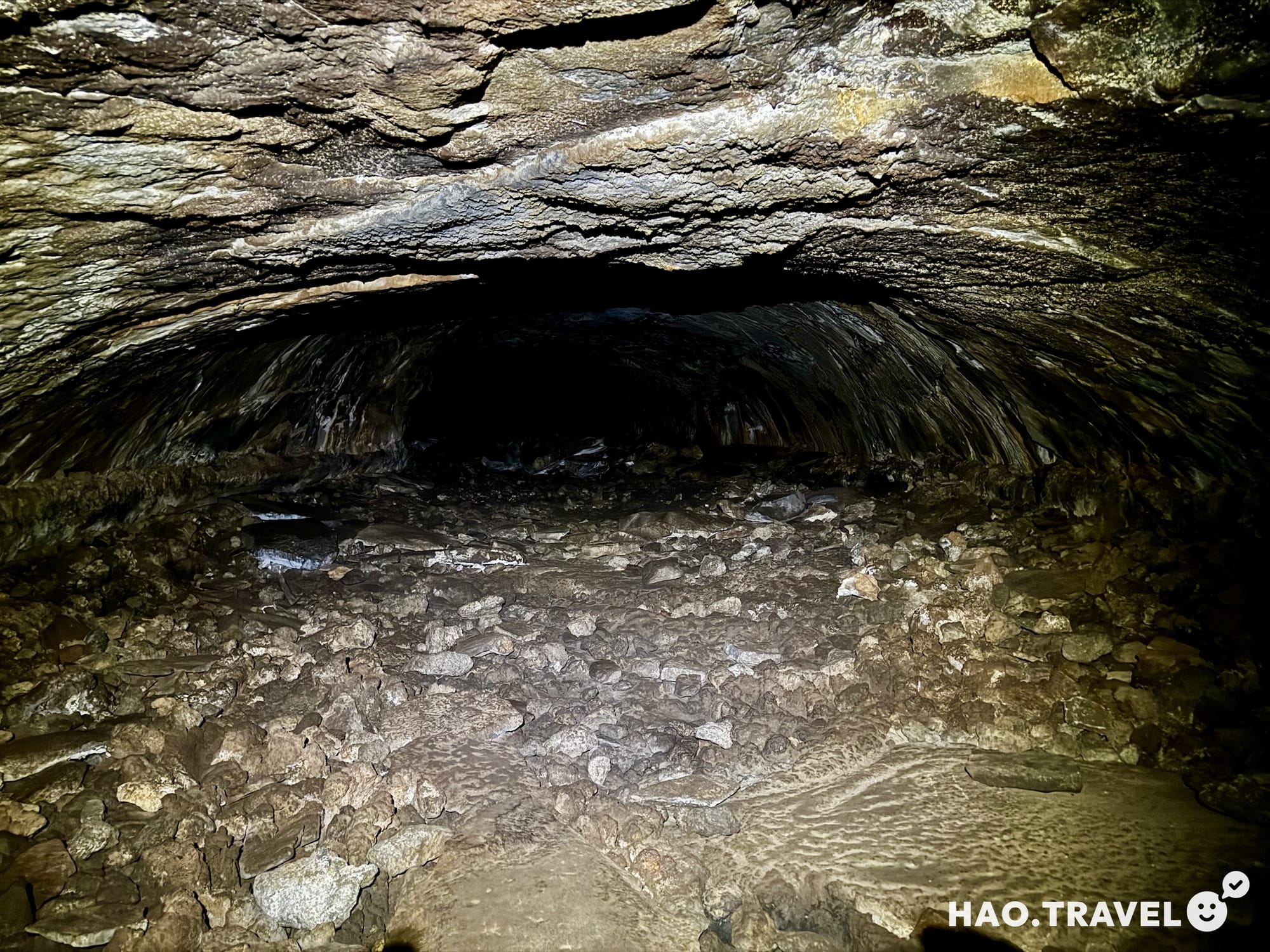
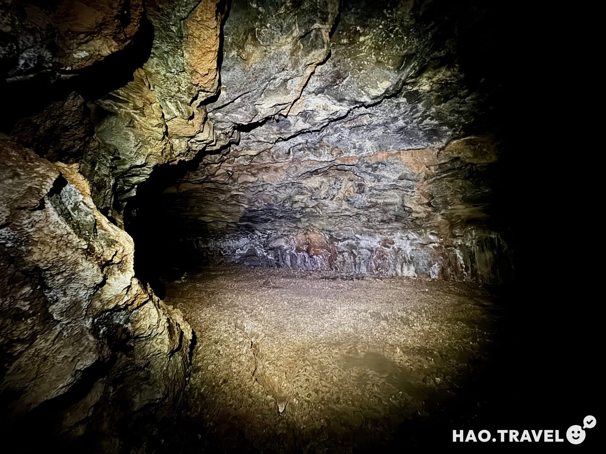
Thankfully, as we sat in our air-conditioned cabin at Dead Horse Ranch State Park, we found the perfect alternative: a lava tube in Coconino National Forest. Known as the Lava River Cave, it’s about an hour’s drive from Sedona, 14 miles north of Flagstaff, and it stays a cool 42°F (6°C) year-round—a perfect escape from the heat. We grabbed our headlamps and hiking boots and headed into the cave.
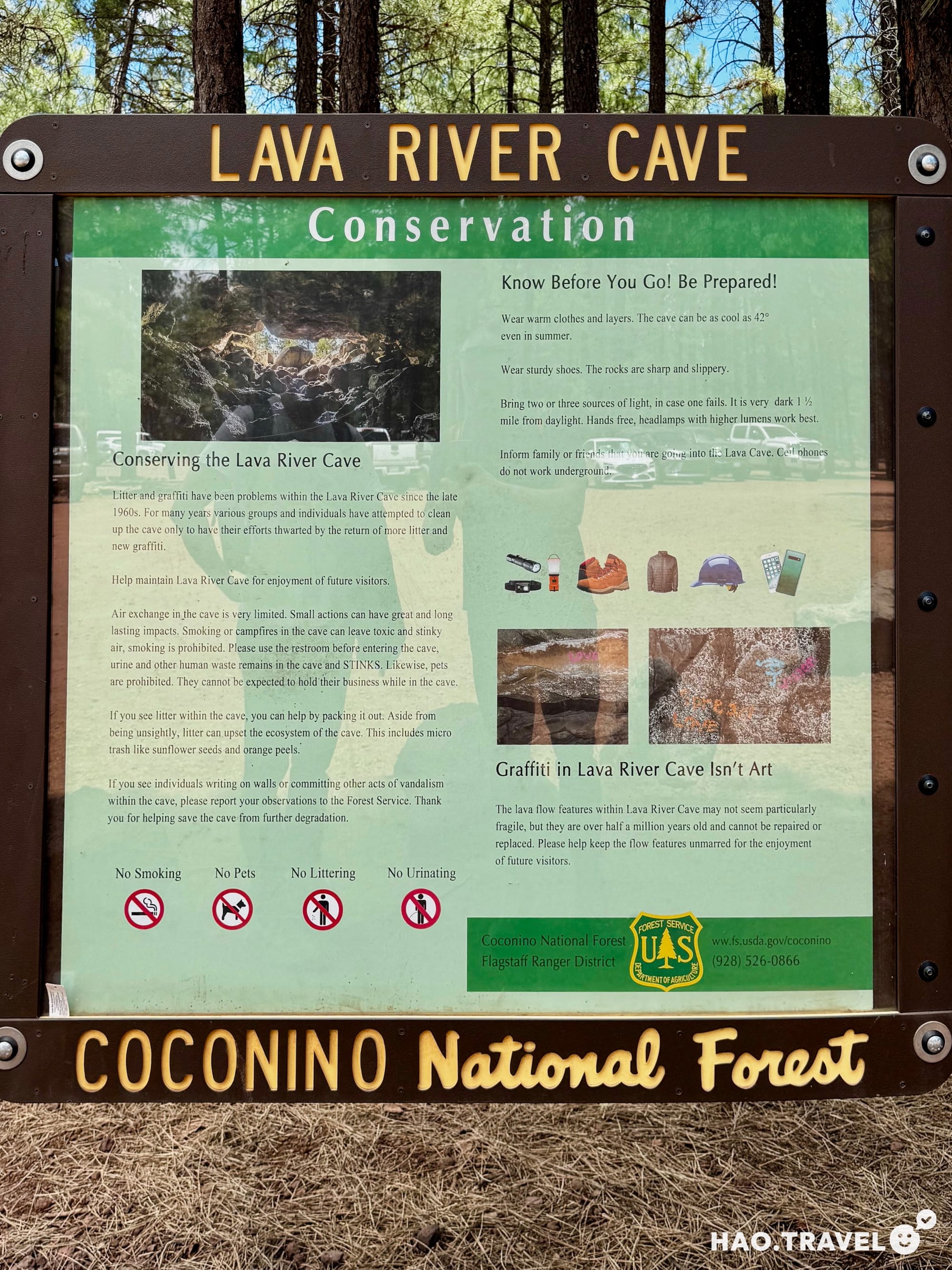
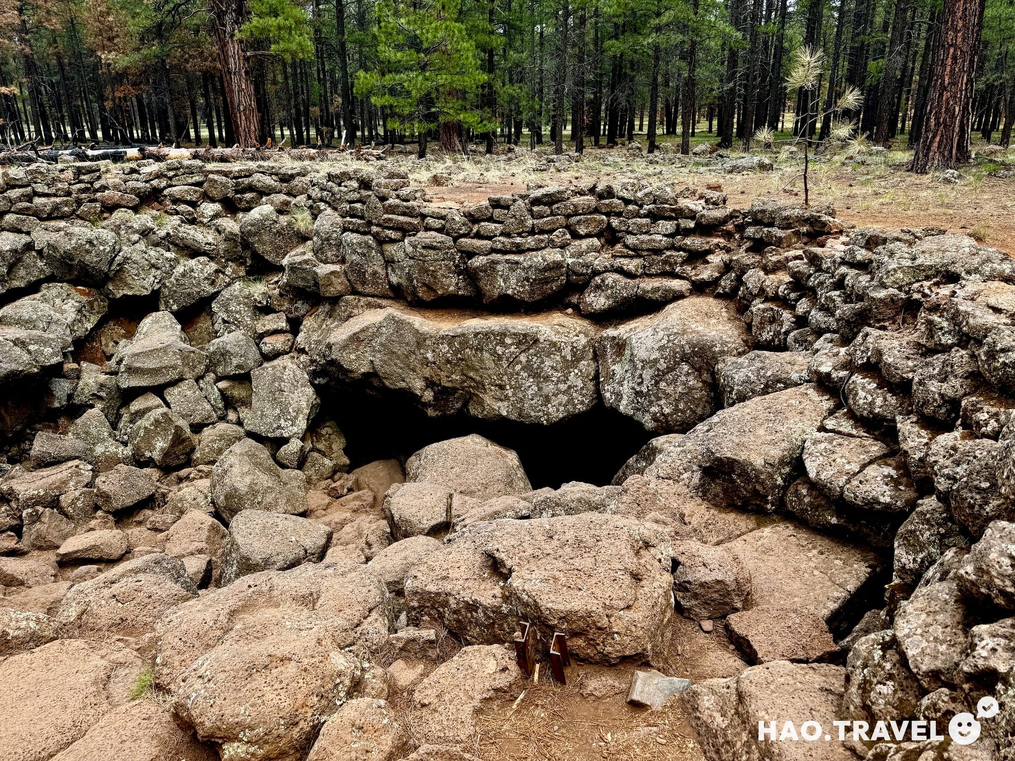
The hike through the cave is about 3/4 of a mile one way, and we took a bit longer on the return to explore the other fork and see a different section of the cave. One of the best parts? Only a few other groups were inside, so we often had that vast, dark space to ourselves. At one point, we turned off our headlamps and stood in complete darkness. The silence and stillness were surreal—standing there, you lose all sense of direction and distance as your senses recalibrate to the quiet. Reflecting on the experience, it was the perfect way to beat the heat and a great reminder that flexibility on a trip can lead to unexpected discoveries.
- Bring layers: The chill is noticeable, even with a sweatshirt and pants.
- Carry multiple light sources: Headlamps, flashlights, or even backup batteries are essential—there’s no natural light and no cell reception, so if a light dies or you get turned around, it’s on you to navigate safely.
- Consider gloves and a hat: The cave temperature and rocks can feel colder than expected, especially after the summer heat outside.
After our cave adventure, we headed back to Sedona and checked into a very new Holiday Inn. It was one of the nicest we’d seen, with a solid breakfast and water bottle fillers on the fountains—small perks, but we appreciated them!
We wrapped up the day with a return to Simon’s Angel Tacos. Just like the night before, the tacos were a great way to end the day, and headed back to our cabin, ready for whatever the trip would bring next.
Day 8: Stepping Back in Time
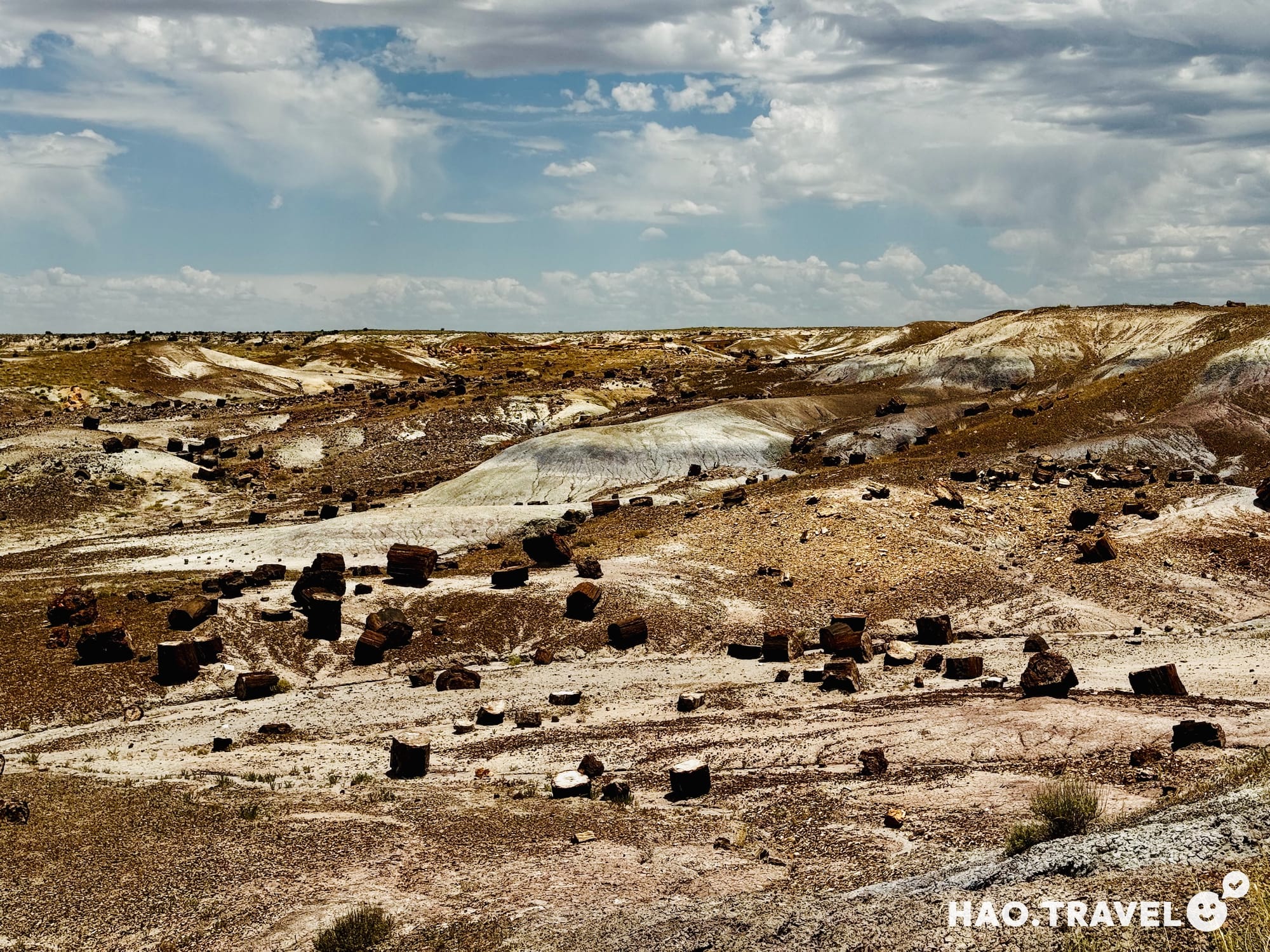
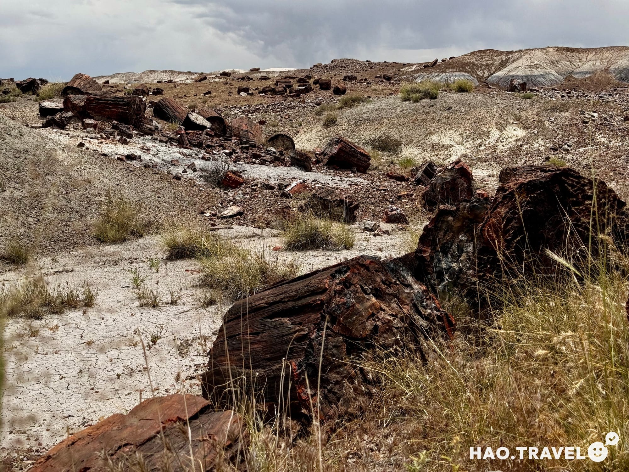
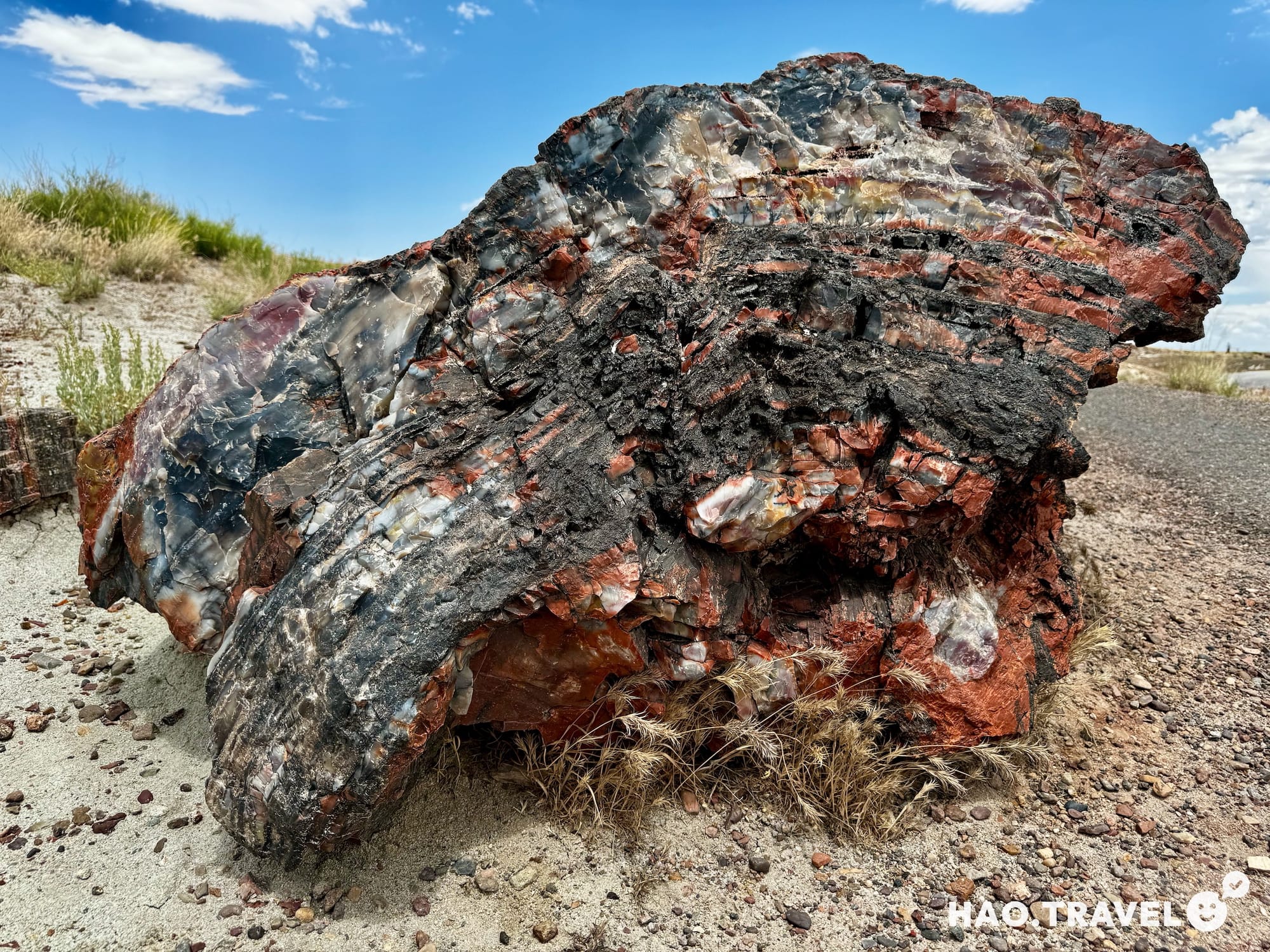
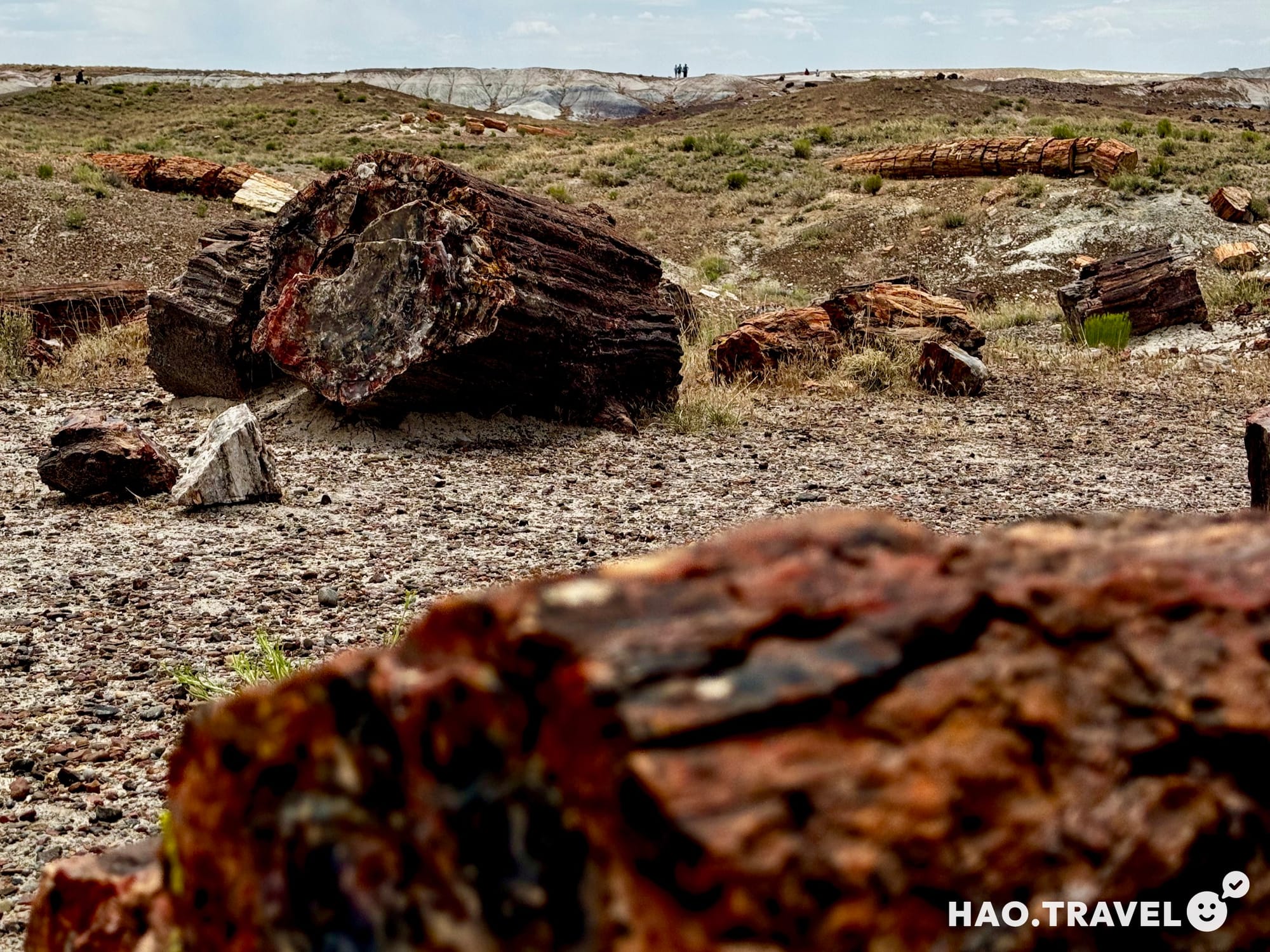
Our time in Sedona was up, and we packed the car for the five-and-a-half-hour drive toward Chaco Culture National Historical Park. But first, we couldn’t pass up the chance to stop by Petrified Forest National Park on our way out of Arizona. We visited the park’s visitor center, where we got an intro to the science behind petrified wood, learning how ancient trees from over 200 million years ago were transformed into colorful stone through a process called permineralization. The minerals in the groundwater gradually replaced the organic material, creating the vibrant reds, purples, and yellows we’d soon see on the trails.
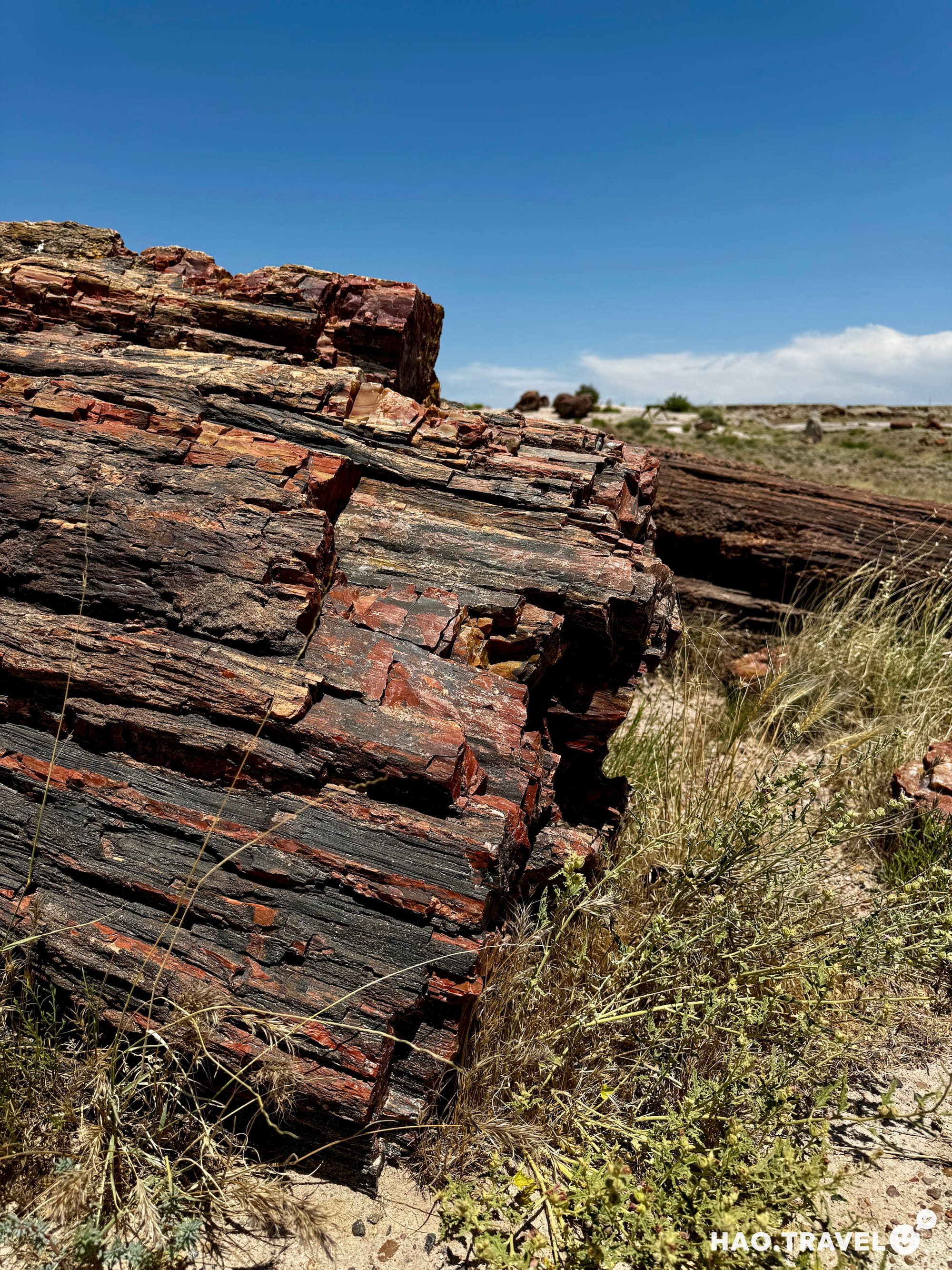
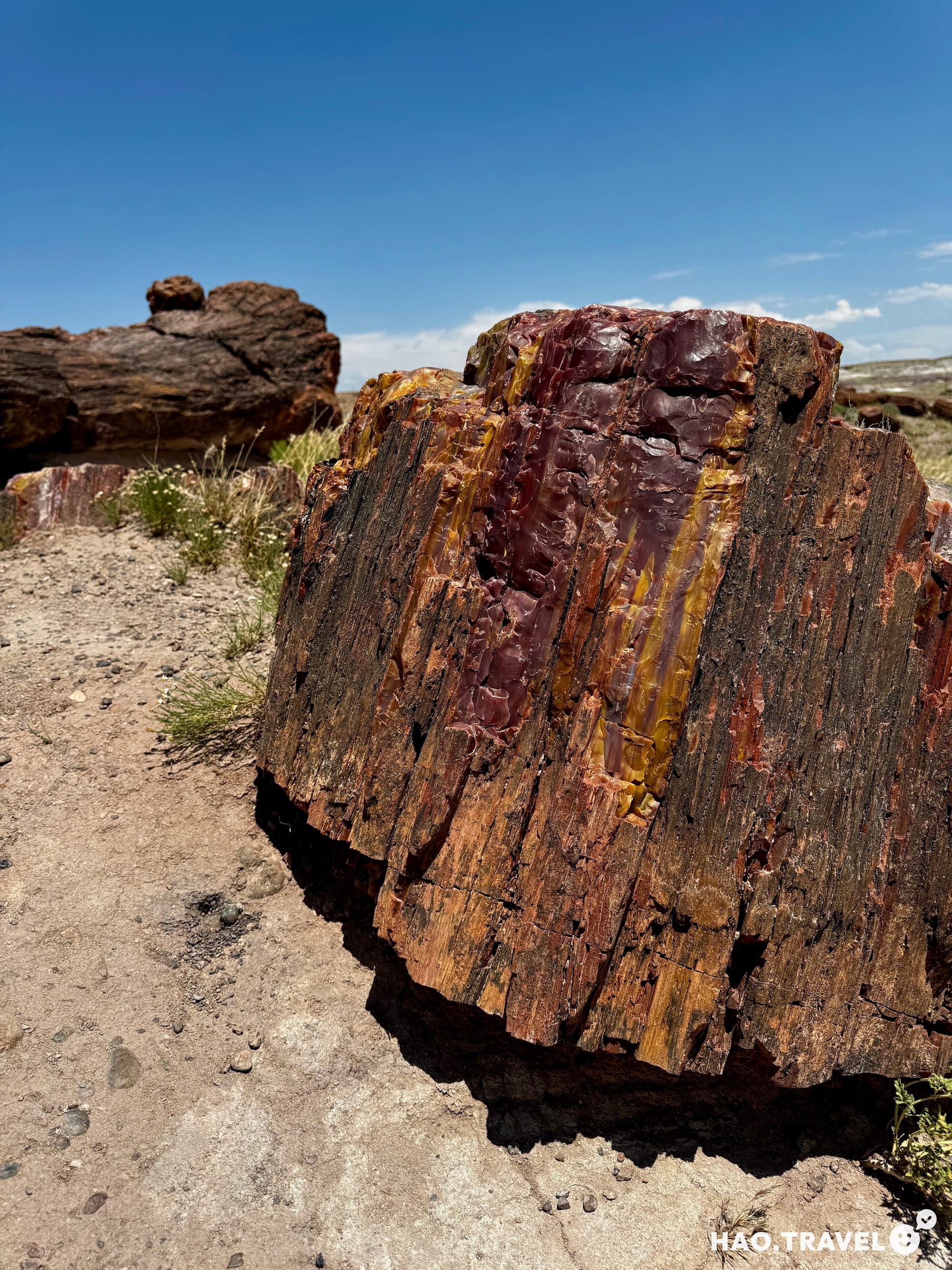
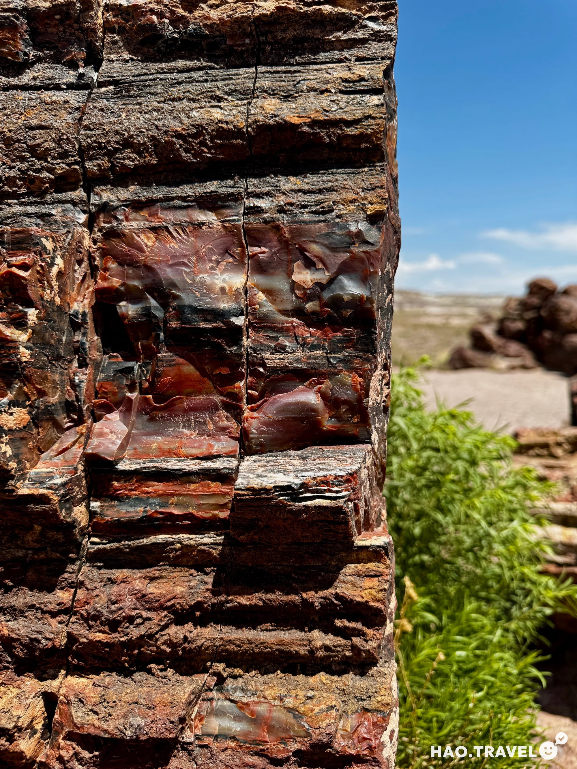
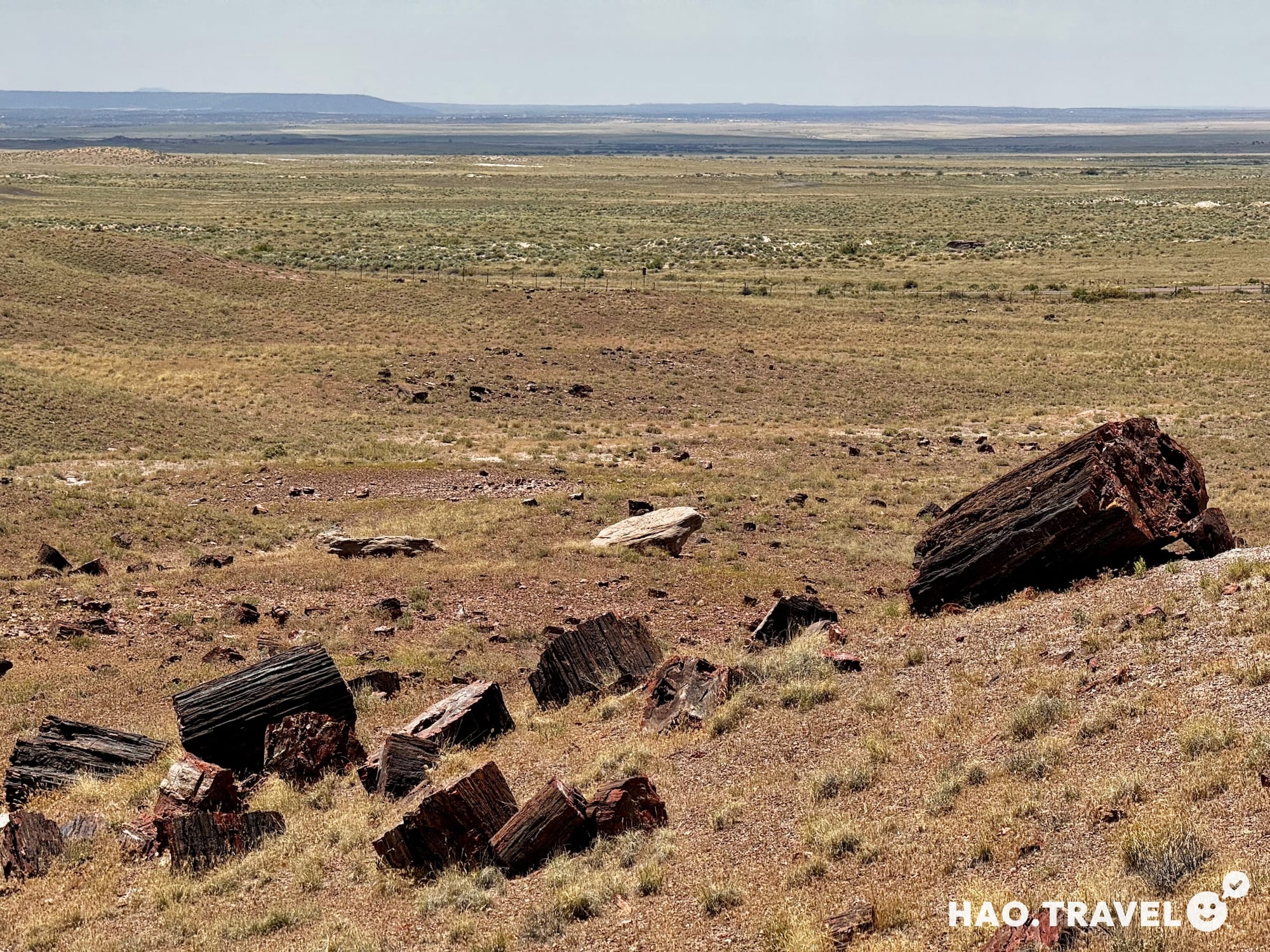
With our curiosity piqued, we headed out to the Giant Logs Trail and the Crystal Forest Trail. The Giant Logs Trail was a quick but fascinating walk through massive petrified trees, with some logs stretching over 10 feet (3 meters) in length. Many of these ancient logs were bigger than we expected, lying scattered across the desert landscape as if they’d fallen only yesterday. The Crystal Forest Trail added a different angle, with petrified wood featuring shimmering quartz crystals that glinted in the sunlight. Walking through these trails, surrounded by a colorful desert, was like stepping back in time to a prehistoric landscape—an experience that felt beautifully surreal.
After our stop at Petrified Forest, we continued the journey to Chaco Canyon, arriving via the 13-mile dirt road that we’d heard could get sketchy in rain. Fortunately, we only had a few sprinkles on the drive in. We set up our tent at Gallo Campground, a spot that usually books up quickly, so we felt lucky to have snagged a reservation just a few weeks before the trip.
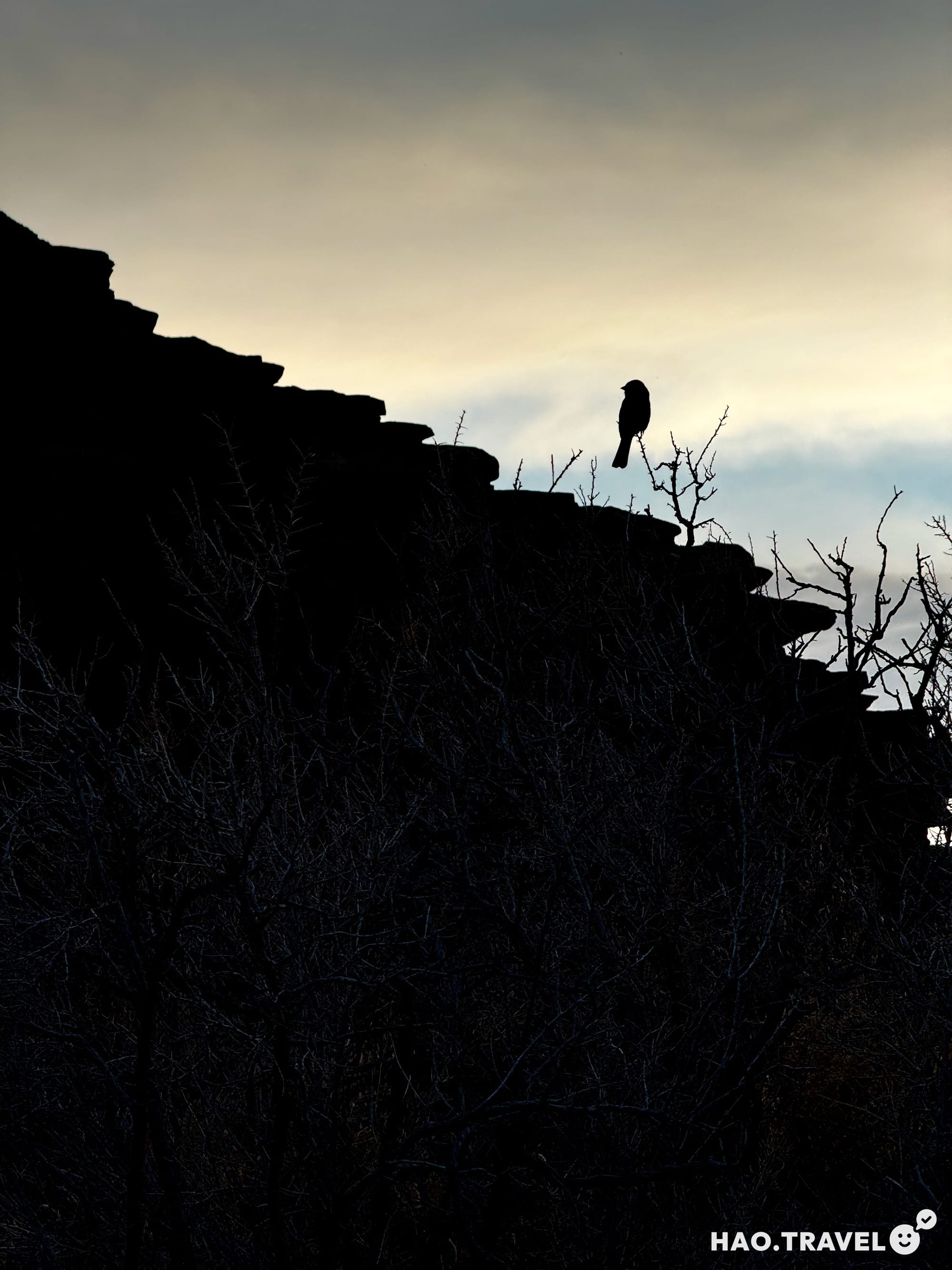
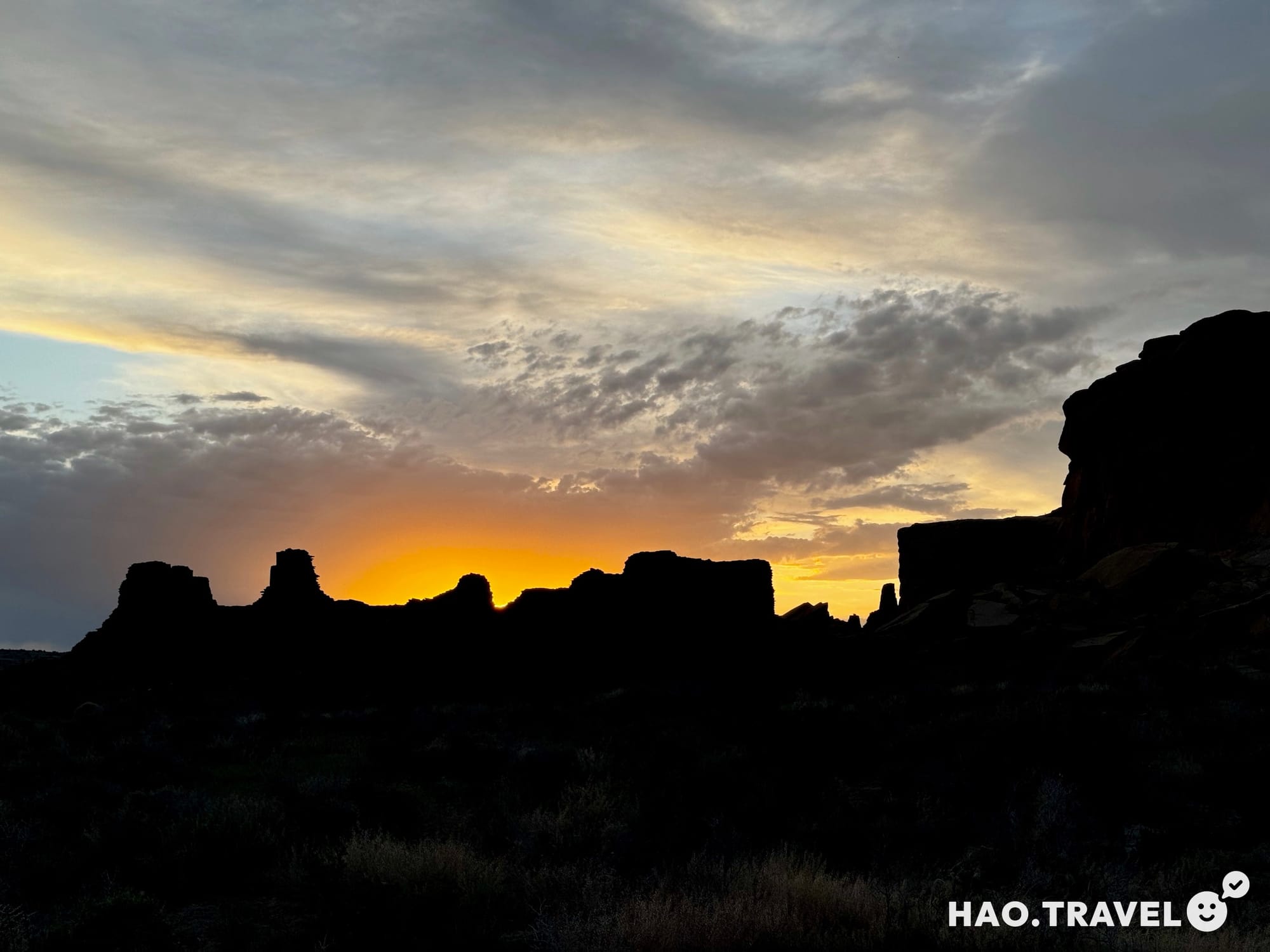
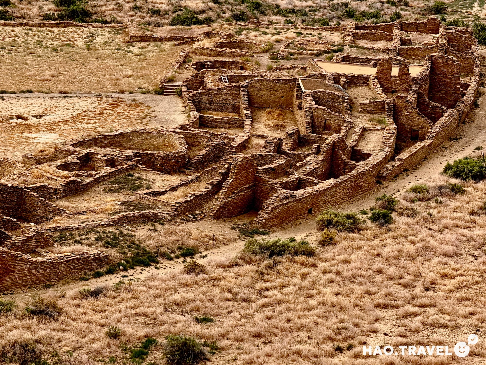
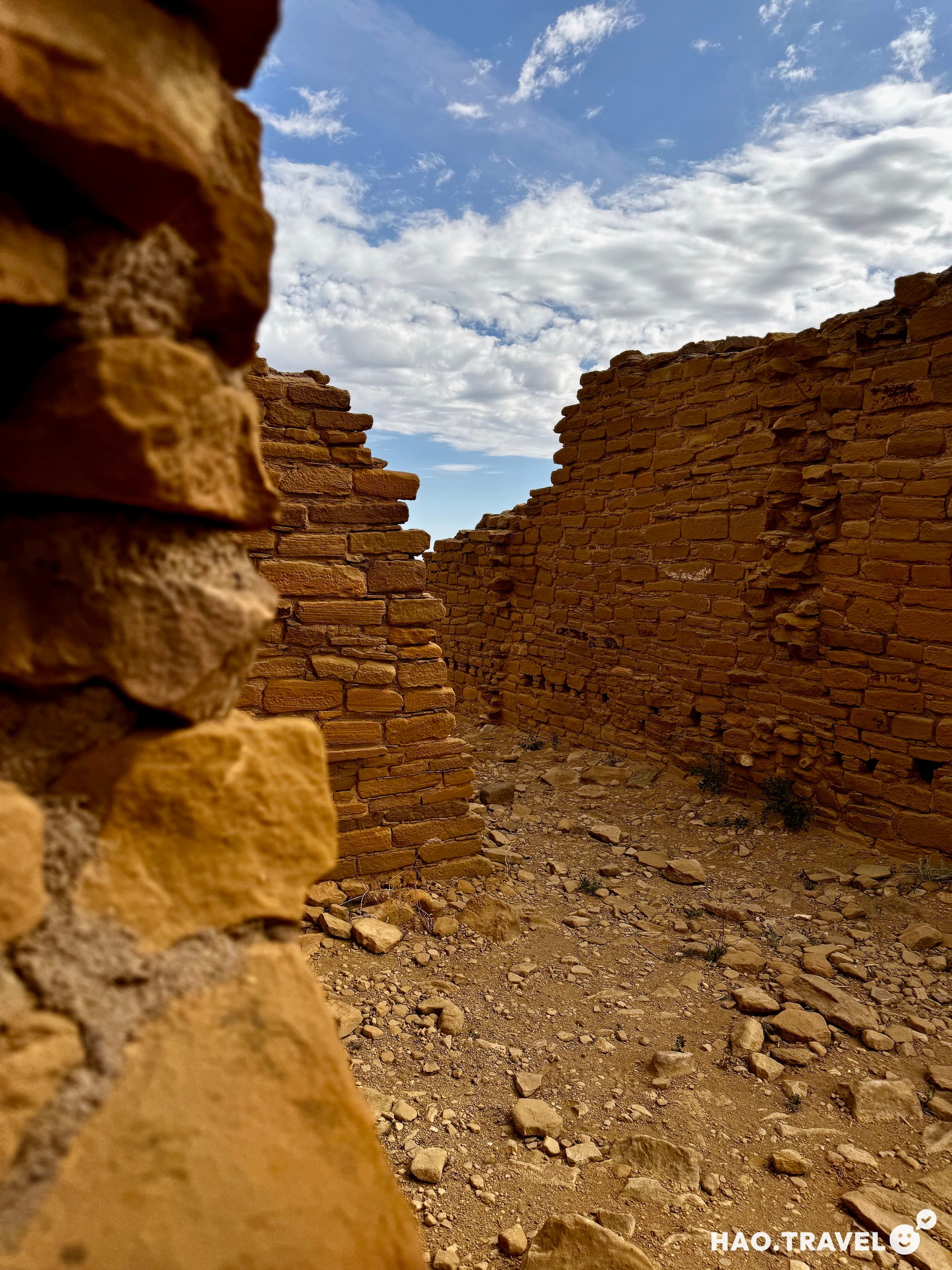
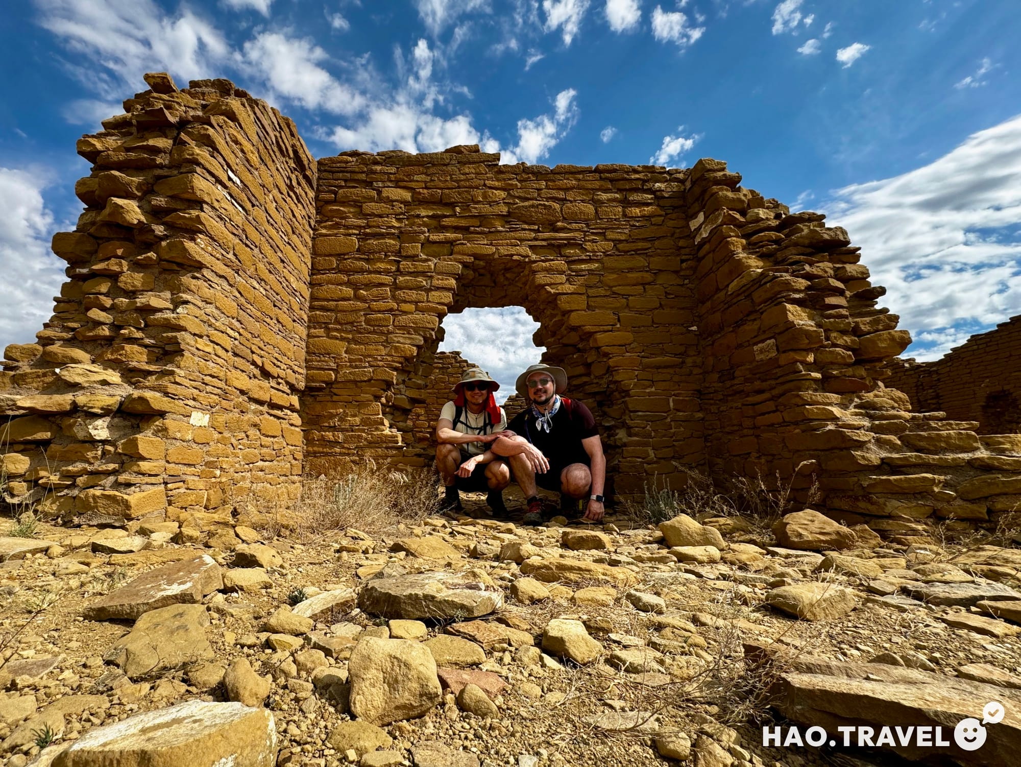
With camp set up, we headed out to explore the ruins at sunset, starting with Hungo Pavi, Pueblo Bonito, and Chetro Ketl—each site offering its own unique glimpse into the lives of the Chacoans who lived here over a thousand years ago.
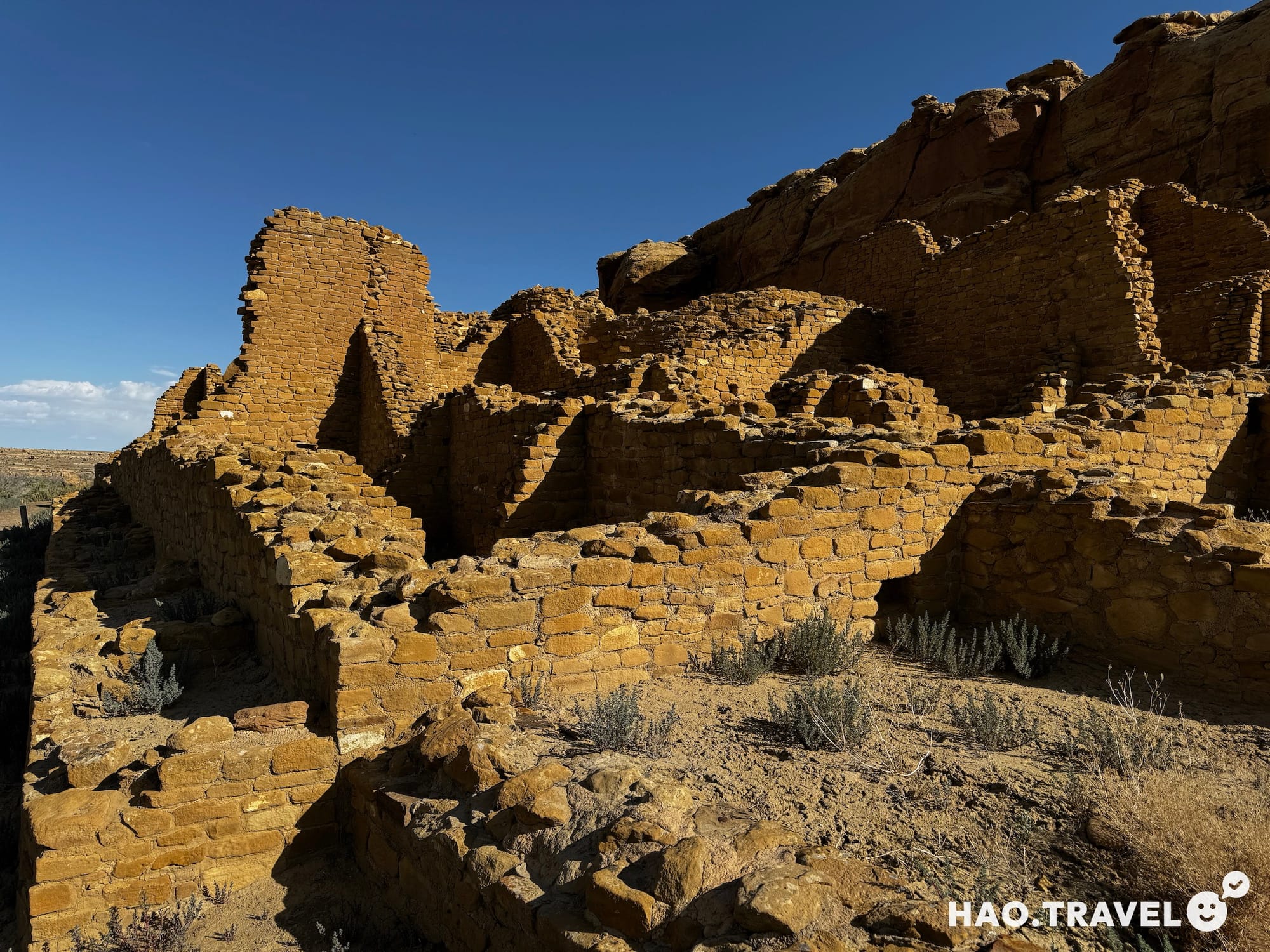
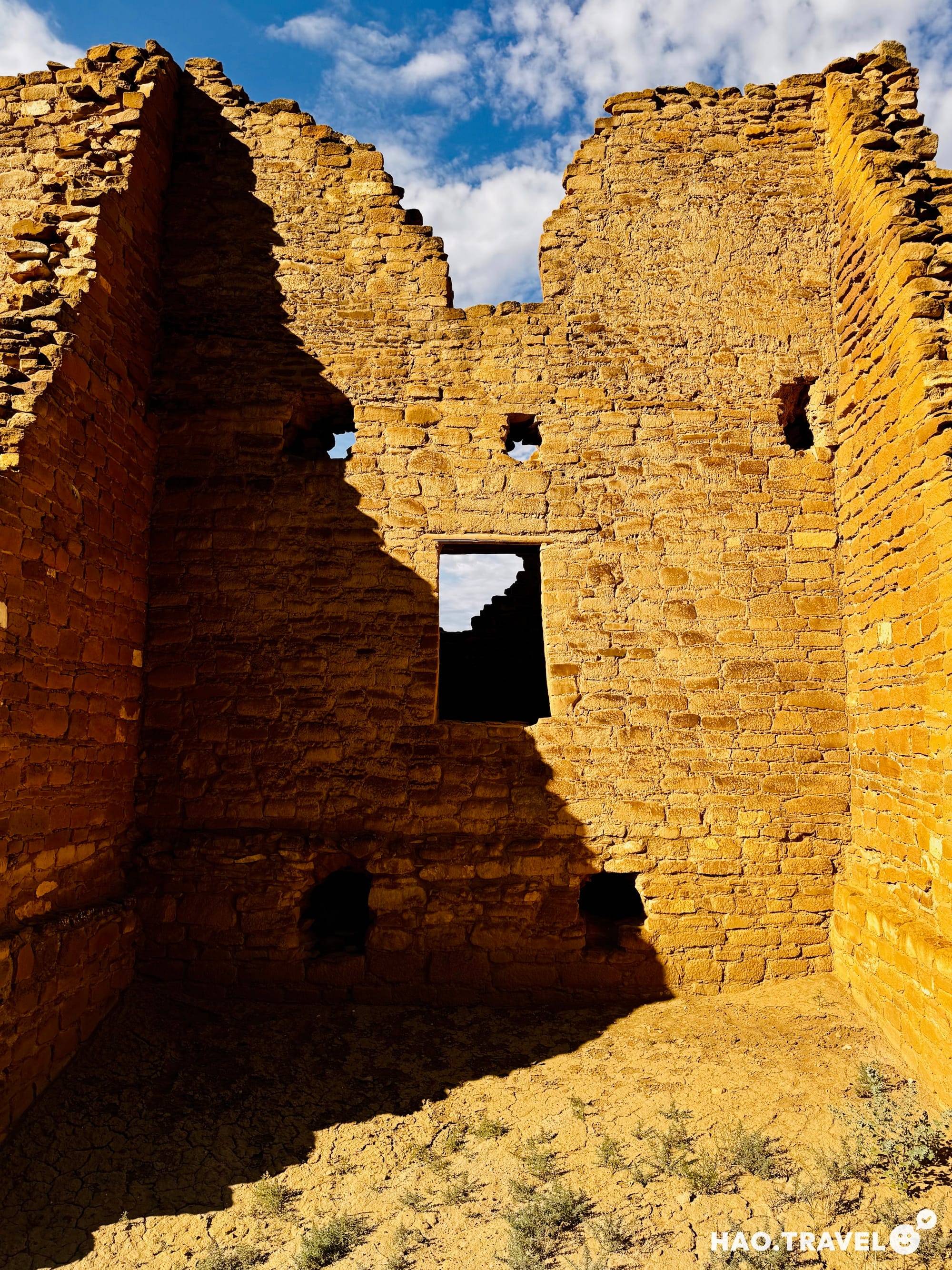
Exploring the Ruins: Hungo Pavi, Pueblo Bonito, and Chetro Ketl
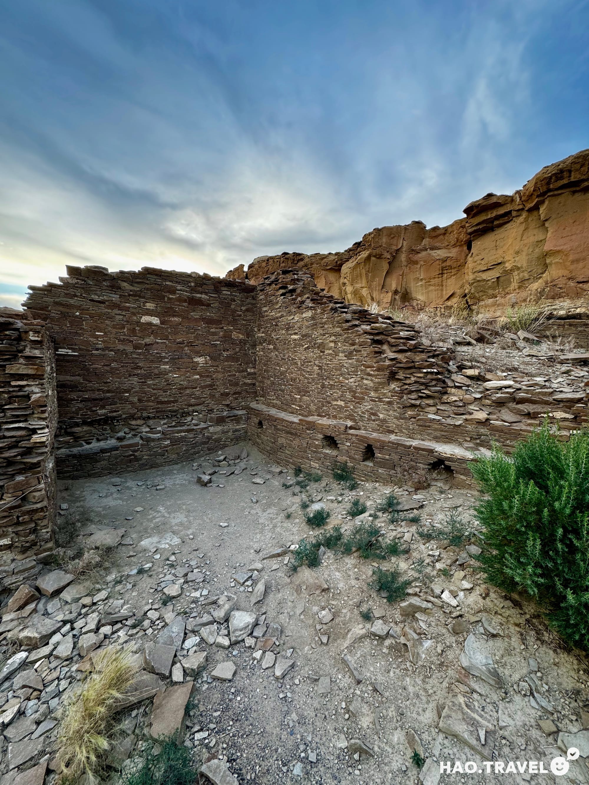
Hungo Pavi: This partially excavated site is one of the less-visited ruins, giving it a secluded, reflective feel. The site has some distinctive features, including massive masonry walls and kivas (circular ceremonial rooms) that suggest it may have been an important communal gathering place. Standing here, we couldn’t help but think about how many others had stood in these spots, and how the structures themselves hold the memory of so many generations.
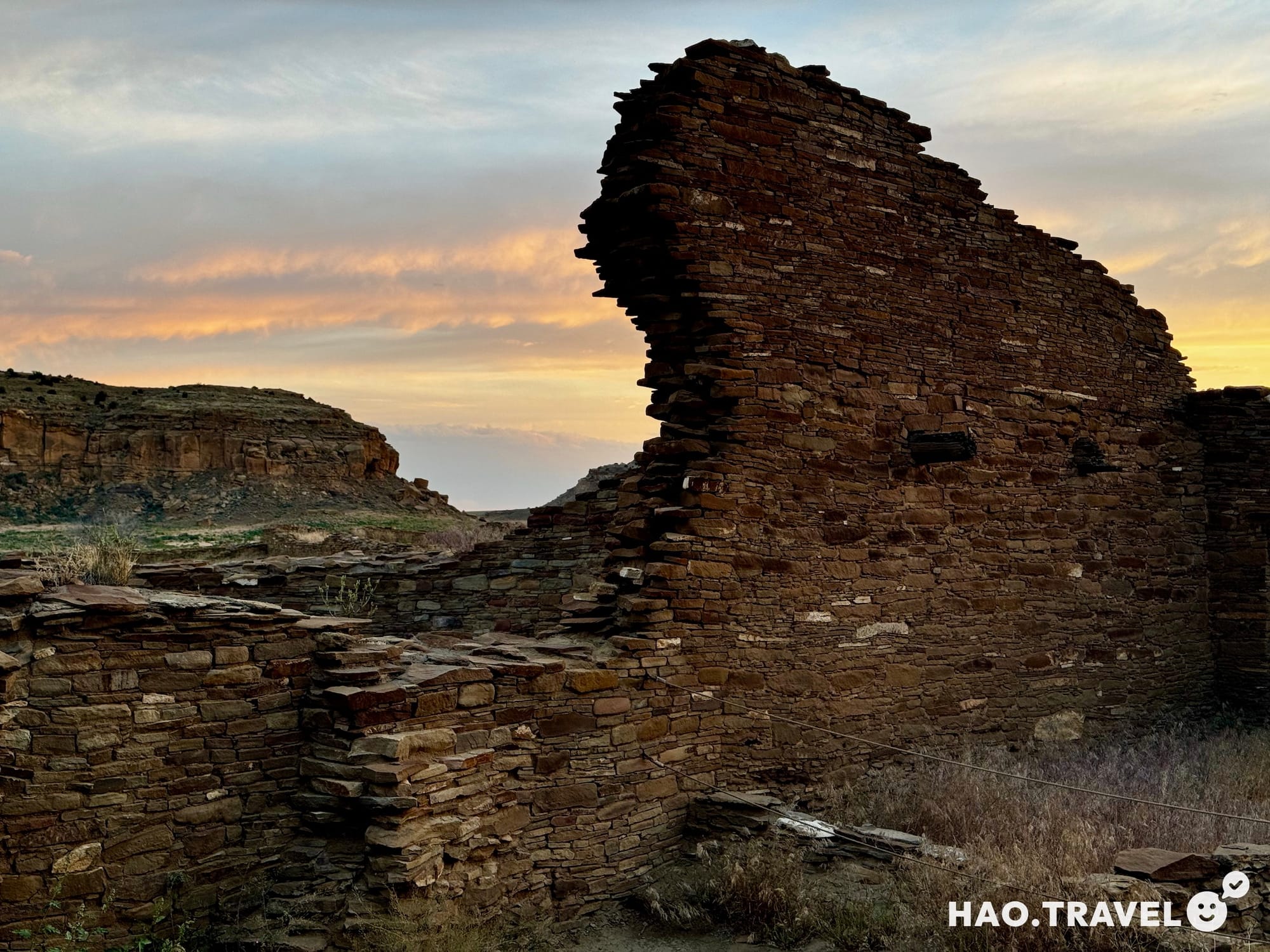
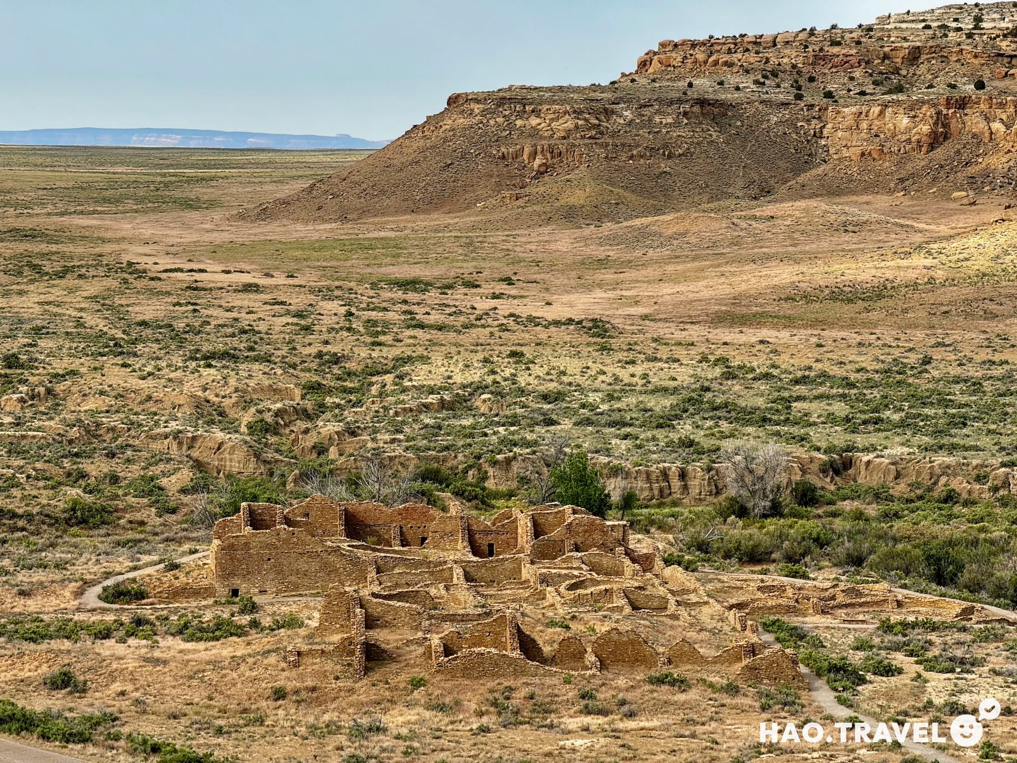
Pueblo Bonito: The largest and most iconic ruin in Chaco Canyon, Pueblo Bonito once had over 600 rooms and stood four stories high. It was likely the heart of Chacoan civilization. What makes Pueblo Bonito even more fascinating is how it was aligned to reflect the Chacoans’ knowledge of astronomy. The structure is oriented to capture the equinoxes, with certain rooms and doorways specifically positioned to track the sun’s movement across the year. It’s incredible to consider the advanced knowledge of astronomy and geometry the Chacoans possessed, using the stars not just for navigation but as a blueprint for their society.
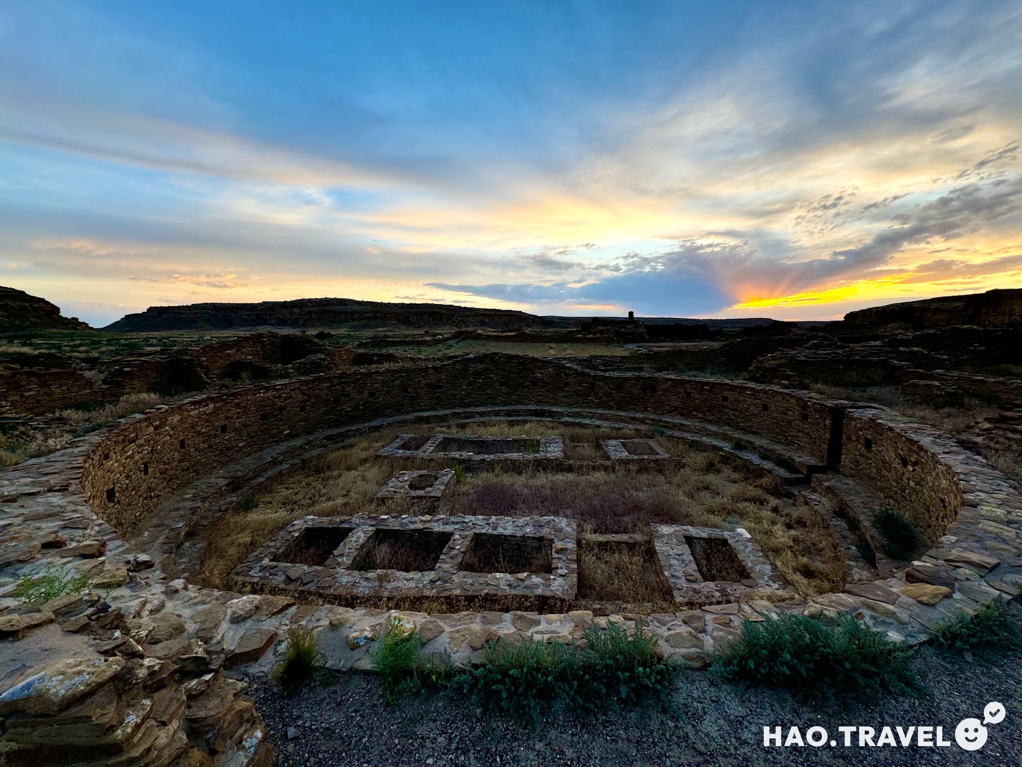
Chetro Ketl: This ruin has one of the largest plazas in Chaco and a “great kiva”—a ceremonial structure unique to Chaco. This kiva was likely a hub of religious or social life, a place where people gathered to mark time, honor the cosmos, and strengthen community bonds. Standing here at sunset, we felt connected to the ancient rhythm of the place, as if we were glimpsing something timeless.
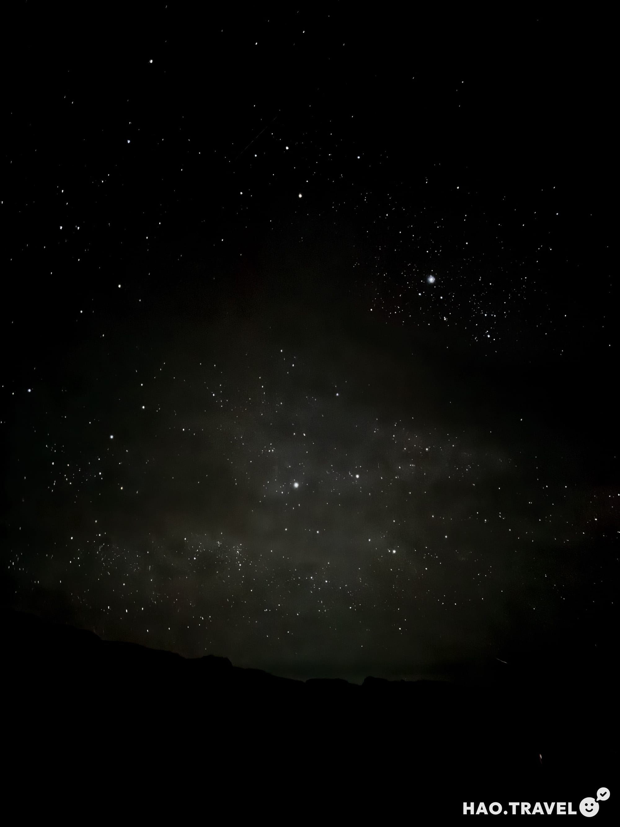
After exploring these sites, we spent the evening stargazing, capturing the night sky in a way that only a dark sky park allows. Using the iPhone’s night mode with a 30-second exposure, we were able to take some pretty striking shots, although a tripod and phone mount were crucial for getting clear, steady images. Just like the Chacoans looked to the skies for guidance, we felt a similar sense of wonder under the same stars they once studied.
Day 9: Hiking the Chaco Trails and Mesa Top Ruins
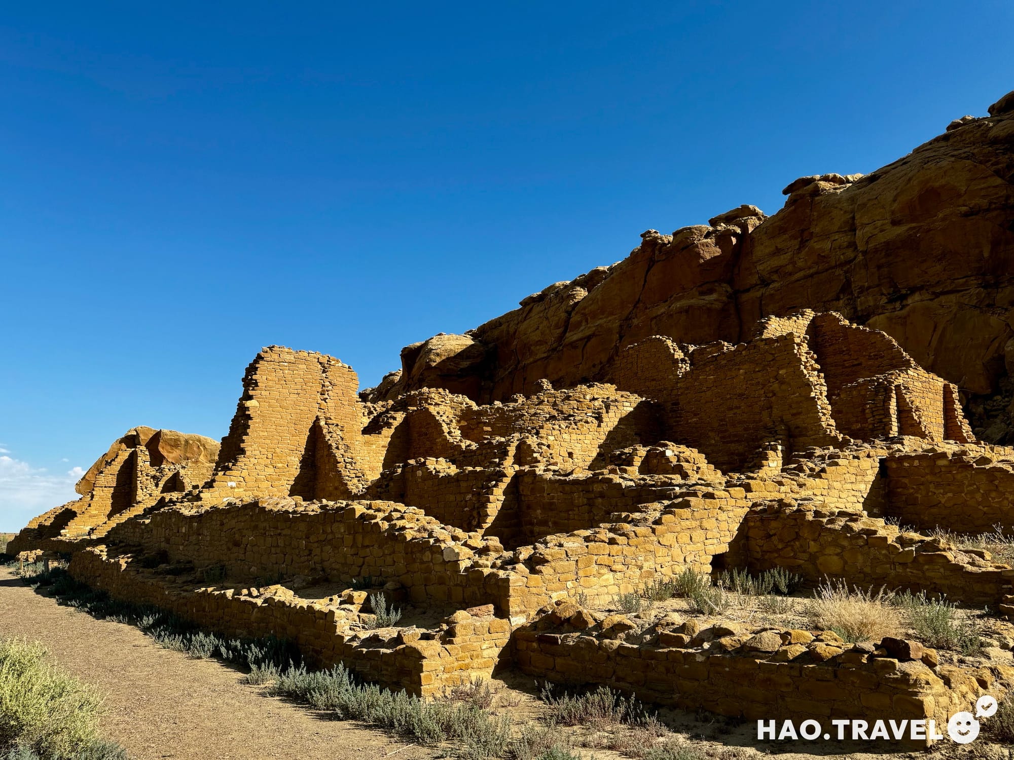
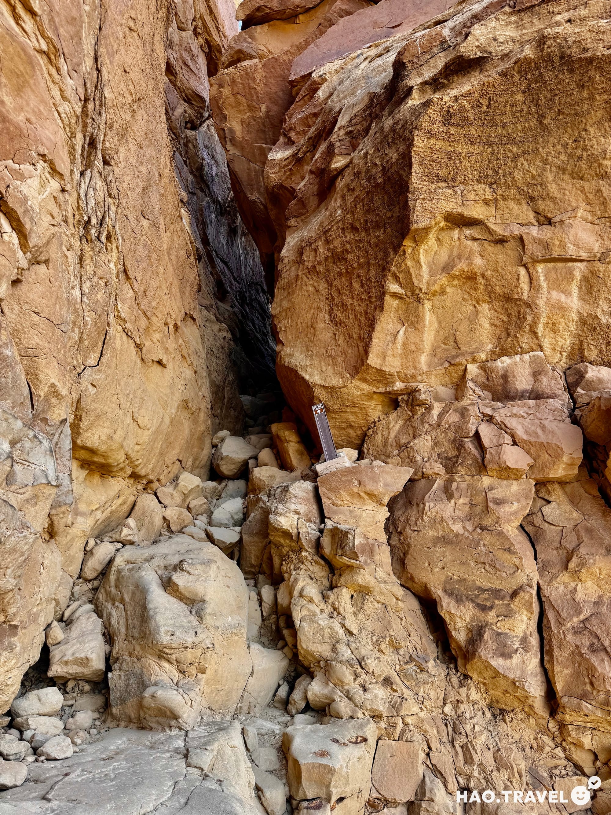
The following morning, we packed up camp early and set out for one last hike before leaving. We chose the trail just past Pueblo Bonito, which led us up onto the mesa for a new vantage point. Right at the start, we got a bit of light scrambling and navigated a narrow slot in the rock—a fun little challenge.
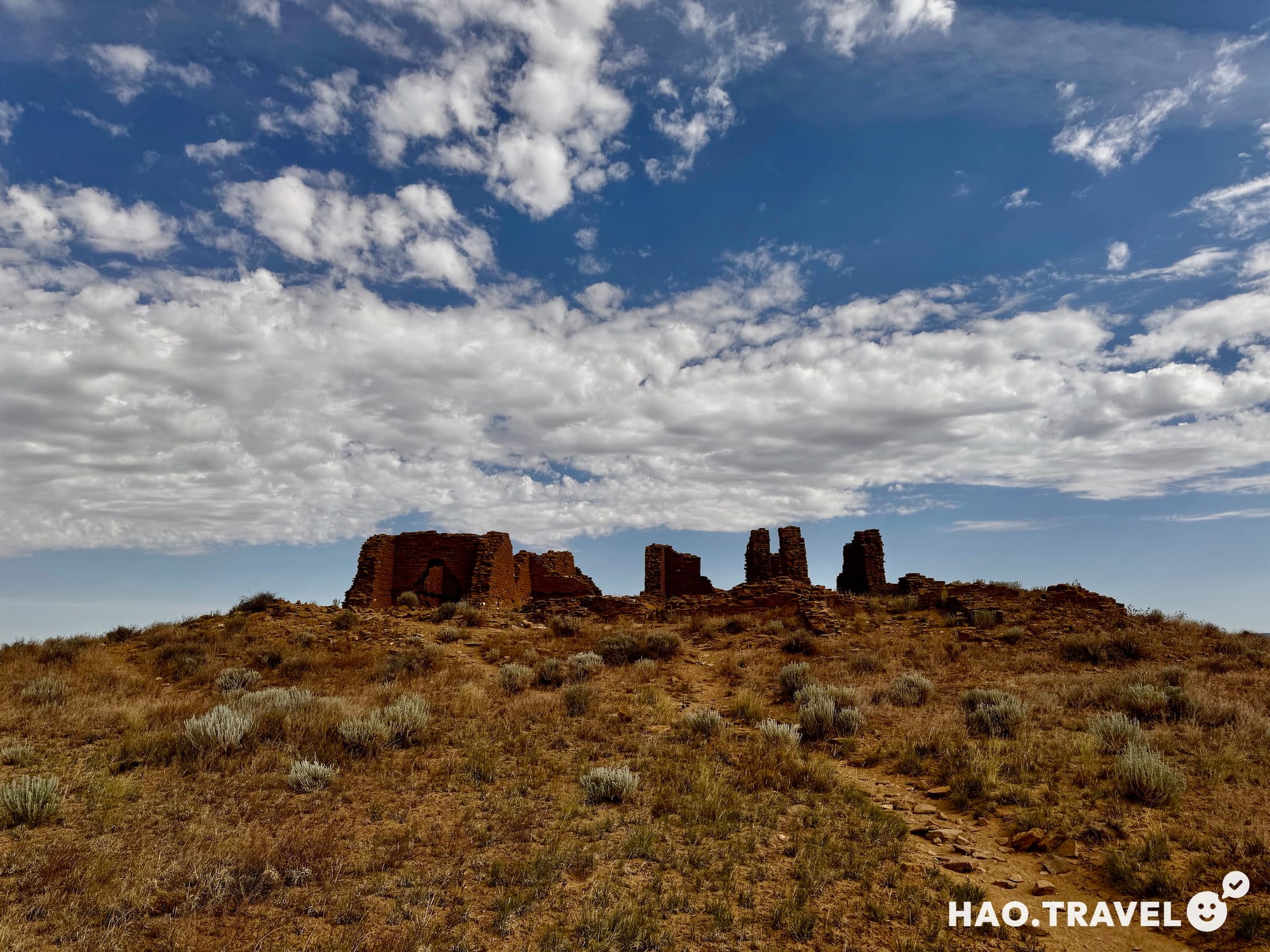
The hike took us to Pueblo Alto and New Alto, two ruins perched on top of the mesa. Seeing the ruins from above gave us a new perspective on the ancient city. Pueblo Alto and New Alto both felt rugged and exposed, standing in stark contrast to the structures below. As we walked through the ruins, we tried to imagine what each room might have been used for, picturing the everyday lives of the people who once lived here and how the same land and stars shaped their world.
Reflecting on Chaco Canyon’s Legacy
Chaco Canyon’s history is as vast as its night skies. The Chacoans built a complex society here around 850-1250 AD, creating a hub of culture, astronomy, and trade that drew people from across the Southwest. Their roads stretched out in straight lines across the desert, connecting various settlements and sacred sites with remarkable precision. The Chacoans also tracked the movement of the stars and the sun, integrating these cosmic cycles into their architecture in a way that reveals a deep awareness of their place in the universe.
Experiencing Chaco Canyon reminded us of how these ancient structures, the night sky, and the isolation of the desert all combine to create something magical. With no cell service or modern distractions, we could connect with this timeless landscape and feel part of a continuum that stretches far beyond us. There’s something humbling in standing where the Chacoans once stood, in awe of the same stars, and feeling a shared wonder and curiosity about our place in the cosmos.
Final Thoughts
After nearly 2,000 miles, countless canyons, and endless memories, our Southwest road trip left us humbled, exhausted, and grateful for the wild beauty we encountered along the way. From breathtaking hikes to quiet nights under the stars, each stop offered something unforgettable. Looking back, it’s not just the landscapes that stand out but the reminder of how much nature has to offer when you give it time and space. This was only the beginning of our travels together, and if this trip taught us anything, it’s that every adventure, big or small, holds the potential to shape us in unexpected ways.
Here’s to many more adventures and stories to come. 👋